AXEL21 Over St. George, September 11 — Photo 1
What This Image Shows
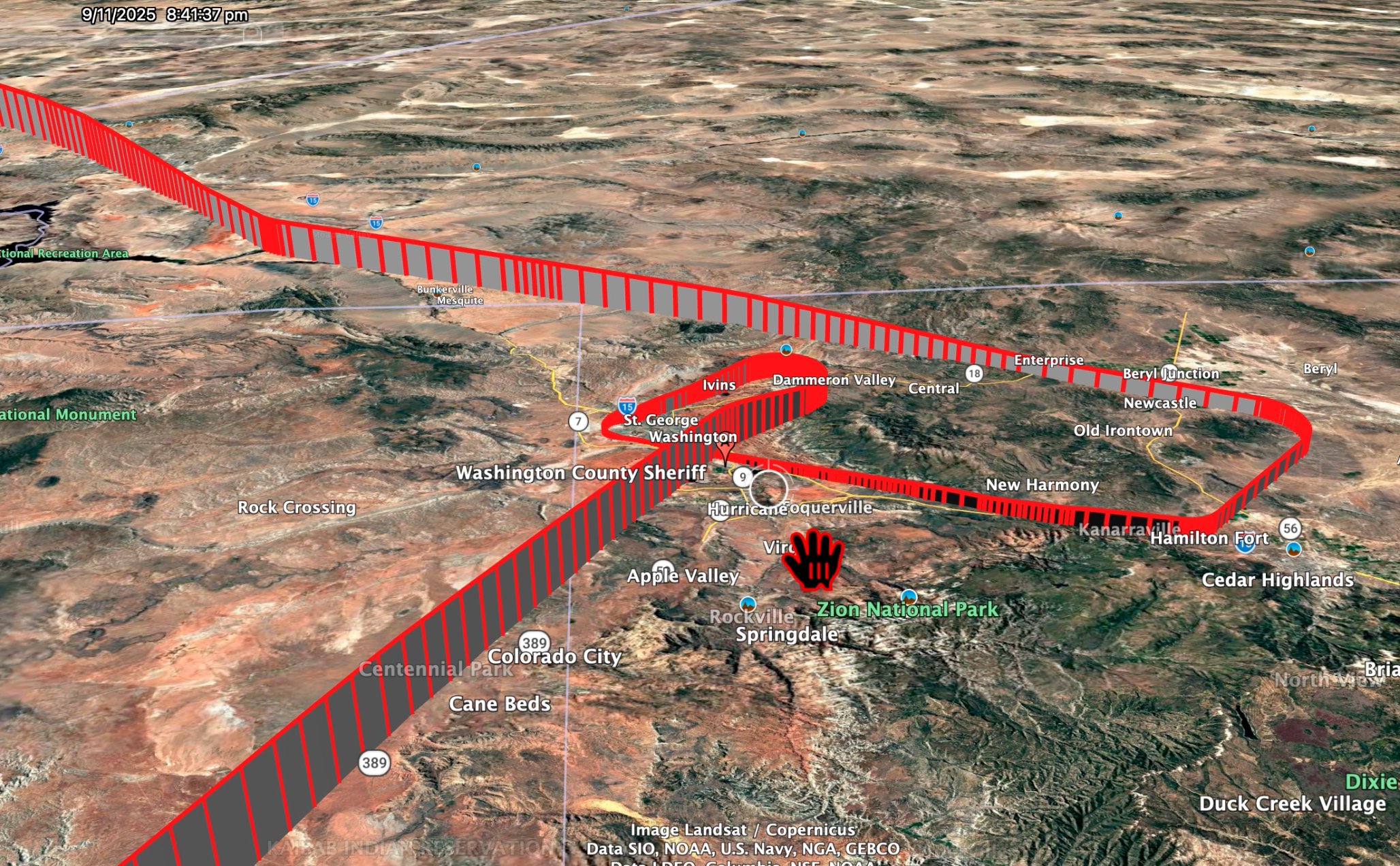
Google Earth 3D render of southwest Utah looking northeast, with the timestamp 9/11/2025 8:41:37 pm burned into the upper left. A red ADS-B altitude ribbon traces the flight of the aircraft flying callsign AXEL21 - tail N2100L, a LASAI Aviation Global 6500 and fleet-mate of the N1098L HADES ISR jet - entering from the northwest past Bunkerville and Mesquite, running southeast over St. George and Washington, turning tightly near a placemark labelled Washington County Sheriff, then looping east past New Harmony, Kanarraville, Hamilton Fort and Cedar Highlands before doubling back; a second long leg runs southwest across Colorado City, Cane Beds and the Kanab Indian Reservation. Zion National Park, Hurricane, Toquerville, Springdale and Rockville are labelled. Posted by John Cullen on X on 2 September 2026. This site's recovered adsb.lol and airplanes.live traces confirm the track and show it is an approach to St. George Regional runway 19 flown down to 1,109 ft above the field at 8:59 pm MDT that did not land.
Where This Image Appears
This image is used on the following investigation page:
Related Areas
- Cluster: Aircraft and Flight Records
- All photos: Photos
More In This Cluster
- Previous: N102DZ Kirk's Plane — Photo 1
- Next: Candace Owens Breaks the SU-BTT Story