Drone Drop Off Slide 9: Tent and Water
 Next Image
What This Image Shows
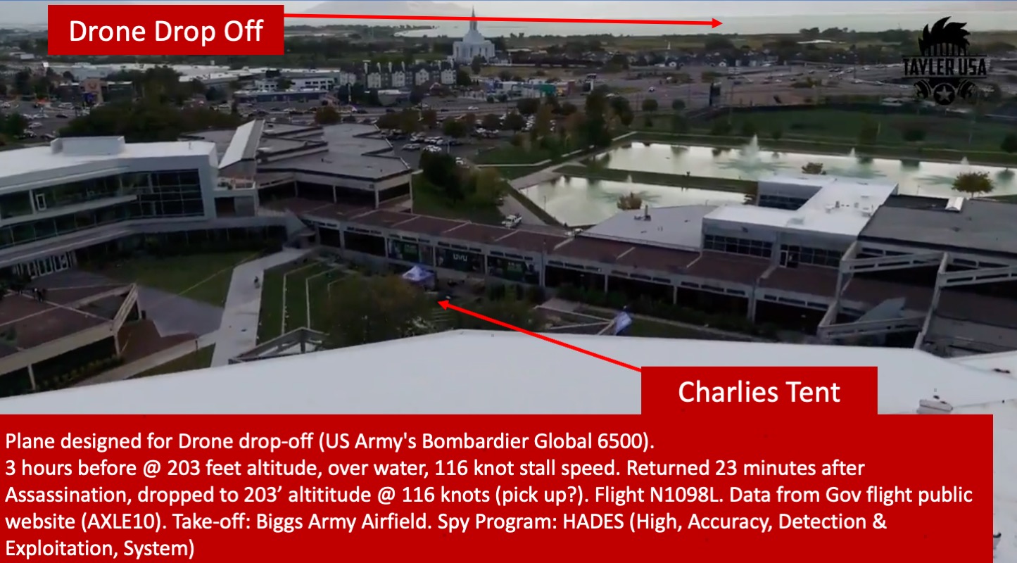
One cut of a thirteen-slide deck built on a single annotated aerial photograph of the Utah Valley University campus.
The red banner across the bottom reads: "Plane designed for Drone drop-off (US Army's Bombardier Global 6500). 3 hours before @ 203 feet altitude, over water, 116 knot stall speed. Returned 23 minutes after Assassination, dropped to 203' altititude @ 116 knots (pick up?). Flight N1098L. Data from Gov flight public website (AXLE10). Take-off: Biggs Army Airfield. Spy Program: HADES (High, Accuracy, Detection & Exploitation, System)." The misspelling of "altititude" and the question mark after "pick up?" are in the original.
A cut identifying the campus explicitly in the framing. The 203-foot figure and the 116-knot figure are the numbers most often quoted from this deck. They describe an aircraft flying very low and very slowly for its type, which is genuinely unusual for a transit flight and entirely normal for a training profile.
Go up to Drop Off for the clean unannotated aerial, then weigh the claim against N1098L Spy Plane and Sept 10 Flight Timeline.
This website's author is @HolonCitizen on X and YouTube/@HolonCitizen. Follow me there.
Where This Image Appears
This image is used on the following investigation pages:
Related Areas
- Cluster: 2 Drop Off Spy Plane
- All photos: Photos