Dense Flight Telemetry Over Utah Lake
 Next Image
What This Image Shows
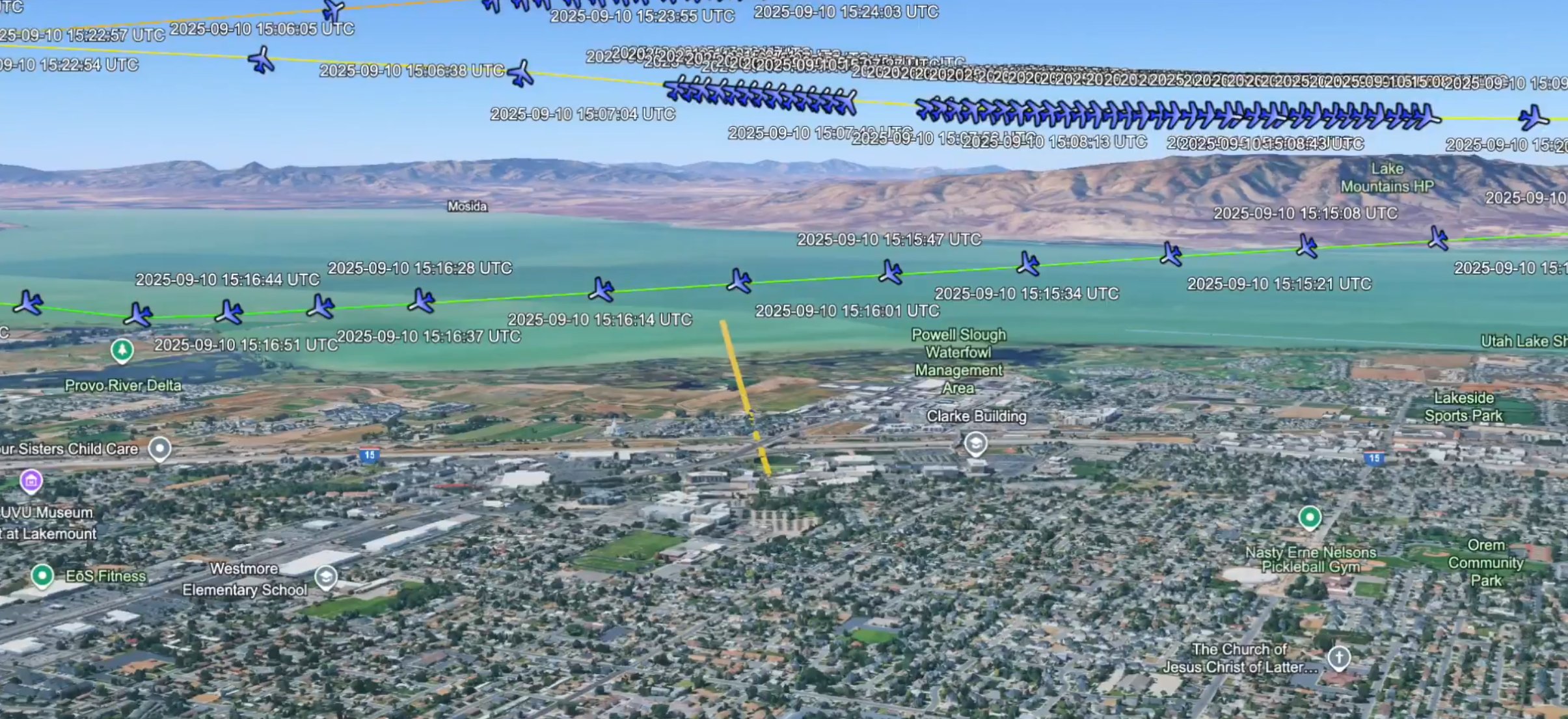
A three-dimensional aerial rendering of Orem, Utah looking west toward Utah Lake and the Lake Mountains, overlaid with a dense mesh of tracked flight positions, aircraft icons and UTC timestamps.
The timestamps cluster in two bursts on 2025-09-10: one around 15:06 to 15:09 UTC and a longer run from 15:15:08 through 15:16:51, then a final group at 15:22:54 through 15:24:03. Landmarks labelled on the terrain include Mosida, the Powell Slough Waterfowl Management Area, the Clarke Building, and the Lake Mountains. The filename this image carries refers to a 650-foot altitude, which is the figure the poster attached to the pass.
The visualization is what makes the drop-off argument legible: instead of a single line across the map, the points bunch and double back over the water at the lake edge, roughly a mile from the UVU campus. That is a real feature of the tracking data. What it means is the open question -- researchers read it as a loiter for release and recovery, while the operator has been reported as describing low passes of this kind as drone retrieval training. Neither reading has been confirmed by any official statement.
Compare the companion rendering on Photo 9, the annotated aerials in 2 Drop Off Spy Plane, and the analysis at N1098L Spy Plane.
This website's author is @HolonCitizen on X and YouTube/@HolonCitizen. Follow me there.
Where This Image Appears
This image is used on the following investigation pages:
Related Areas
- Cluster: Aircraft and Flight Records
- Section: Planes
- All photos: Photos
More In This Cluster
- Previous: AI Chatbot Producing N1098L Crew Names
- Next: Political Cartoon Drone