AXEL10 Playback: El Paso to Kalispell
 Next Image
What This Image Shows
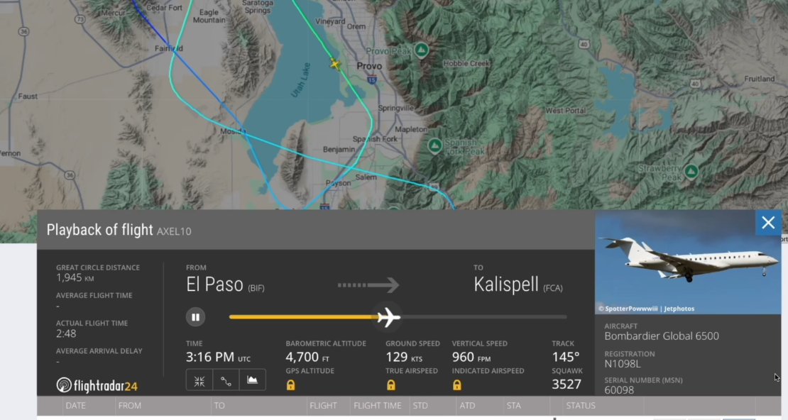
A Flightradar24 playback view. The map covers the Utah Valley -- Cedar Fort, Eagle Mountain, Saratoga Springs, Vineyard, Orem, Provo, Springville, Mapleton, Spanish Fork, Salem, Payson and Benjamin are all labelled. The panel below reads "Playback of flight AXEL10," FROM El Paso (BIF), TO Kalispell (FCA), GREAT CIRCLE DISTANCE 1,945 km, ACTUAL FLIGHT TIME 2:48, TIME 3:16 PM UTC. Telemetry at that instant reads BAROMETRIC ALTITUDE 4,700 FT, GROUND SPEED 129 KTS, VERTICAL SPEED 960 FPM, TRACK 145 degrees, SQUAWK 3527.
AXEL10 is the callsign associated with N1098L. BIF is Biggs Army Airfield at Fort Bliss, El Paso. The two numbers on this panel are the ones the whole low-pass argument turns on: 129 knots is very slow for a Global 6500, and 4,700 feet is low for an aircraft transiting between Texas and Montana. Investigators have cited figures as low as 203 feet and 116 knots for the closest passes, so this capture appears to catch the aircraft climbing back out rather than at its lowest point.
What the panel establishes is speed, altitude, position and time from a public source. It does not establish purpose. It also does not, on its own, distinguish a surveillance orbit from a training manoeuvre.
See N1098L Spy Plane, Biggs Army Airfield, and the same-day leg list on Flight Numbers.
This website's author is @HolonCitizen on X and YouTube/@HolonCitizen. Follow me there.
Where This Image Appears
This image is used on the following investigation pages:
Related Areas
- Cluster: Aircraft and Flight Records
- Section: Planes
- All photos: Photos