AXEL10 Over Orem at 15:16 UTC
 Next Image
What This Image Shows
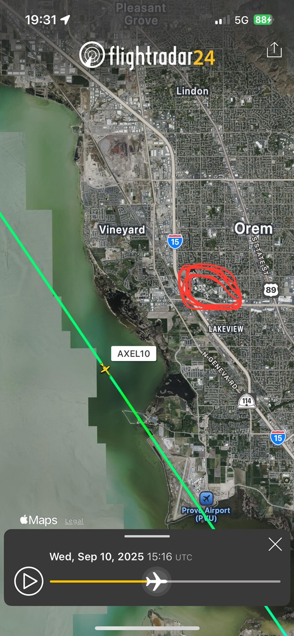
A Flightradar24 mobile capture on satellite view. The map covers Pleasant Grove, Lindon, Vineyard and Orem with Utah Lake on the left, Interstate 15 and Geneva Road labelled, and Provo Airport (PVU) marked at the bottom. A green track runs across the frame with a yellow aircraft icon labelled AXEL10 on it. The timestamp reads Wed, Sep 10, 2025 15:16 UTC.
Converted to local time, 15:16 UTC is 9:16 AM MDT -- the same minute annotated as the lowest recorded altitude on the FlightAware capture elsewhere in this cluster, and inside the burst of position points visible in the 3D renderings. Three independent captures from different tools converging on the same minute is the strongest kind of corroboration available from public data.
What they corroborate is position and time: an aircraft under the AXEL10 callsign was low over the Vineyard and Orem area, west of the UVU campus and near the lake shore, at 9:16 AM on the morning of the shooting. That is the documented part. The purpose of the pass is not documented anywhere.
See Photo 9 and 650 Feet for the 3D views, FlightAware capture for the altitude annotation, and N1098L Spy Plane.
This website's author is @HolonCitizen on X and YouTube/@HolonCitizen. Follow me there.
Where This Image Appears
This image is used on the following investigation pages:
Related Areas
- Cluster: Aircraft and Flight Records
- Section: Planes
- All photos: Photos