Tuba City Airport on the Map
 Next Image
What This Image Shows
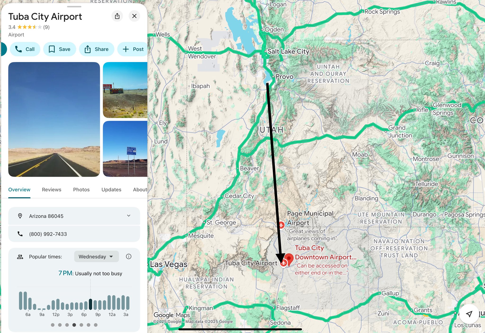
A Google Maps capture for Tuba City Airport, Arizona 86045, rated 3.4 from nine reviews, with the standard details panel -- Overview, Reviews, Photos, Updates -- a popular-times bar chart, and a phone number. The regional map beside it spans Utah, Nevada and northern Arizona, with Salt Lake City, Provo, St. George, Las Vegas, Cedar City, Kingman and Page Municipal Airport labelled. A review snippet reads "Great views of airplanes coming in."
This is a location lookup, proof of nothing. It sits in the file because Tuba City is the strip named in the claim that N888KG was flying toward a remote field after leaving Provo -- the post on Photo 3 calls it "super-remote" and reads that remoteness as significant.
The map is worth looking at precisely because it lets a reader check the geography for themselves. Tuba City sits on the Navajo Nation in northern Arizona, roughly in the direction N888KG was tracking when it descended near the Utah line. Whether the aircraft landed there, at Page, or anywhere else during the ADS-B gap is unestablished -- the tracking data simply stops, and no arrival record has been produced.
See N888KG and the ADS-B captures on Photo 39 and Photo 45.
This website's author is @HolonCitizen on X and YouTube/@HolonCitizen. Follow me there.
Where This Image Appears
This image is used on the following investigation pages:
- Salt Lake City Field Office
- Cedar City Maverik Gas Station (I-15)
- Provo Municipal Airport (PVU)
- Img Photo 3ed165
- overview
Related Areas
- Cluster: Aircraft and Flight Records
- Section: Planes
- All photos: Photos