N59906: A Second Aircraft Over UVU
What This Image Shows
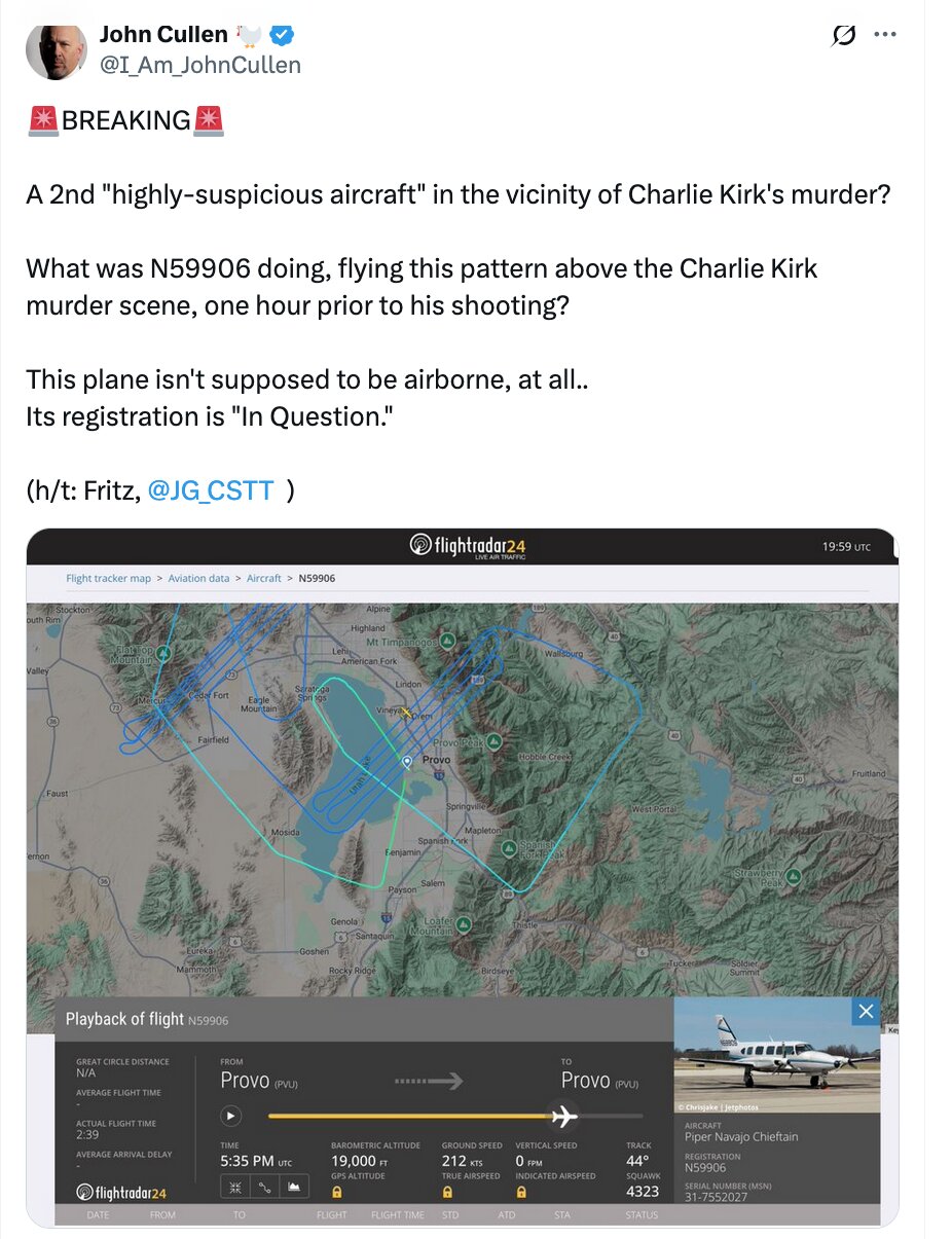
A screenshot of an X post by John Cullen (@I_Am_JohnCullen) with a Flightradar24 map attached. The post reads: "BREAKING. A 2nd 'highly-suspicious aircraft' in the vicinity of Charlie Kirk's murder? What was N59906 doing, flying this pattern above the Charlie Kirk murder scene, one hour prior to his shooting? This plane isn't supposed to be airborne, at all.. Its registration is 'In Question.'" Credit is given to "Fritz, @JG_CSTT."
The map is timestamped 19:59 UTC and shows the track over the Utah Valley -- American Fork, Provo, Springville, Spanish Fork, Payson, Santaquin, Goshen and Mosida are all labelled. Public reporting describes N59906 as a Piper PA-31 Navajo Chieftain operated by MARC Inc., a contractor providing survey and mapping aircraft, and researcher Eric Rosenwald documented four passes over the campus between roughly 11:01 AM and 11:35 AM local time, at around 15,000 feet above ground level, equipped for high-resolution imaging and LiDAR.
The registration-in-question detail is the poster's claim and has not been confirmed here. The ordinary explanation for a MARC aircraft flying a grid at that altitude is contract aerial survey work, possibly for the nearby interstate corridor; neither MARC Inc. nor any agency has publicly stated who commissioned the flight. If imagery was captured, it would cover the campus in the hour before the shooting.
Read N59906 for the full analysis and N55906 for the related tail-number confusion.
Related Areas
- Cluster: Aircraft and Flight Evidence
- Section: Planes
- All photo evidence: Photos