3D Flight Track Over Orem and Utah Lake
 Next Image
What This Image Shows
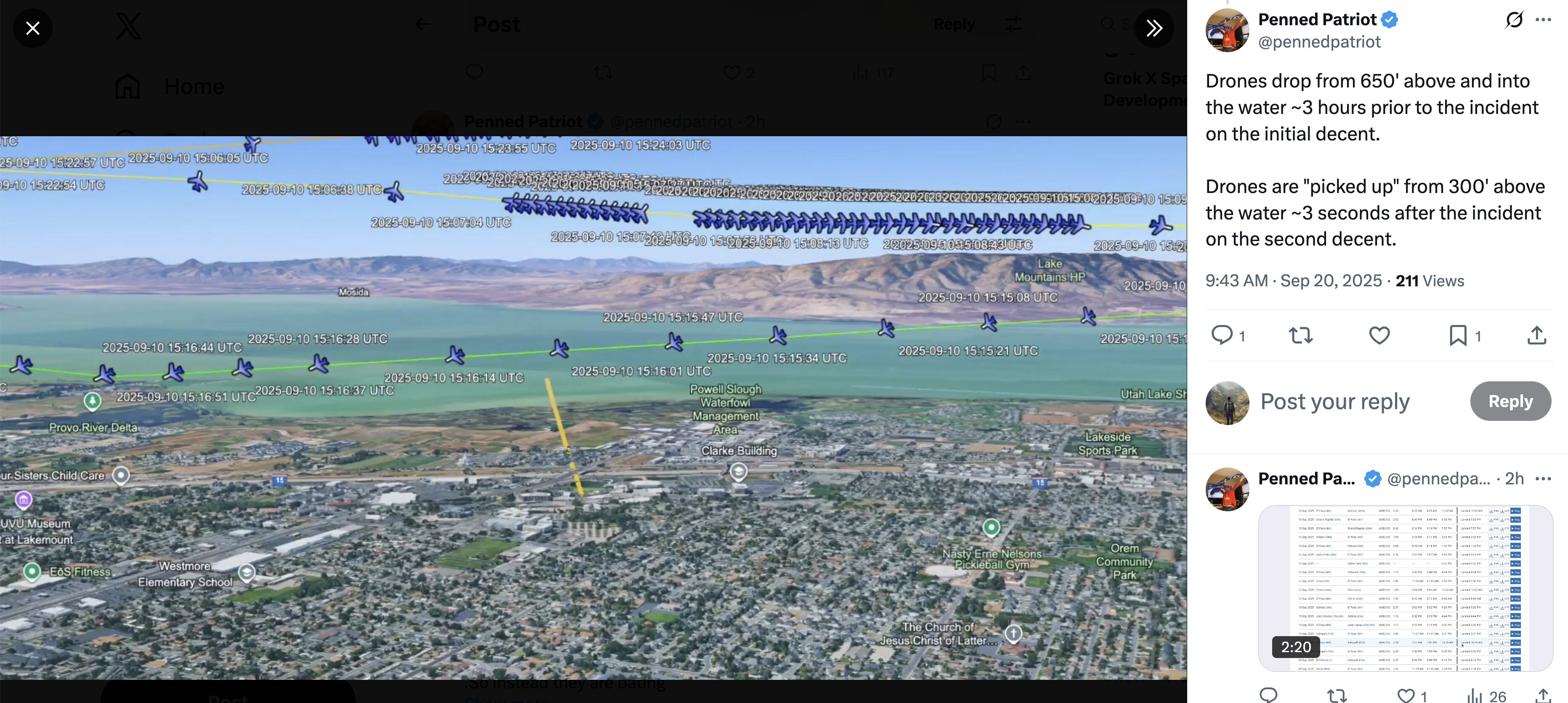
A screenshot of an X post by Penned Patriot (@pennedpatriot) showing a three-dimensional aerial map, rendered in a Google Earth style, with tracked flight positions plotted over Orem, Utah and the shoreline of Utah Lake.
Every plotted point carries a UTC timestamp, and they cluster tightly: 2025-09-10 15:06:05, 15:07:04, 15:15:34, 15:15:47, 15:16:01, 15:16:14, 15:16:28, 15:16:37, 15:16:44, 15:16:51, 15:22:54, 15:22:57, 15:23:55, 15:24:03. Named landmarks visible on the map include the UVU Museum, Provo River Delta, Powell Slough Waterfowl Management Area, Lakemount, Westmore, and EoS Fitness. Converting to local time places that whole window in the 9 AM hour on the morning of the shooting.
This is the kind of capture the drop-off theory is built from -- the position points show an aircraft holding over the water and the campus edge rather than transiting through. The map shows where and when; it does not show what the aircraft was doing, and the operator has been reported as describing low passes of this type as drone retrieval training.
Compare with the annotated aerials in 2 Drop Off Spy Plane, then read N1098L Spy Plane and N1098L Air-Launched Drones.
This website's author is @HolonCitizen on X and YouTube/@HolonCitizen. Follow me there.
Where This Image Appears
This image is used on the following investigation pages:
- X (Twitter) Coverage
- Grok — X Replies
- Img Photo a85fed
- overview
- Platform Water Bottles Under Charlie's Feet
- Grok AI Analysis: Mirandizing Date
- Image: Sept 11 Grok Screenshot — Bates 003996-R2 Analysis
Related Areas
- Cluster: Aircraft and Flight Records
- Section: Planes
- All photos: Photos