FlightAware: El Paso to Kalispell, 4,700 Feet
 Next Image
What This Image Shows
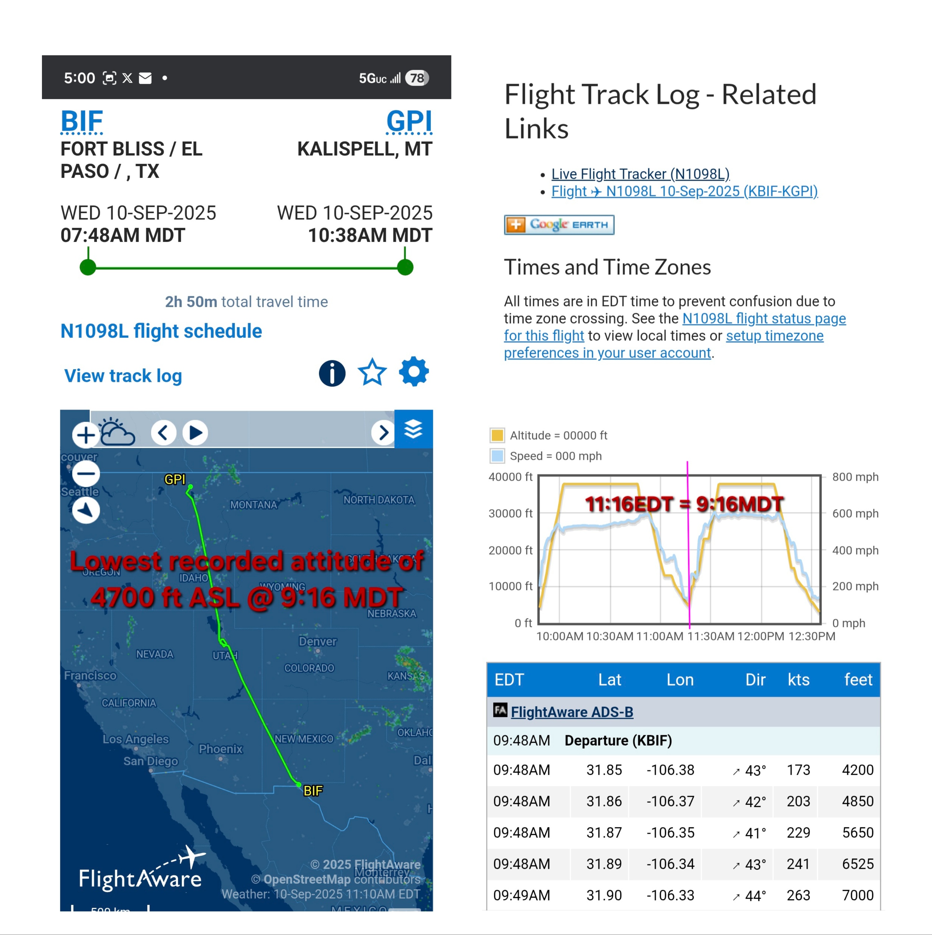
A FlightAware capture for N1098L on WED 10-SEP-2025. The route header reads BIF FORT BLISS / EL PASO, TX departing 07:48AM MDT, to KALISPELL, MT (GPI) arriving 10:38AM MDT, with "2h 50m total travel time." A map shows the track running north across Utah and Montana, and a performance graph plots altitude and speed below.
Someone has annotated the image with the line "Lowest recorded altitude of 4700 ft ASL @ 9:16 MDT." That timestamp falls inside the window investigators point to for the first low pass over the Utah Valley, and 4,700 feet above sea level is only a few hundred feet above the valley floor, which sits near 4,500 feet.
That altitude annotation is where the interpretive work begins. Read as feet above sea level, a Global 6500 at 4,700 feet over Provo is extraordinarily low for a transit flight. Read carelessly as feet above ground, it would be unremarkable. The distinction is exactly the kind of detail that separates a documented anomaly from a misread chart, and it is worth checking against the raw track log rather than the annotation.
See N1098L Spy Plane, the same-day leg list on Flight Numbers, and Biggs Army Airfield.
This website's author is @HolonCitizen on X and YouTube/@HolonCitizen. Follow me there.
Where This Image Appears
This image is used on the following investigation pages:
- 600,000-File Document Dump and Withheld Raw Data (Claims)
- Img Photo ac74d8
- overview
- Biggs Army Airfield (KBIF)
- Shooting Time Disputes (12:23 vs 12:27 MDT)
Related Areas
- Cluster: Aircraft and Flight Records
- Section: Planes
- All photos: Photos