N59906 Tracked Over the Utah Valley
 Next Image
What This Image Shows
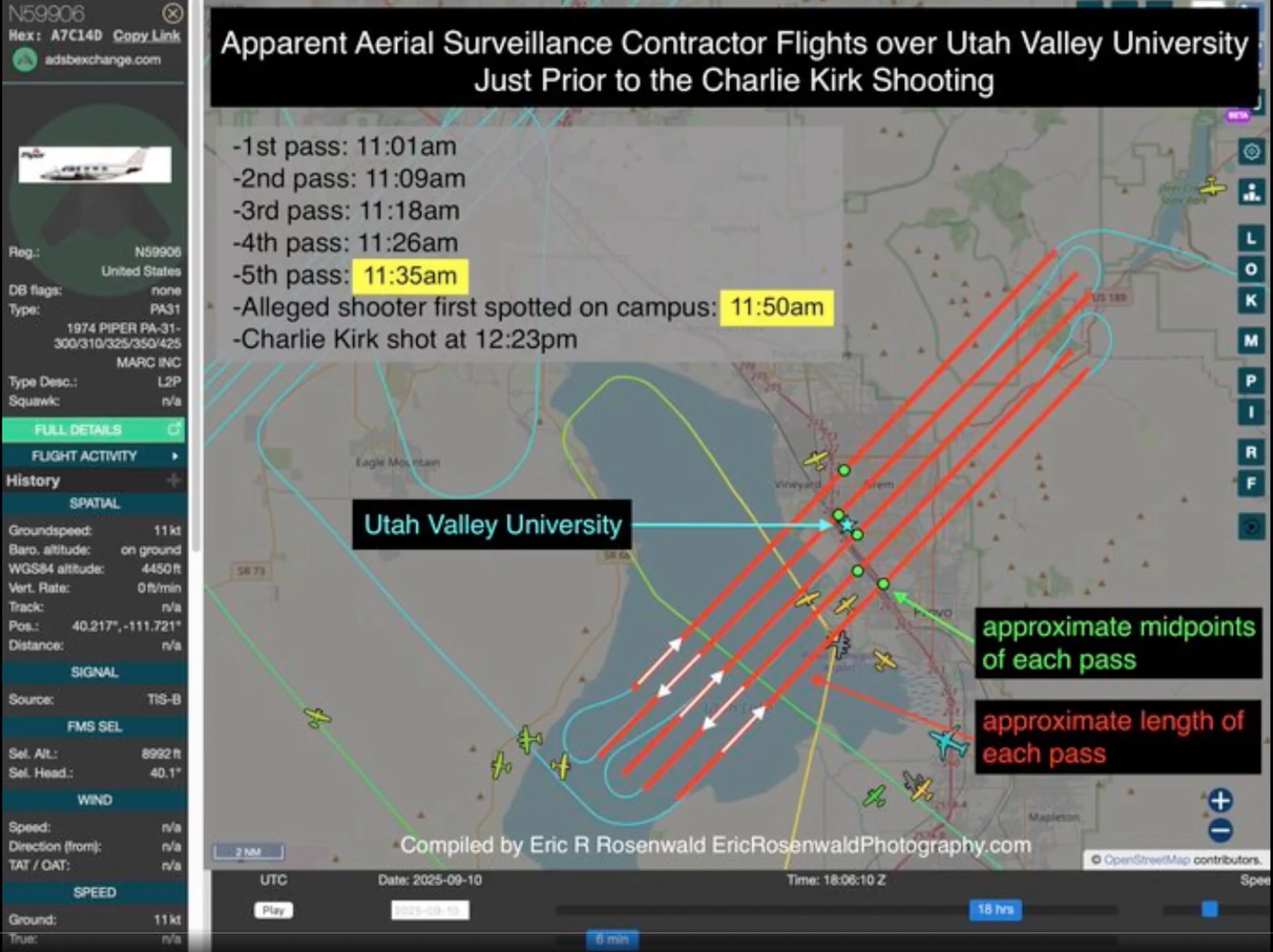
An ADS-B Exchange capture for N59906. The sidebar reads Hex A7C14D, Reg. N59906, United States, Type PA31, 1974 PIPER PA-31-300/310/325/350/425, operator MARC INC, type description L2P. Telemetry shows groundspeed 11 kt, on ground, barometric altitude 4,450 ft, position 40.217, -111.721, signal source TIS-B. The map traces flight paths over the Utah Valley near UVU, and the capture has been annotated with a timeline and the heading "Apparent Aerial Surveillance Contractor Flights over..."
The position given is the Provo airport area, so this frame catches the aircraft on the ground rather than mid-pattern. What the annotated track shows is the reported sequence: four passes over the campus between roughly 11:01 AM and 11:35 AM local time on September 10, 2025, at around 15,000 feet above ground level, ending about 48 minutes before the shooting.
MARC Inc. is a contractor supplying survey and mapping aircraft to government and commercial clients, and a PA-31 flying a north-south grid at that altitude is the standard profile for aerial photography or LiDAR work -- possibly for the nearby interstate corridor. The unanswered question is narrow and specific: who commissioned the flight, and does imagery from it exist. Neither MARC Inc. nor any agency has answered publicly.
See N59906 for the full analysis and N55906 for the tail-number confusion.
This website's author is @HolonCitizen on X and YouTube/@HolonCitizen. Follow me there.
Where This Image Appears
This image is used on the following investigation pages:
Related Areas
- Cluster: Aircraft and Flight Records
- Section: Planes
- All photos: Photos