N888KG Track Toward Northern Arizona
 Next Image
What This Image Shows
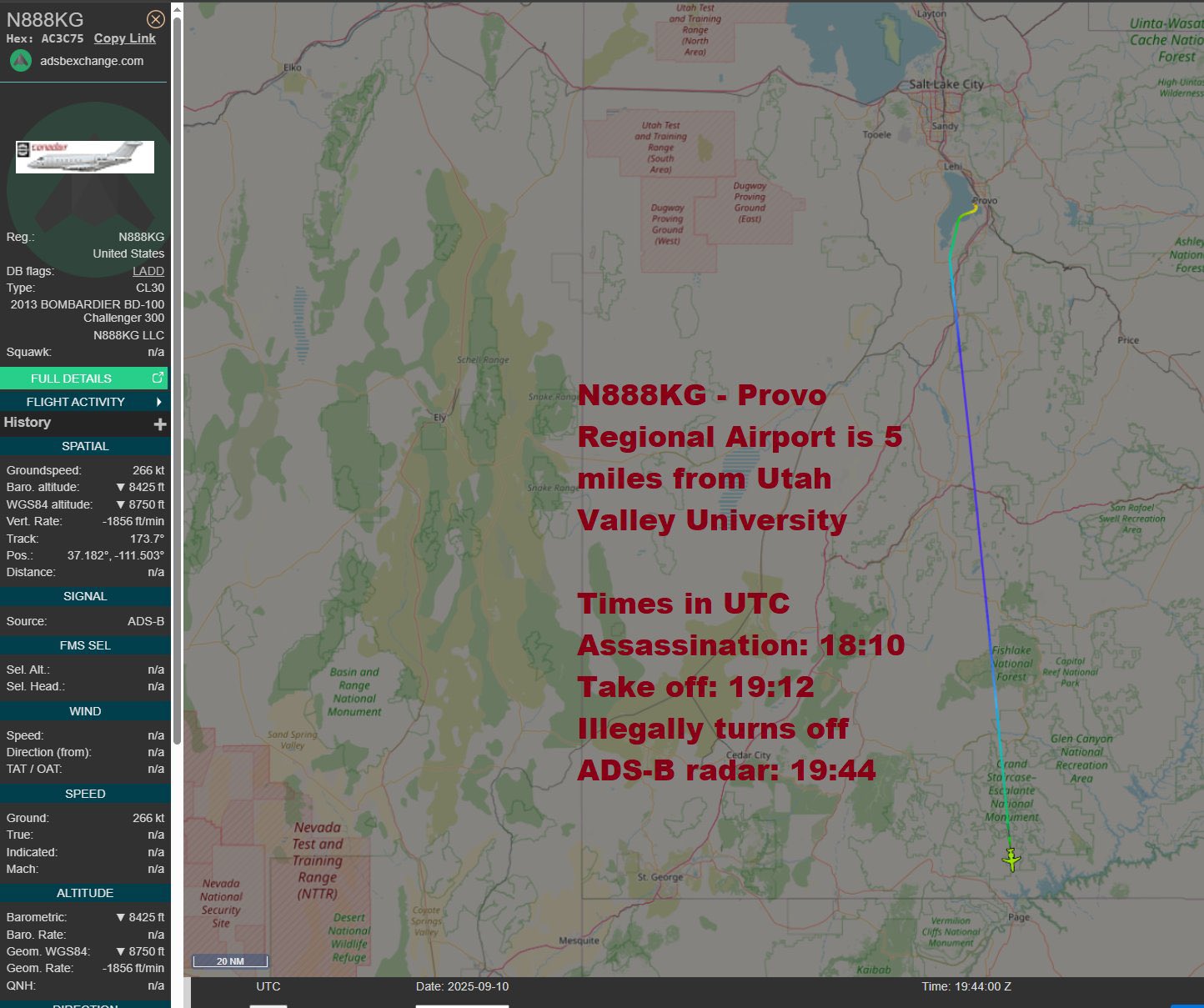
A third ADS-B Exchange capture of N888KG, this one weighted toward the map. The topographic view traces the flight path over Utah and into northern Arizona; the sidebar repeats the identity block -- Hex AC3C75, LADD, CL30, 2013 Bombardier BD-100 Challenger 300, N888KG LLC -- with groundspeed 266 kt, barometric altitude 8,425 ft descending, vertical rate -1,856 ft/min, track 173.7 degrees, position 37.182, -111.503.
The telemetry matches Photo 39 exactly, so these are two crops of the same moment -- one framed on the data panel, one on the route. Preserving both is deliberate: the panel documents the numbers, the map documents where they were taken.
What the combined picture supports is narrow and worth stating precisely. A privately held Challenger 300, blocked from mainstream trackers, was descending toward the Page area of northern Arizona on the evening of September 10, 2025, some hours after departing the Provo area. Where it went next, and who was aboard, is not in any public record.
See N888KG, Tuba City Airport, and Sept 10 Flight Timeline.
This website's author is @HolonCitizen on X and YouTube/@HolonCitizen. Follow me there.
Where This Image Appears
This image is used on the following investigation pages:
- Img Photo f03fe7
- overview
- N888KG LLC — Post-Shooting Jet (Claims)
- Other Planes Activity Timeline (N888KG, SAM Flights, Cluster)
Related Areas
- Cluster: Aircraft and Flight Records
- Section: Planes
- All photos: Photos