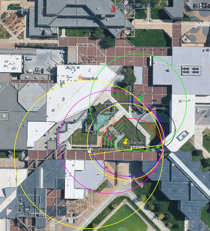
Sound Radius Map With Camera POV Pins
 Next Image
What This Image Shows
An overhead satellite view of the campus courtyard, overlaid with a series of concentric coloured ellipses in yellow, magenta, green, blue, red, and black, and with labelled map pins dropped on specific points. The pins read Rooftop, Balcony POV, Stage Left POV, Charlie, Livestream POV, and Chick-fil-A.
This is one of the more genuinely useful analytical images in the cluster. The pins fix the recording positions of the surviving videos relative to the stage and to the claimed firing position, and the concentric rings model how far sound travels in a given interval — the basis for timing a gunshot's arrival at each camera. If the audio on two recordings made at known distances does not fit the propagation model for a single event at a single origin, that is a measurable discrepancy rather than an impression.
That is exactly the argument independent acoustic analysts have advanced, and it is the reason this map exists. The acoustics work is collected in the Acoustics Expert sub-cluster and set out at Acoustic Two-Event Split and Witness Audio Conflicts. The rooftop position itself is examined at Losee Center and the courtyard layout at Courtyard.
This website's author is @HolonCitizen on X and YouTube/@HolonCitizen. Follow me there.
Where This Image Appears
This image is used on the following investigation pages:
- Institutional Resignations After the Shooting
- Bullet Lodged in Stage Wood
- Canon XA55 Audio — Three Booms and Stage Detonation
- Institutional, Media, and Organizational Motive Dynamics (Claims)
- Img Map Bullets Sound a05228
- overview
- Img Map Bullets Sound a05228 x
- overview
- UVU Institutional Response
- Maps
Related Areas
- Cluster: Ballistics and the Gun
- Section: Gun & Bullet Analysis
- All photos: Photos