Impact Location Analysis at 157 Degrees
 Next Image
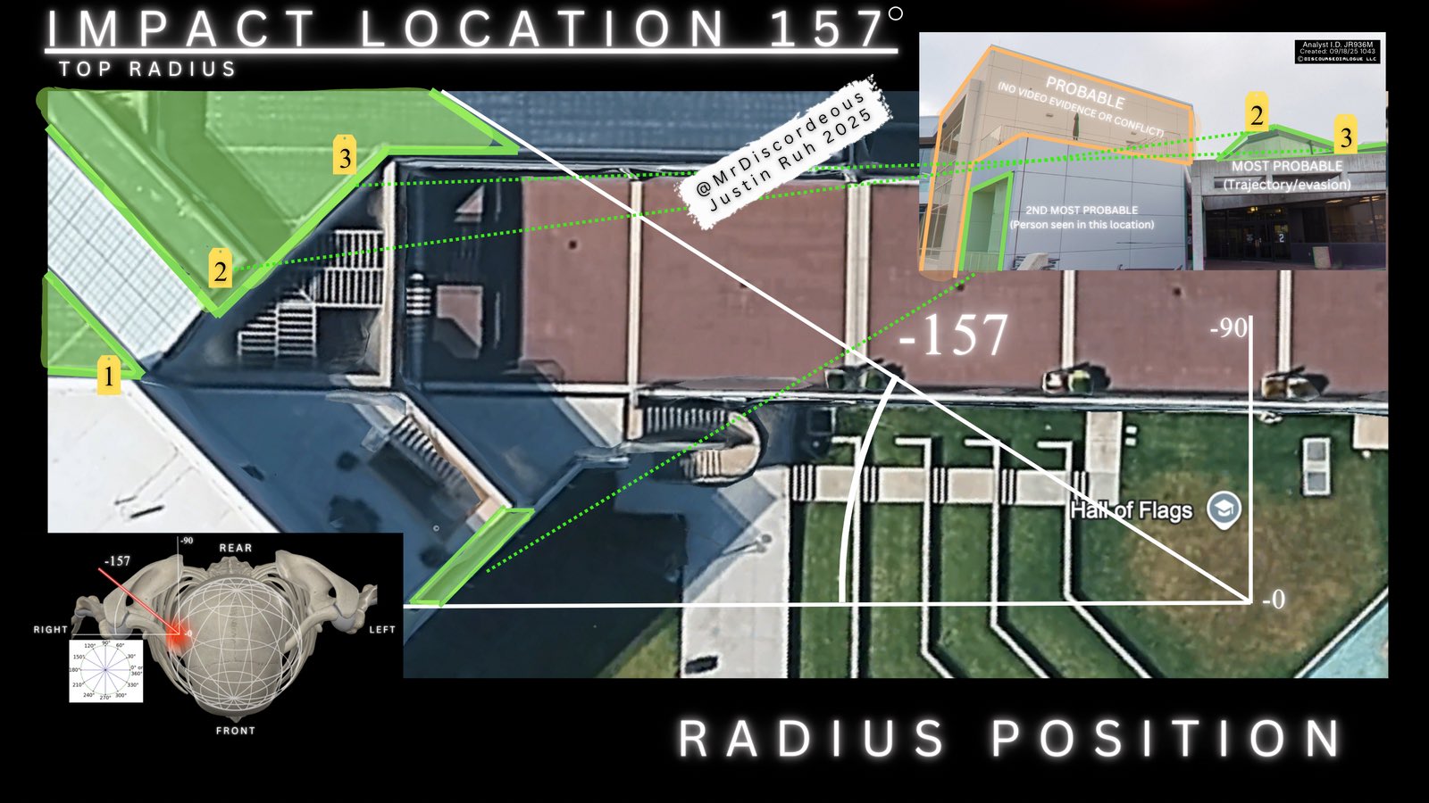
What This Image Shows
A dense analytical graphic built on a high-resolution aerial view of the campus plaza. Geometric lines, angle measurements, and colour-coded green and orange zones are overlaid on the map, along with two inset windows — a three-dimensional skull diagram marked RIGHT, REAR, LEFT, FRONT, and a street-level architectural photograph. The header reads IMPACT LOCATION 157 degrees and TOP RADIUS, the footer reads RADIUS POSITION, and angle indicators run from 0 through minus 90 to minus 157.
The graphic is signed and dated in a way most of this material is not: a box at the upper right reads Analyst I.D. JR936M, Created 09/18/25 1043, DISCOURSEDIALOGUE LLC, watermarked to @MrDiscordeous, Justin Ruh, 2025. The labelled zones rank candidate origins — one marked PROBABLE with the note no video evidence or conflict, one marked 2ND MOST PROBABLE with the note person seen in this location, and a third ranked by trajectory. A campus map pin marks the Hall of Flags.
The method is to work backwards from the orientation of the head at impact, expressed as a bearing on the skull inset, to a compass line across the plaza, and then to a set of positions along that line ranked by what the available footage supports. It is one of the more rigorous independent reconstructions in circulation, and it is still an inference built on public video rather than on measurements. Read it against Shooting Locations, Losee Center, and Acoustic Two-Event Split.
This website's author is @HolonCitizen on X and YouTube/@HolonCitizen. Follow me there.
Where This Image Appears
This image is used on the following investigation pages:
- Gun & Bullet Analysis
- MrDiscordeous (Justin Ruh) — X Posts
- Real Killer
- Img Photo 1fe5c0 x
- overview
- Img Photo 1fe5c0
- overview
Related Areas
- Cluster: Ballistics and the Gun
- Section: Gun & Bullet Analysis
- All photos: Photos