Elevation Rise Map in the 120-Degree Analysis
 Next Image
What This Image Shows
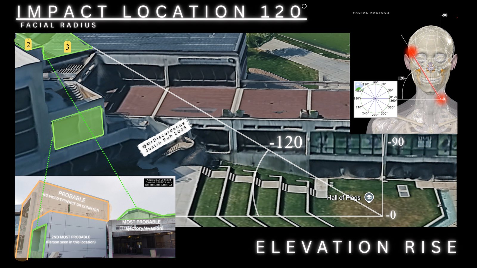
The map half of the 120-degree reconstruction. Aerial three-dimensional imagery of the campus plaza carries geometric overlays and directional lines, with an anatomical inset and compass diagram at the upper right and a photographic inset at the lower left. Headers read IMPACT LOCATION 120 degrees, FACIAL RADIUS, and, along the bottom, ELEVATION RISE.
The overlaid labels rank the candidate origins in the same scheme used across this analyst's sheets: MOST PROBABLE, annotated trajectory and evasion; 2ND MOST PROBABLE, annotated person seen in this location; and a position marked PROBABLE with the note no video evidence or conflict. The analyst identification box reads JR936M with a creation stamp of 09/18/25, and the campus pin marks the Hall of Flags.
The ELEVATION RISE label is the substantive addition here. A bearing across a flat map does not by itself distinguish a shot from a rooftop from a shot at ground level along the same line, so elevation has to be brought in separately — and that is exactly the question the acoustic analysts in this cluster are arguing about from the other direction. Compare with Losee Center, Shooting Locations, and Acoustic Two-Event Split.
This website's author is @HolonCitizen on X and YouTube/@HolonCitizen. Follow me there.
Where This Image Appears
This image is used on the following investigation pages:
- Gun & Bullet Analysis
- MrDiscordeous (Justin Ruh) — X Posts
- Real Killer
- Img Photo 6b443d x
- overview
- Img Photo 6b443d
- overview
Related Areas
- Cluster: Ballistics and the Gun
- Section: Gun & Bullet Analysis
- All photos: Photos