Measured Distances Across the UVU Plaza
 Next Image
What This Image Shows
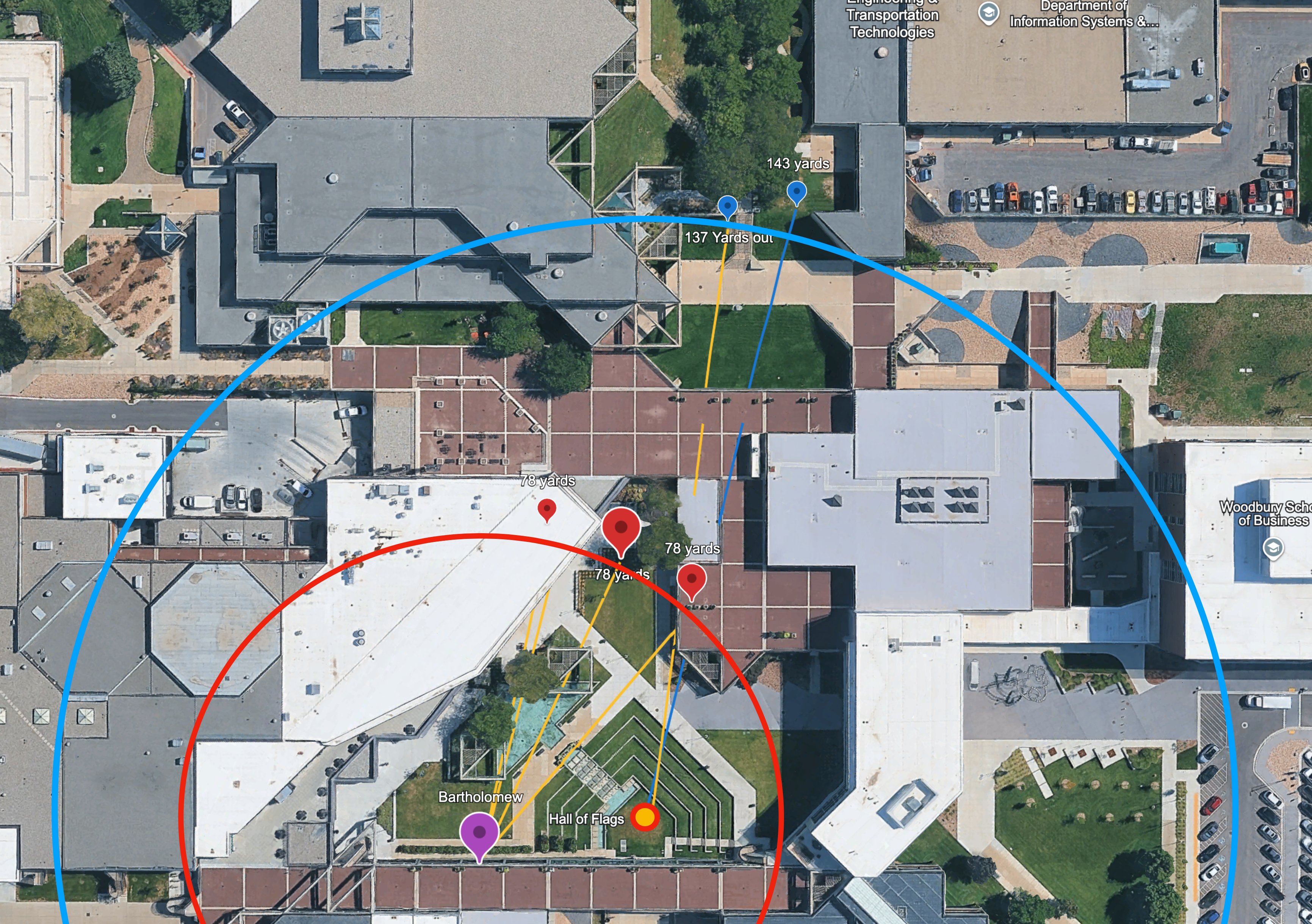
An aerial satellite photograph of the campus, overlaid with a red circle, a larger blue circle, and yellow and blue measurement lines running out to labelled points. The buildings are named on the map — Engineering and Transportation Technologies, the Woodbury School of Business, the Department of Information Systems — with the Hall of Flags marked at the bottom.
The measurements are the content: 143 yards to one pin, 137 yards out to another, and 78 yards repeated at three points around the central red circle, with a purple pin labelled Bartholomew. Those distances are the inputs every acoustic and trajectory argument in this cluster depends on, and putting them on a single sheet is what makes those arguments checkable.
The named buildings matter too, because the dispute over where the shot originated is a dispute about which of these structures had a line of sight to the stage and which of them anyone was seen on or near. The candidate positions are examined at Shooting Locations and Losee Center; the acoustic use of these distances is at Acoustic Two-Event Split, and the plaza itself at Courtyard.
This website's author is @HolonCitizen on X and YouTube/@HolonCitizen. Follow me there.
Where This Image Appears
This image is used on the following investigation pages:
- State Department and Diplomatic Response (Claims)
- Law 1: Force Information Disclosure
- Img Photo d1d5eb
- overview
- Superfeed Technologies (Claims)
- UVU Institutional Response
- Donor & Pre-Event Meeting Circle
Related Areas
- Cluster: Ballistics and the Gun
- Section: Gun & Bullet Analysis
- All photos: Photos