Campus Map With Sound Rings and POV Pins
 Next Image
What This Image Shows
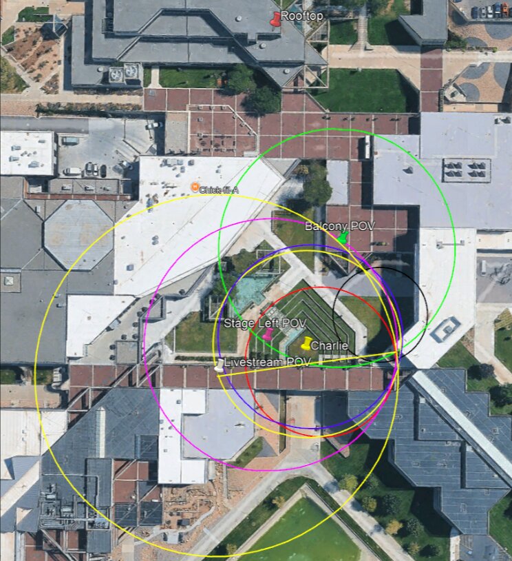
A top-down satellite view of the courtyard and the buildings around it, overlaid with multi-coloured concentric circles in yellow, green, magenta, indigo, red, and black, and marker pins labelled Rooftop, Balcony POV, Stage Left POV, Charlie, Livestream POV, and Chick-fil-A.
The pins fix five things: the claimed firing position, the stage position, and the three surviving camera viewpoints that recorded usable audio. The concentric rings are the propagation model — each ring is where a sound originating at the centre has reached after a fixed interval, so the ring spacing converts distance into arrival time for every pin on the map.
Set up that way, the map turns a subjective argument into a testable one: given the pin positions, a single event at the rooftop predicts a specific arrival order and specific gaps at the three cameras. If the recordings disagree with that prediction, either a pin is wrong or the assumption of a single origin is. That is the case independent analysts have been pressing. See Acoustic Two-Event Split, Losee Center, and the near-identical companion map in this cluster.
This website's author is @HolonCitizen on X and YouTube/@HolonCitizen. Follow me there.
Where This Image Appears
This image is used on the following investigation pages:
Related Areas
- Cluster: Ballistics and the Gun
- Section: Gun & Bullet Analysis
- All photos: Photos
More In This Cluster
- Previous: Handwritten Sound-Propagation Calculation
- Next: Troofevades Analysis Great