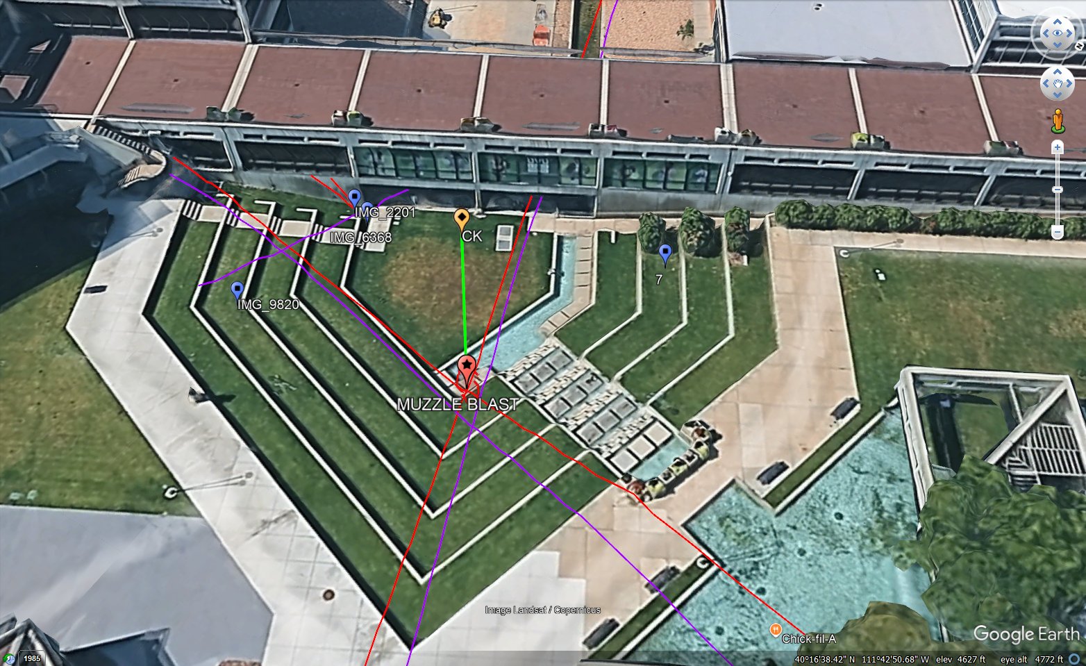
Google Earth Map Placing the Muzzle Blast
 Next Image
What This Image Shows
A three-dimensional Google Earth capture of the campus plaza, with the terraced lawns, walkways, water feature, and surrounding buildings visible. Coloured lines in red, purple, and green radiate from a central red pin labelled MUZZLE BLAST. An orange pin is labelled CK, and blue pins are labelled with source file names — IMG_9820, IMG_2201, IMG_6368. The coordinate bar reads 40 degrees 16 minutes north, 111 degrees 42 minutes west, elevation 4627 feet.
The file naming is the useful part. Rather than describing the sources in prose, the analyst has pinned each individual phone video to the spot it was shot from, so anyone with the same clips can reproduce the geometry. The lines from the muzzle-blast pin are the sight lines and propagation paths to each of those positions.
Where the muzzle-blast pin sits is of course the conclusion rather than an input, and it is the point in dispute — the state places the shot on the Losee Center rooftop, and several independent analysts place it lower and closer. The coordinates make the claim checkable against the campus, which is more than most of this material offers. See Shooting Locations, Losee Center, and Acoustic Two-Event Split.
This website's author is @HolonCitizen on X and YouTube/@HolonCitizen. Follow me there.
Where This Image Appears
This image is used on the following investigation pages:
- Institutional Resignations After the Shooting
- Institutional, Media, and Organizational Motive Dynamics (Claims)
- Forensic Analysis Gaps
- Central Figures in the Charlie Kirk Case (Context Only)
- Img Troofevades Analysis Great a2d749
- overview
- UVU Institutional Response
Related Areas
- Cluster: Ballistics and the Gun
- Section: Gun & Bullet Analysis
- All photos: Photos
More In This Cluster
- Previous: Campus Map With Sound Rings and POV Pins
- Next: Close E0XsJ