Flightradar24 Wide View — Before and After Marks
 Next Image
What This Image Shows
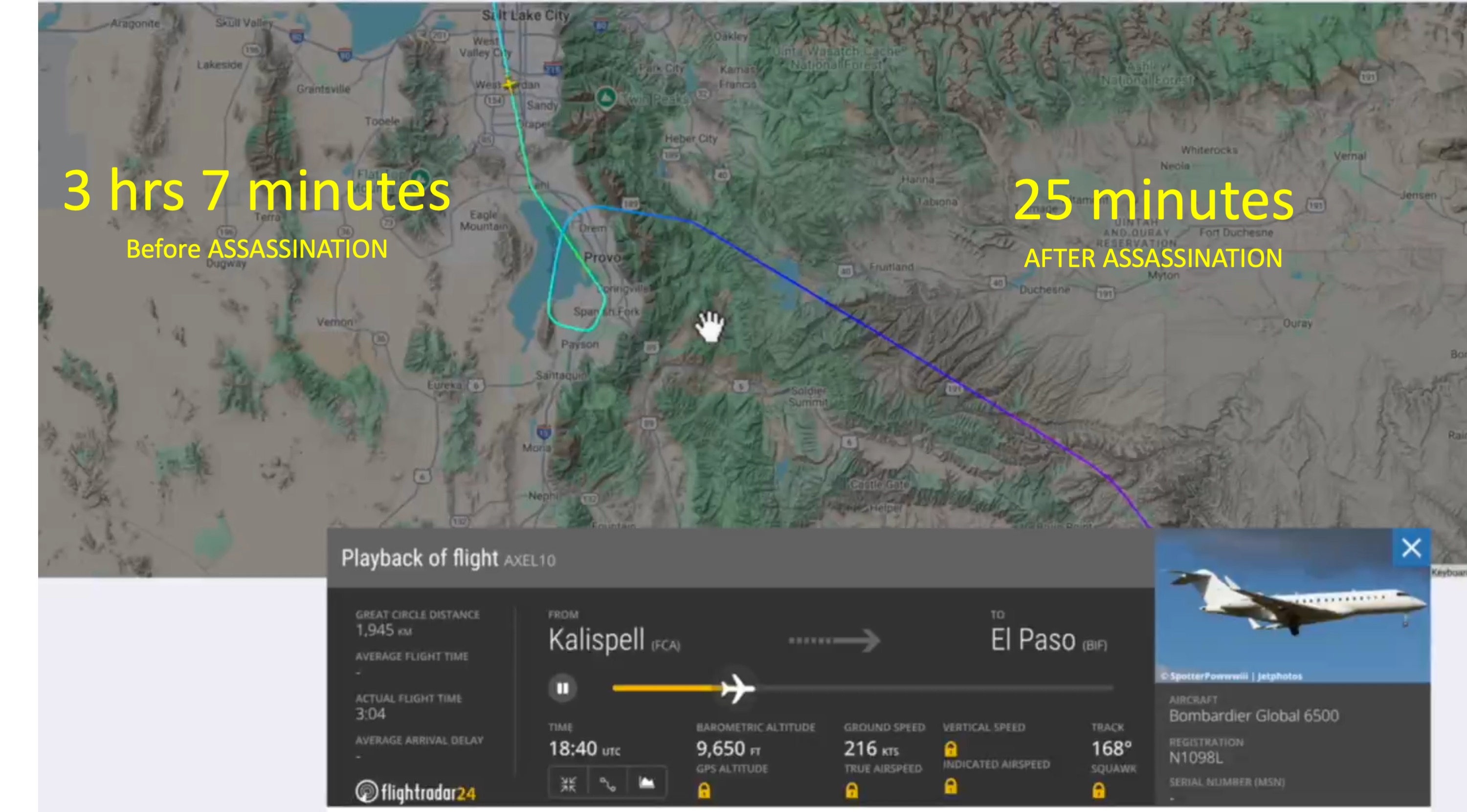
The recurring caption block on this slide is the deck's core flight claim, repeated on every N1098L slide: "The Flight N1098L is designed to launch military drones. Normally flies at 41,000' altitude. Dropped to 203' altitude 116 knots stall speed @ 9:16am MT 1-mile from UVU. Then looped back to 1-mile from UVU and 203' altitude @ stall speed 25 minutes after assassination." The header calls the aircraft a "Drone Spy Plane" associated with the callsign AXEL10 and the Army's HADES program.
This is the wide-area version of the tracking view, covering Salt Lake City, Skull Valley, Grantsville, Oakley, Heber City, Eagle Mountain, Provo, Payson, Duchesne, and Vernal. The deck has placed two markers on the track: "3 hrs 7 minutes Before ASSASSINATION" and "25 minutes AFTER ASSASSINATION." The Flightradar24 panel reads time 18:40 UTC, barometric altitude 9,650 feet, ground speed 216 knots, track 168 degrees, route Kalispell (FCA) to El Paso (BIF), actual flight time 3:04, aircraft Bombardier Global 6500, registration N1098L.
Read the numbers as the deck author's reading of public flight-tracking data, not as a finding. Low, slow passes near an airport corridor are ordinary, aircraft descend on approach, and no agency has said N1098L had any role in events at Utah Valley University. The deck itself states on its closing slide that "No claim is made that drone assassinated Charlie Kirk. Or that flight crew knew about assassination." This frame is useful precisely because it shows the whole leg: the aircraft was flying a long cross-country route between Montana and Texas, which is context the closer-in map frames leave out.
For the site's analysis of this aircraft see N1098L and HADES over UVU, the N1098L spy plane page, and N1098L air-launched drones.
This website's author is @HolonCitizen on X and YouTube/@HolonCitizen. Follow me there.
Where This Image Appears
This image is used on the following investigation pages:
- Utah County Jail (Spanish Fork)
- AES — The Heber City → Nashville Flight (Aug 25, 2025)
- Img Slide22 173ff1
- overview
- overview
- overview
Related Areas
- Cluster: VIDEO Drones CIA Israel
- All photos: Photos