N1098L at 203 Feet, One Mile From UVU
 Next Image
What This Image Shows
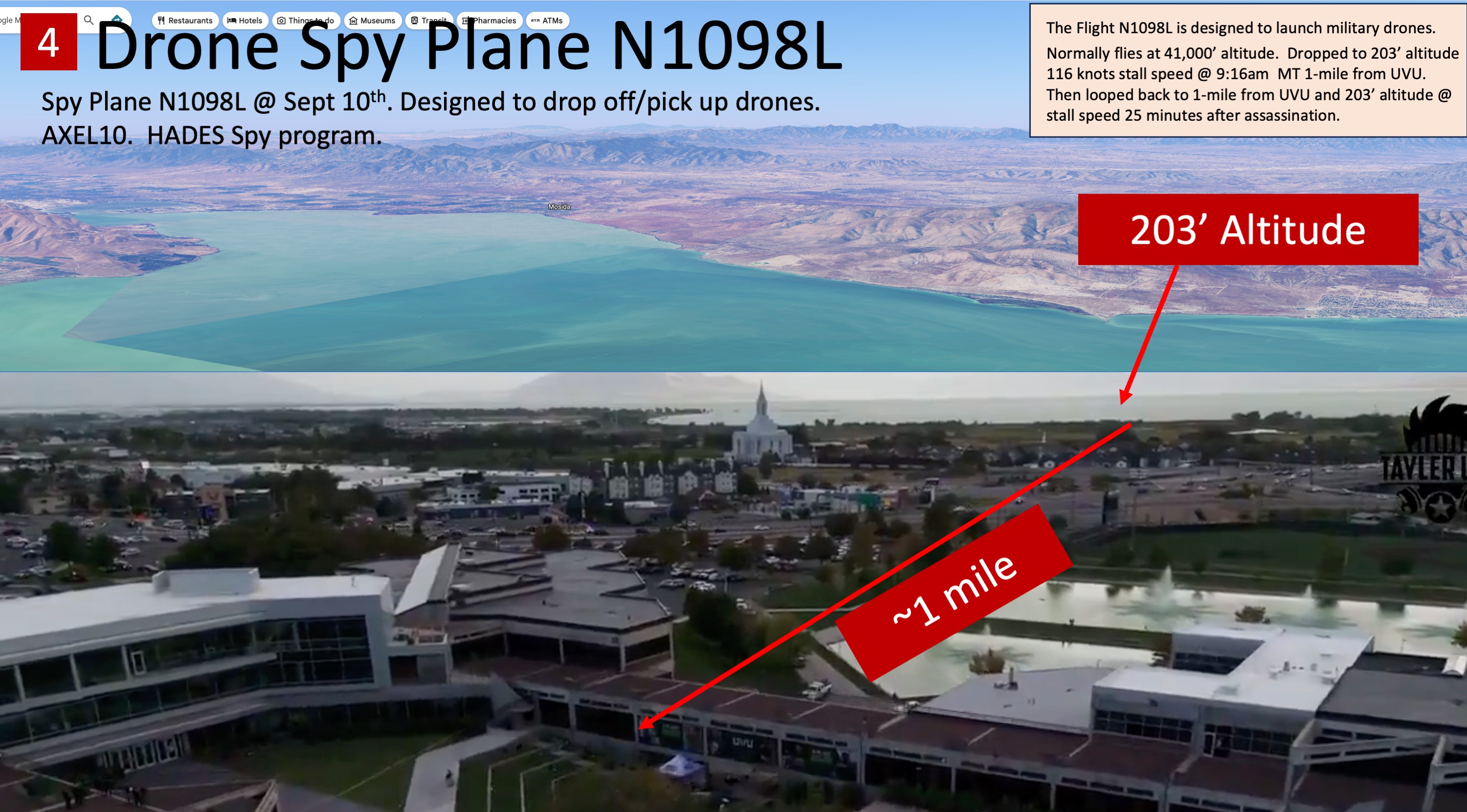
The recurring caption block on this slide is the deck's core flight claim, repeated on every N1098L slide: "The Flight N1098L is designed to launch military drones. Normally flies at 41,000' altitude. Dropped to 203' altitude 116 knots stall speed @ 9:16am MT 1-mile from UVU. Then looped back to 1-mile from UVU and 203' altitude @ stall speed 25 minutes after assassination." The header calls the aircraft a "Drone Spy Plane" associated with the callsign AXEL10 and the Army's HADES program.
This frame isolates the single number the whole thread turns on. The annotation reads "203' Altitude" with a distance callout of approximately one mile, marking where the deck says the aircraft was flying when it passed the campus. It is the low end of the claimed descent, set against the 41,000-foot cruise altitude shown on the companion slides.
Read the numbers as the deck author's reading of public flight-tracking data, not as a finding. Low, slow passes near an airport corridor are ordinary, aircraft descend on approach, and no agency has said N1098L had any role in events at Utah Valley University. The deck itself states on its closing slide that "No claim is made that drone assassinated Charlie Kirk. Or that flight crew knew about assassination." Two hundred feet is very low for a business-jet airframe, which is exactly why the claim deserves independent verification against the raw flight-tracking record rather than acceptance from a slide.
For the site's analysis of this aircraft see N1098L and HADES over UVU, the N1098L spy plane page, and N1098L air-launched drones.
This website's author is @HolonCitizen on X and YouTube/@HolonCitizen. Follow me there.
Where This Image Appears
This image is used on the following investigation pages:
- Img Slide8 7ac012
- overview
- overview
- overview
- N1098L Spy Plane
- N1098L (HADES) Plane Activity Timeline — Pre & Post Shot
Related Areas
- Cluster: VIDEO Drones CIA Israel
- All photos: Photos