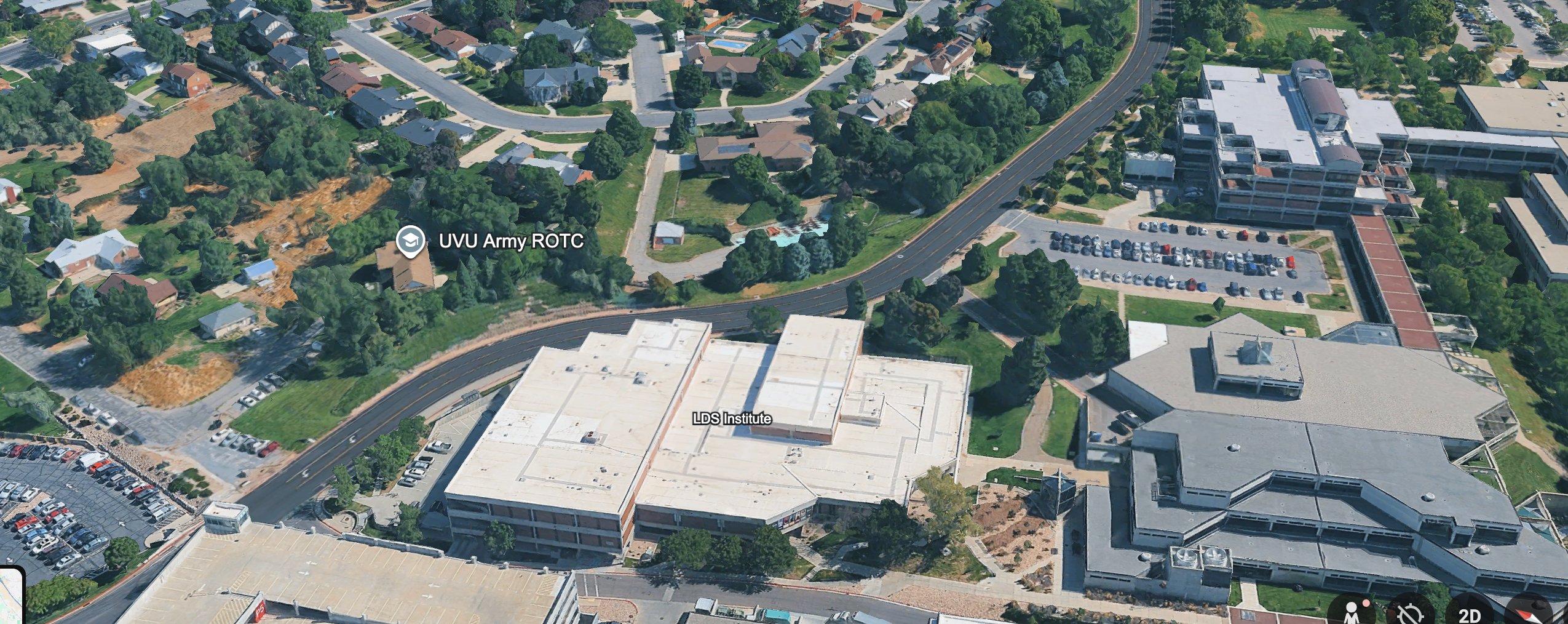
Aerial Map: LDS Institute and ROTC Building
 Next Image
What This Image Shows
An oblique three-dimensional aerial map showing part of the Utah Valley University campus and the residential neighbourhood beside it — winding roads, full parking lots, single-family homes with lawns and mature trees. Overlay labels identify the LDS Institute and the UVU Army ROTC building, and the mapping interface controls are visible at the corner.
The map is a working reference for the route the official account says the suspect took on foot after leaving the Losee Center rooftop. Rendering it obliquely rather than straight down matters, because it shows building heights and the sight lines between the campus edge and the houses — what a person on that route could see and be seen from.
The route is contested at every point. According to a June 2026 post by @MuppetMasher, the official statement puts the suspect's car in a campus lot at 8:29 AM without ever stating when it left, and no cell-tower reconstruction has been released. The written record is at Gun Dropped Location and Gun Discovery Sequence; the search photography along the same corridor is at Drop Off Locations.
This website's author is @HolonCitizen on X and YouTube/@HolonCitizen. Follow me there.
Where This Image Appears
This image is used on the following investigation pages:
Related Areas
More In This Cluster
- Next: Walk Path — Photo 2