Sightlines From Numbered Roof Points to the Lawn
 Next Image
What This Image Shows
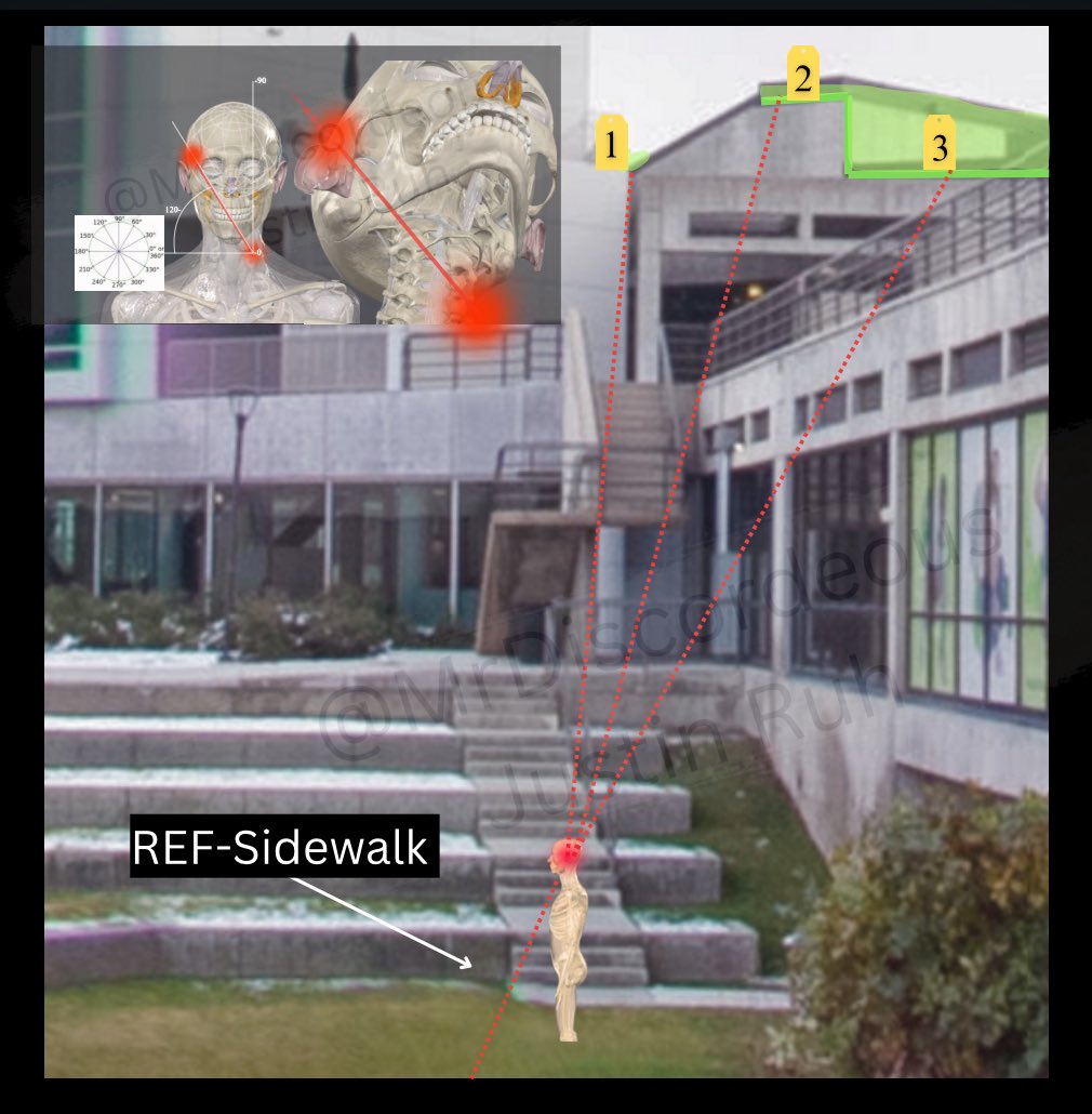
An analytical diagram built on a ground-level photograph rather than a satellite view, showing the exterior of the multi-level concrete building with its external staircases and metal railings, and the grass lawn bordered by tiered concrete steps in front of it.
Three numbered yellow tags are placed on the structure and red dashed lines are projected from them down to a figure on the lawn. The bearing figures 210 and 240 to 300 degrees appear again, along with 1201 and a REF-Sidewalk reference marker, and skeletal graphics sit in the upper left corner. Working from a real photograph rather than a render is the strength of this one: the parapets, the stair landings and the railing heights are actual, not modelled, so a sightline drawn on it reflects what a person standing at each numbered point could genuinely see.
That is what makes the numbered points worth testing individually. Some elevated positions on that facade have a clear view of the marked spot on the lawn and some do not, and the diagram invites the reader to check which. It remains an independent reconstruction, not an official exhibit, and it identifies no person. Read Losee Center, Courtyard, Wound Trajectory and Angle and Maps and Site Geometry.
This website's author is @HolonCitizen on X and YouTube/@HolonCitizen. Follow me there.
Where This Image Appears
This image is used on the following investigation pages: