Angles — Photos
Photos filed under Angles — 3 images on this page. Scan the list and open any image for the full picture and its write-up.
About This Cluster
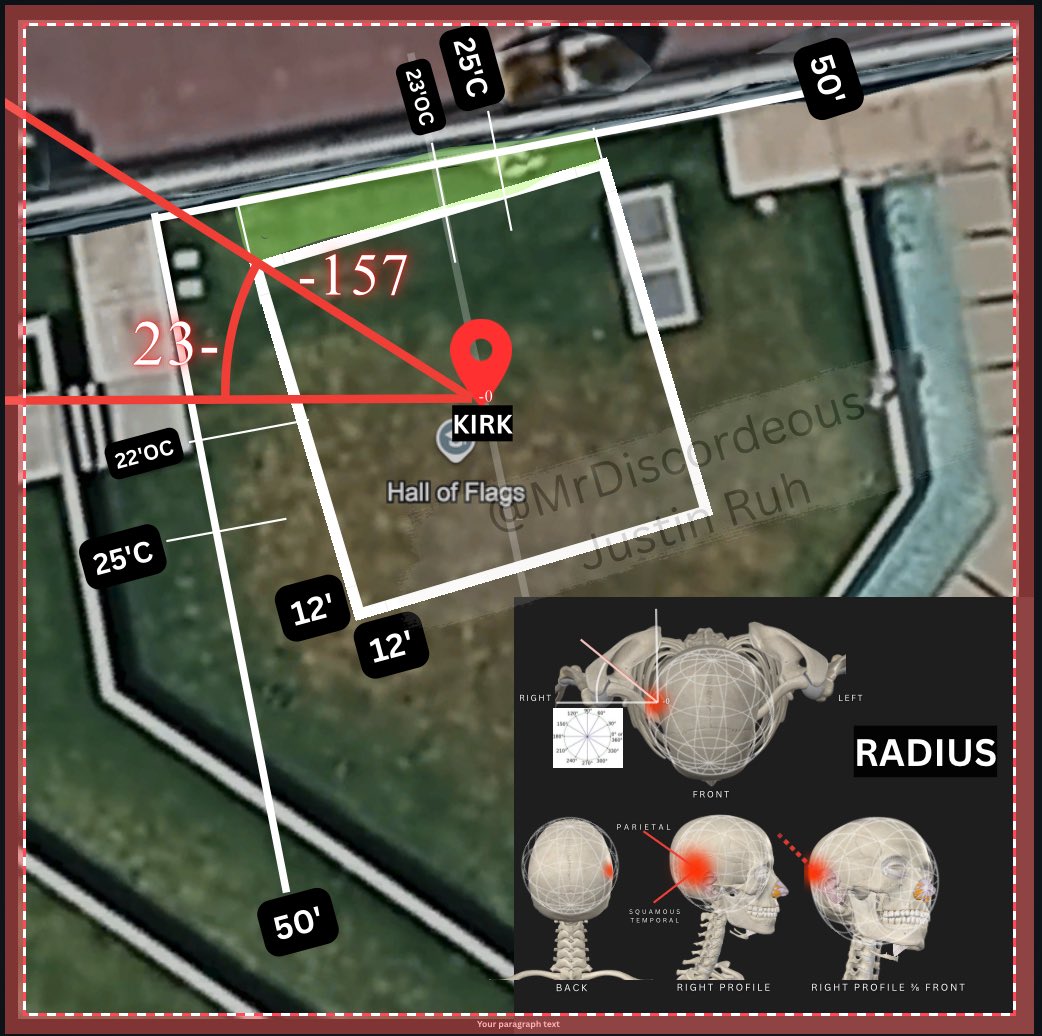
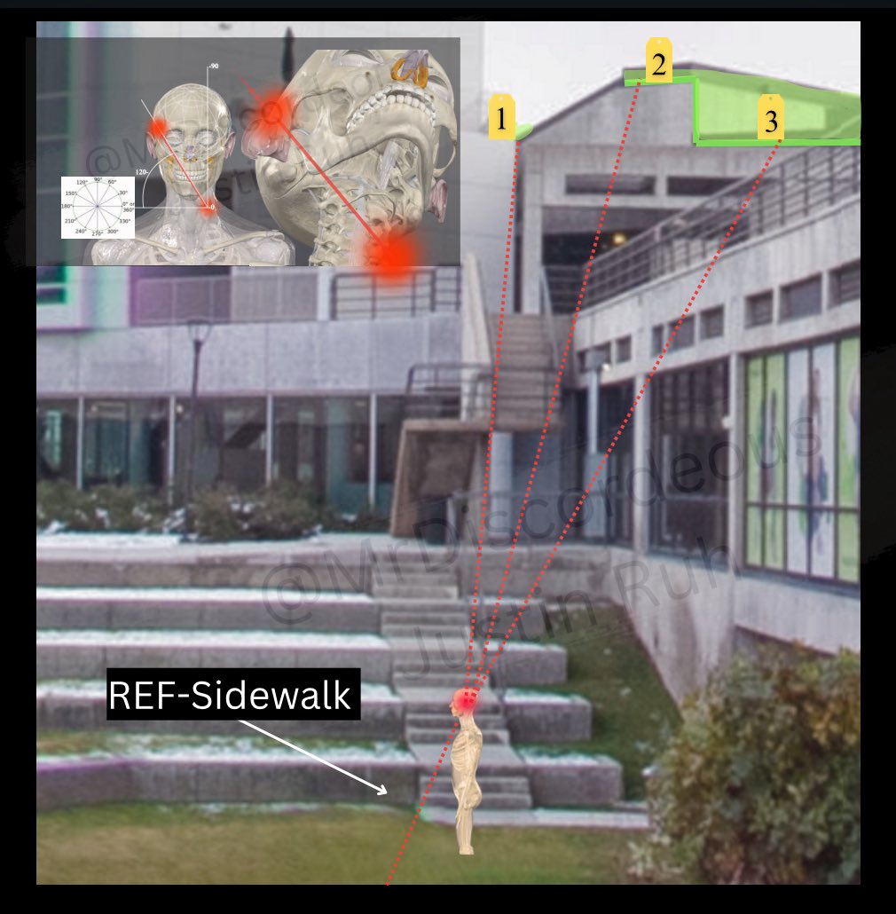
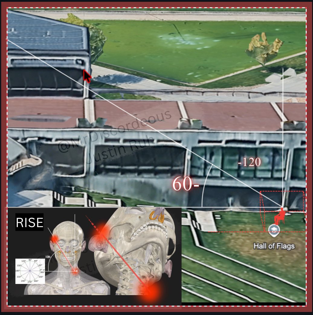
Angles holds three analytical diagrams that take the site geometry one step further and try to reconcile a shooter position with the wound. All three are composites built by independent researchers on top of Google Earth imagery and campus photographs, with measured lines, bearing figures and anatomical inserts drawn on. They are working reconstructions published on social media, not forensic reports, and the site presents them as arguments to be checked rather than as findings.
One diagram overlays bearing marks including 210 degrees, 240, 250 and 300 onto a 3D render of the concrete structure and the grass area beside the Hall of Flags, with a seated figure icon placed where Charlie Kirk was. A second maps distances and angles across the lawn, marks a rectangle labelled KIRK near the Hall of Flags, and sets an anatomical inset beside it showing skull and pelvis outlines with the parietal and squamous temporal regions labelled and impact points marked in red, with figures of 12 feet and 50 feet noted on the lawn. The third projects red dashed sightlines from numbered points on the multi-level concrete building down to a figure on the lawn below, keyed to a sidewalk reference. Taken together they are attempts to answer one question: does the officially described firing position produce the wound path that was described. Different analysts working the same imagery have reached different answers, and none of these diagrams has been verified against the autopsy record or the physical scene.
Read these next to Wound Trajectory and Angle, Cause of Death and Alternative Calibers and Weapons. For the underlying site layout, go back to Maps and Site Geometry and Losee Center.
This website's author is @HolonCitizen on X and YouTube/@HolonCitizen. Follow me there.
Related Areas
- Up: Maps and Site Geometry
- All photos: Photos