Google Maps Pins Around the UVU Courtyard
 Next Image
What This Image Shows
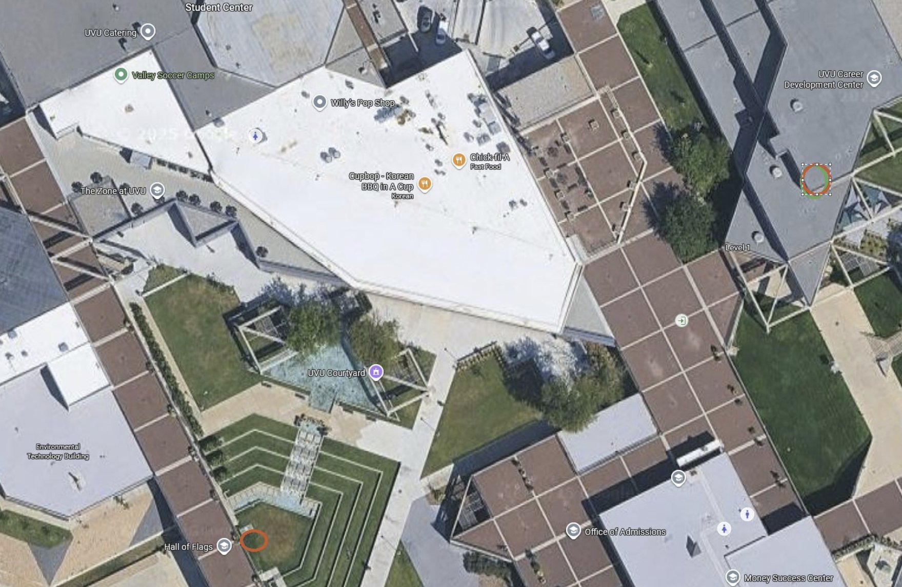
A top-down Google Maps aerial of the courtyard block, showing the large irregular white roof at the centre with its scattered HVAC units, the surrounding buildings, the paved plazas and the landscaped strips between them.
The map pins name the everyday functions of the block: Student Center, UVU Catering, Willy's Pop Shop, The Zone at UVU, Cupbop, UVU Courtyard, Environmental Technology Building, Hall of Flags, UVU Career Development Center, Chick-fil-A and Office of Admissions. Several of those names - Hall of Flags, Chick-fil-A and the courtyard itself - are used as fixed reference points in the trajectory and ranging diagrams elsewhere in this cluster, so this plate is what lets a reader translate a label on an analytical overlay back to a real place on the campus.
It is unannotated, which is its value. Use it to sanity-check the marked-up maps before trusting their geometry. Then read Angles, Courtyard, UVU Maps and Maps.
This website's author is @HolonCitizen on X and YouTube/@HolonCitizen. Follow me there.
Where This Image Appears
This image is used on the following investigation pages:
Related Areas
- Cluster: Maps and Site Geometry
- Section: Maps
- All photos: Photos