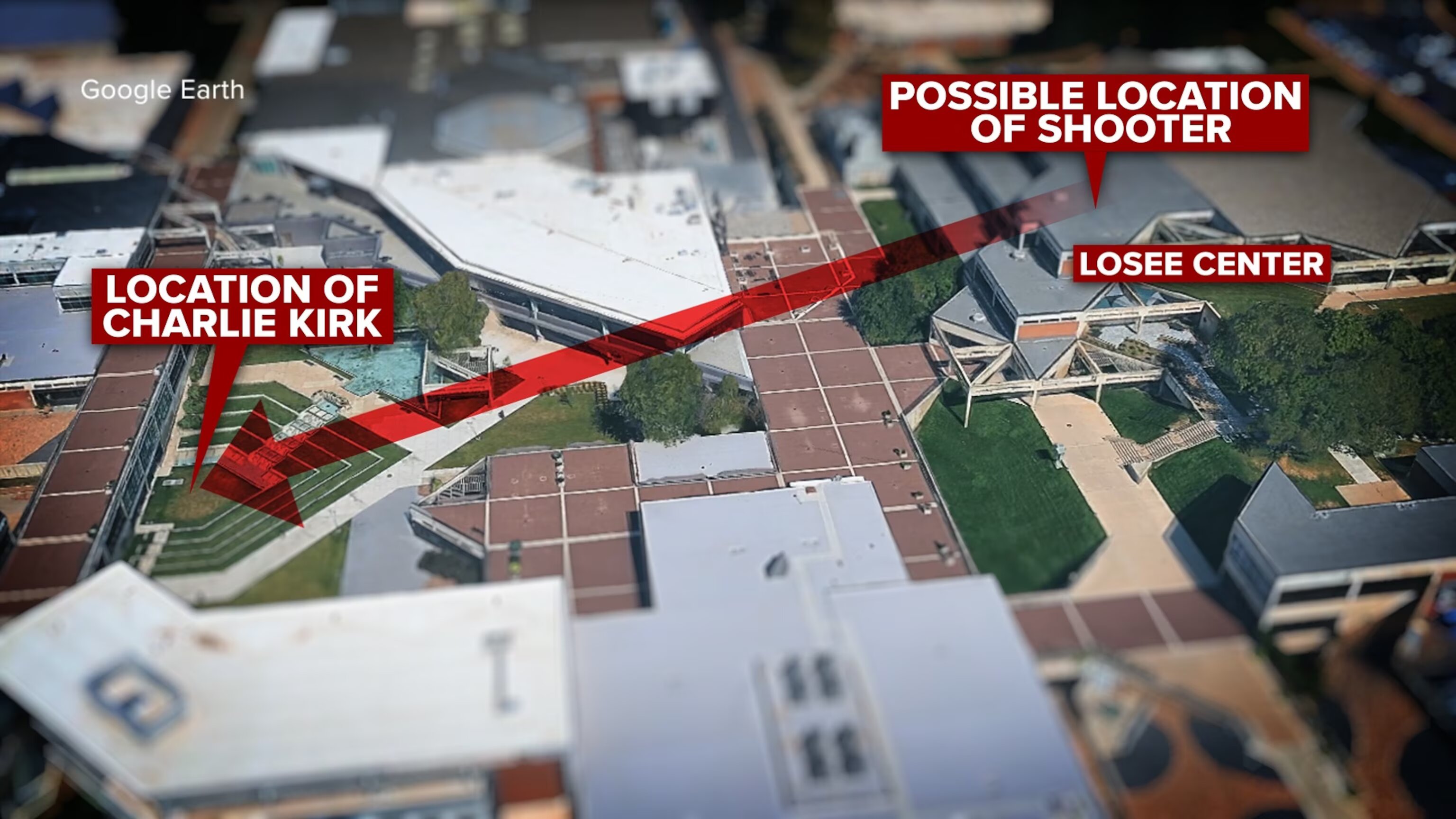
Google Earth Line of Sight to Losee Center
 Next Image
What This Image Shows
A 3D Google Earth render of the campus with red callout boxes and a large red arrow drawn across it to show a line of sight. The underlying imagery captures the brick-paved plaza, the light grey concrete buildings with their flat roofs and angular massing, and the open green spaces between them.
The three labels read LOCATION OF CHARLIE KIRK, POSSIBLE LOCATION OF SHOOTER and LOSEE CENTER. The word possible is the annotator's, and it is doing real work: this is a proposed sightline, drawn on public imagery by an independent researcher, not a surveyed line from an official reconstruction.
What the graphic does establish is that the geometry is at least plausible in the crude sense - there is an unobstructed path between those two points. That is not the same as establishing that a shot came from there, which is the question the acoustic work and the wound-path work in this investigation are trying to answer from other directions. Read it with Sound radius rings, Angles, Losee Center and Gun and Bullet.
This website's author is @HolonCitizen on X and YouTube/@HolonCitizen. Follow me there.
Where This Image Appears
This image is used on the following investigation pages:
Related Areas
- Cluster: Maps and Site Geometry
- Section: Maps
- All photos: Photos