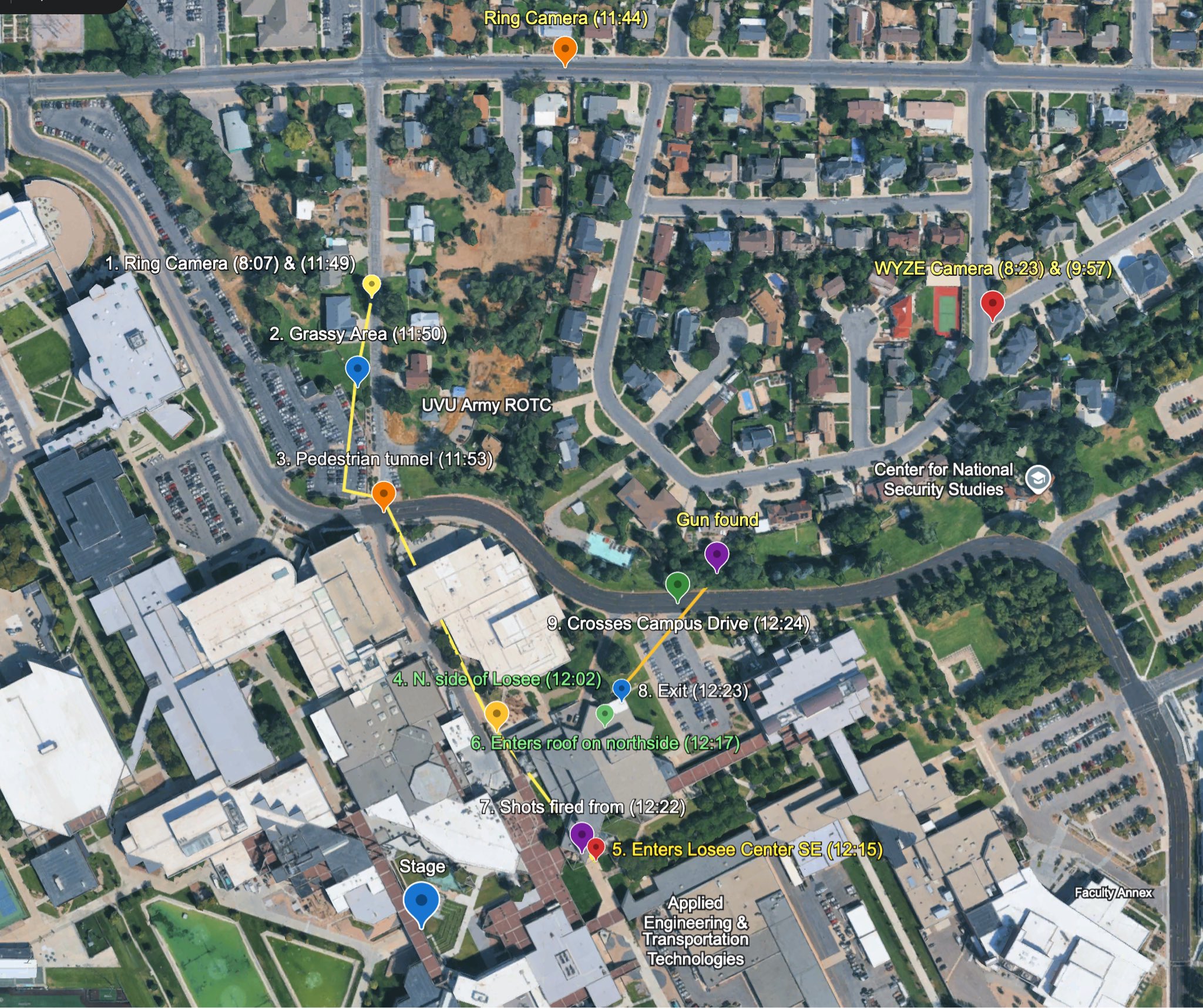
Timed Route Map From Ring Camera to Gun Found
 Next Image
What This Image Shows
The most detailed timed reconstruction in this cluster. A satellite view spanning the residential neighborhood at the top and the campus at the bottom, with coloured pins, a yellow path line and numbered stops laying out a full sequence.
The annotations read: Ring Camera (11:44), 1. Ring Camera (8:07) and (11:49), WYZE Camera (8:23) and (9:57), 2. Grassy Area (11:50), 3. Pedestrian tunnel (11:53), 4. N. side of Losee (12:02), 5. Enters Losee Center SE (12:15), 6. Enters roof on northside (12:17), 7. Shots fired from (12:22), 8. Exit (12:23), 9. Crosses Campus Drive (12:24), plus Gun found, UVU Army ROTC, Center for National Security Studies and Stage. Two things stand out. The times are drawn from private doorbell and security cameras rather than from institutional sources. And the Center for National Security Studies sits directly on the marked route, which the site treats separately.
Every timestamp here is a researcher's compilation from footage of varying quality, and the identity of the person in that footage is contested. Read Ring, WYZE, Timeline, Proof It Was Not Tyler, Gun Dropped Location and Wooded Area Gun Recovery.
This website's author is @HolonCitizen on X and YouTube/@HolonCitizen. Follow me there.
Where This Image Appears
This image is used on the following investigation pages:
Related Areas
- Cluster: Maps and Site Geometry
- Section: Maps
- All photos: Photos