Campus Route Map: Shooting Position to Hid Gun
 Next Image
What This Image Shows
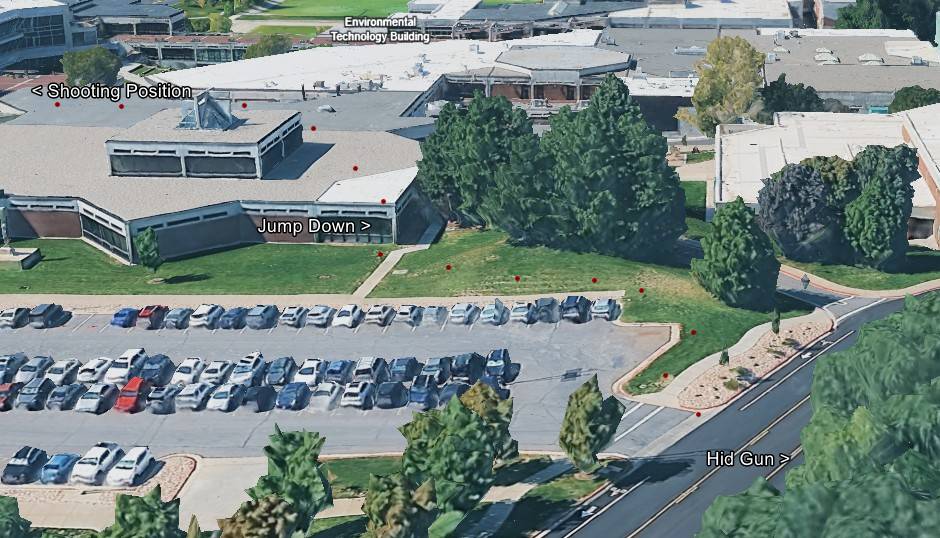
A 3D aerial render of the Utah Valley University campus, built from satellite mapping imagery, with the roof geometry, the parking lot, the lawns and an access road all visible from above. Small red marker dots have been dropped in a line across the render to trace a route, and white text labels with black outlines have been added by the researcher who published it.
The labels read Shooting Position, Technology Building, Enology Building, Jump Down and Hid Gun. Read together they are a compressed version of the official movement account: a firing point on a roof, a place where the person came down off that roof, and a location where the rifle was left. The map is one researcher's reconstruction drawn on public imagery, not an official exhibit, and the label positions are that researcher's reading of the released material.
This is the frame to hold next to the news-organisation maps in this cluster, because it uses the same landmarks but places them by eye rather than from court filings. Where the labels agree with the CBS News timeline graphic and the Fox News Digital map, the geometry is at least consistently reported; where they disagree, the disagreement is itself the finding. For the buildings named here see Losee Center and UVU Maps, and for the recovery location see Gun Dropped Location and Wooded Area Gun Recovery.
This website's author is @HolonCitizen on X and YouTube/@HolonCitizen. Follow me there.
Where This Image Appears
This image is used on the following investigation pages:
- Construction Site — 785 College Dr, Orem
- Img Photo 40b69a x
- overview
- Img Photo 40b69a
- overview
- overview
Related Areas
- Cluster: Maps and Site Geometry
- Section: Maps
- All photos: Photos