Orem Street Map With Vehicle and Timing Notes
 Next Image
What This Image Shows
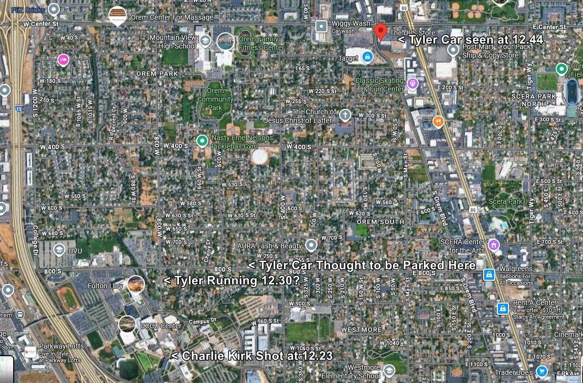
A satellite street map of Orem, Utah, covering the grid between Mountain View High School, Orem Community Park, SCERA Park and the UVU campus, with custom white text labels, arrows and icons added on top by a researcher tracking vehicle and foot movement.
The added labels include Tyler Car seen at 12.4, Tyler Car Thought to be Parked Here, Tyler Running 12.303 and Charlie Kirk Shot at 12.23, alongside ordinary map furniture such as Campus Dr, UCCU Center and Westmore Elementary School. Every one of those labels is the annotator's own reading of the prosecution's account and of footage whose subject is contested — Tyler Robinson has been charged but not convicted, and neither the vehicle identification nor the figure on foot has been established as his. Note the phrasing the annotator chose: thought to be parked here is explicitly a guess, and the site carries it as one. Vehicle location and parking place remain among the least documented parts of the public movement account.
What this map contributes is scale on the street grid rather than on campus. It shows how far the annotated parking candidates sit from the courtyard, which is the input to any argument about how long the trip on foot would take. Independent analysts have used exactly this measurement to question the published timeline. Read it with Timeline, Proof It Was Not Tyler and Tyler Robinson.
This website's author is @HolonCitizen on X and YouTube/@HolonCitizen. Follow me there.
Where This Image Appears
This image is used on the following investigation pages:
Related Areas
- Cluster: Maps and Site Geometry
- Section: Maps
- All photos: Photos