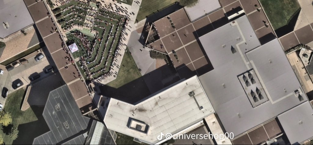
Overhead Aerial of the Crowd in the Terraces
 Next Image
What This Image Shows
A top-down aerial photograph, apparently taken from a drone or a high vantage point, showing the terraced amphitheater lawn at UVU filled with people arranged in neat concentric rows following the contours of the tiers. The flat multi-level roofs, concrete plazas, paved walkways and service lanes around the lawn are all visible.
This is the crowd-density plate. It fixes how many people were in the courtyard, where the seated block ended, and which parts of the surrounding hard surfaces were open. Those details bear directly on witness accounts, because they determine who had an unobstructed view of the stage and who was looking at the back of somebody's head. They also matter to the camera map in this cluster, since a filmer's usable line of sight depends on how many rows sat between them and the tent.
The presence of overhead imagery at all is its own thread on this site, given the separate reporting about aerial platforms over the event. Read Drones, then UVU Tent, Witnesses at UVU and Surveillance Cameras.
This website's author is @HolonCitizen on X and YouTube/@HolonCitizen. Follow me there.
Where This Image Appears
This image is used on the following investigation pages:
Related Areas
- Cluster: Maps and Site Geometry
- Section: Maps
- All photos: Photos