Neighborhood Exit Route and Car Parked Question
 Next Image
What This Image Shows
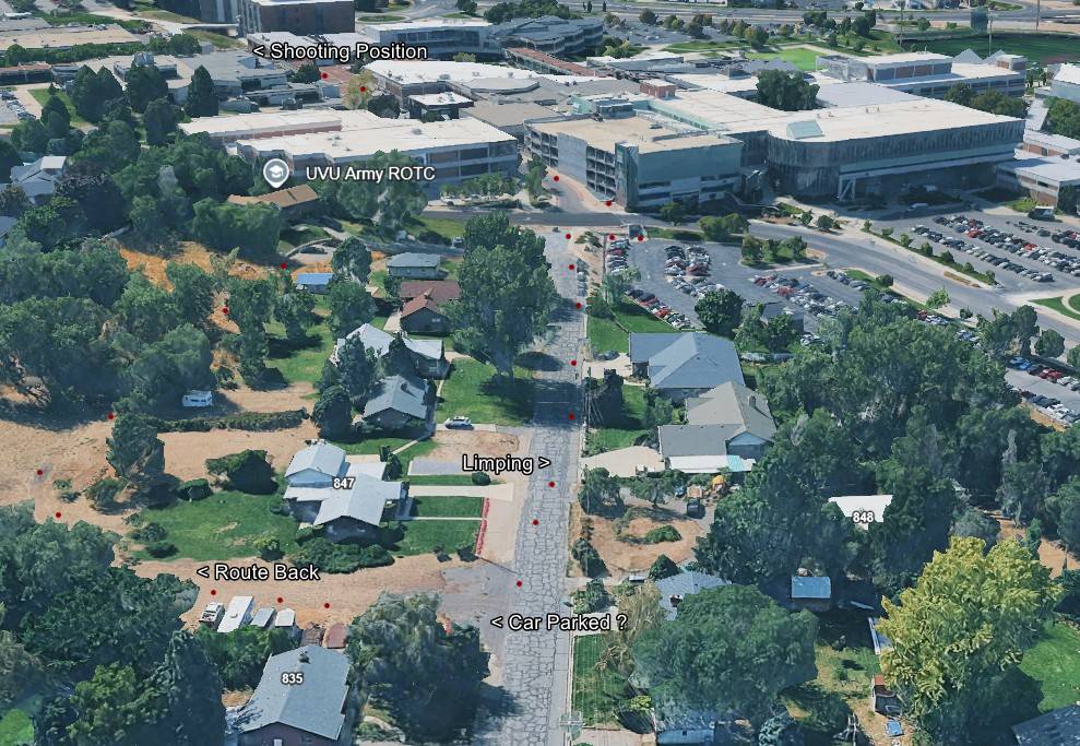
An elevated 3D aerial view looking north-northeast across the residential streets that sit immediately next to the UVU campus. Single-family homes with pitched roofs and mature trees fill the foreground, the modern campus buildings sit at the back of the frame, and red markers with text labels have been added over the top.
The labels read Shooting Position, UVU Army ROTC, Limping, Route Back and Car Parked ?, with a street number 835 visible. The question mark on the parking label is the researcher's own, and it is the honest part of the graphic: where a vehicle was left is one of the least settled points in the movement account. The Limping label refers to a gait description drawn from neighborhood camera footage, which several independent analysts have argued does not match other footage of the person the state charged.
This frame matters because it covers the half of the route that is not on campus and therefore not on institutional cameras. Everything there depends on private doorbell and driveway cameras, which is why the timed maps in this cluster lean on Ring and WYZE timestamps. Read it with Ring cameras, WYZE cameras and Proof It Was Not Tyler.
This website's author is @HolonCitizen on X and YouTube/@HolonCitizen. Follow me there.
Where This Image Appears
This image is used on the following investigation pages:
- Wooded Area — Gun Recovery (North of UVU)
- Img Photo 9cc683 x
- overview
- Img Photo 9cc683
- overview
- overview
- Maps
Related Areas
- Cluster: Maps and Site Geometry
- Section: Maps
- All photos: Photos
More In This Cluster
- Previous: Campus Route Map: Shooting Position to Hid Gun
- Next: kirk shooting map8