Looped Route Map Past the Security Studies Center
 Next Image
What This Image Shows
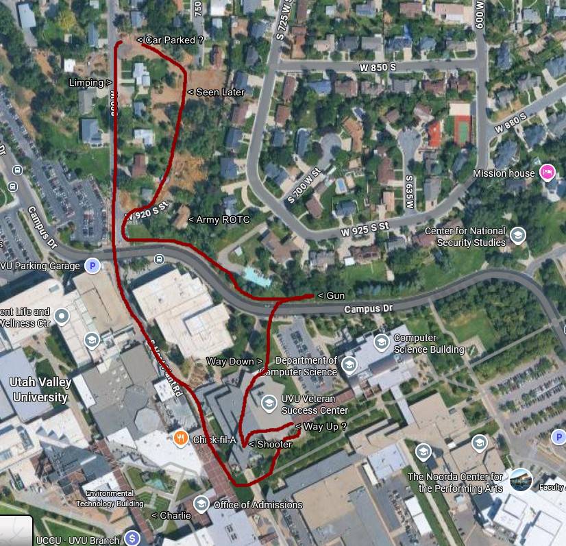
A satellite map of the campus and the housing immediately north of it, with a continuous looping red path drawn on by hand and text annotations pinned along it.
The annotations read Car Parked ?, Limping, Seen Later, Mission house, UVU Parking Garage, Army ROTC, Center for National Security Studies, Gun, Way Down, Way Up ?, Shooter and Charlie, over printed map labels including the Computer Science Building, the Noorda Center for the Performing Arts, the Environmental Technology Building and the Office of Admissions. Two annotations carry question marks - the parking place and the route up - and those are the honest markers of what is not known.
The Center for National Security Studies label is why this map gets attention. The site's research file records public commentary about a university programme with intelligence-community connections, and the fact that the marked route runs past it has been treated by some researchers as significant. Proximity on a campus map is not a connection, and the site records that claim as unverified commentary rather than as a finding. Read UVU CIA Profiles, US Intelligence, Proof of Intelligence Service Involvement and Losee Center.
This website's author is @HolonCitizen on X and YouTube/@HolonCitizen. Follow me there.
Where This Image Appears
This image is used on the following investigation pages:
- State Department and Diplomatic Response (Claims)
- UVU Campus & Location Searches
- Joshua_the_car — X Posts
- Img Photo f4e71c x
- overview
- Img Photo f4e71c
- overview
- UVU Faculty Statements
- UVU Campus Maps
Related Areas
- Cluster: Maps and Site Geometry
- Section: Maps
- All photos: Photos