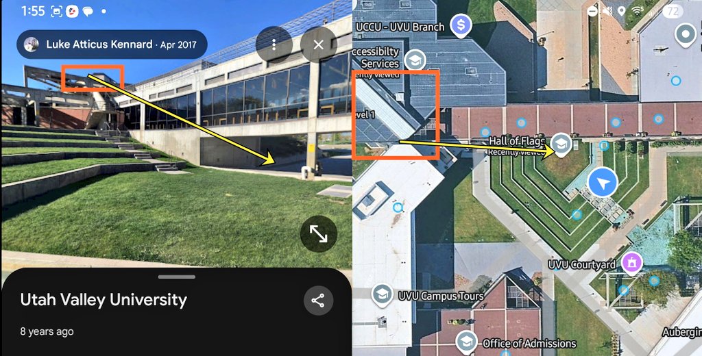
South Stairs Linked to the Courtyard Map
 Next Image
What This Image Shows
A composite reference plate split down the middle. On the left is a ground-level photograph of the modern concrete and glass academic building looking out over the terraced grass amphitheater. On the right is a 2D overhead map of the same place, with the pin labels UVU courtyard, UCCU - UVU Branch, Hall of Flags, Office of Admissions, Accessibility Services and UVU Campus Tours visible. Yellow arrows and orange boxes are drawn on both halves to tie one structural feature on the building to its position on the map. Small interface text credits a Street View style capture by Luke Atticus Kennard, dated Apr 2017 and marked eight years ago.
The feature being linked is a stair run on the south side. Stairs matter in this case because the movement account requires a person to get from a roof to ground level and away, and because separate footage of a figure on stairs became one of the most argued-over pieces of imagery in the whole investigation. Analysts have contested whether the figure on the stairs matches the person charged, pointing to differences in backpack and clothing; those are researcher arguments, not findings.
The honest limitation is the date. A 2017 capture may not show later construction or landscaping changes. For the stairs argument see Proof It Was Not Tyler, and for the geography see Courtyard, Losee Center and UVU Maps.
This website's author is @HolonCitizen on X and YouTube/@HolonCitizen. Follow me there.
Where This Image Appears
This image is used on the following investigation pages:
Related Areas
- Cluster: Maps and Site Geometry
- Section: Maps
- All photos: Photos
More In This Cluster
- Previous: Spreadsheet Timeline for September 11 and 12
- Next: Campus And Shotter