Nine-Point Spatial Index of the Shooting Scene
 Next Image
What This Image Shows
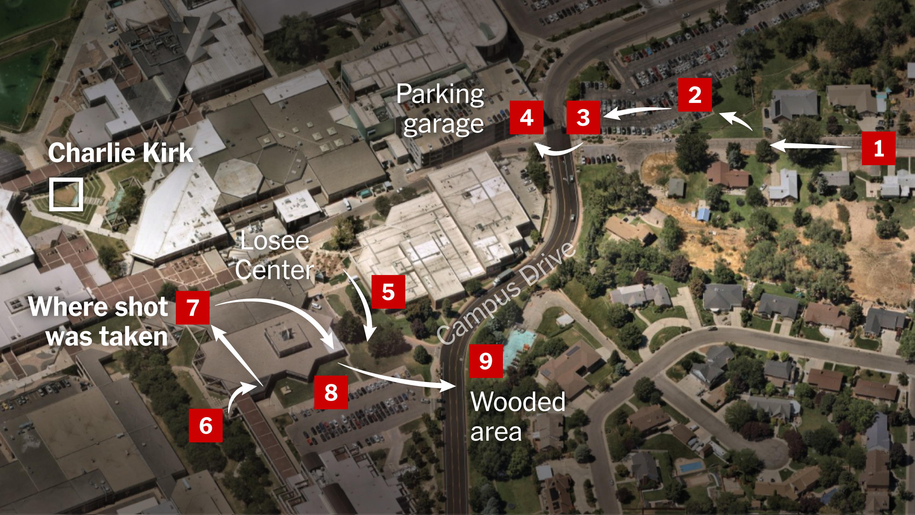
An aerial map of the campus and the neighborhood beside it, overlaid with nine numbered red squares and white arrows that step through a sequence of locations. It is the spatial-index style of graphic newsrooms produce to let a reader hold the whole scene in one view.
The labels read Charlie Kirk inside a white square, Losee Center, Where shot was taken, Parking garage, Campus Drive and Wooded area. That last one is the point where the rifle was reportedly recovered, and the arrows connect it back across Campus Drive to the building roof. The numbering fixes an order of events without committing to clock times, which is what separates this graphic from the timed route maps elsewhere in this cluster.
Used alongside the other maps here it does one job well: it shows how short the distances actually are. The courtyard, the building, the garage and the tree line all sit inside a few hundred yards, which is why questions about sound arrival, sightlines and movement timing are so tightly coupled in this case. See Losee Center, Wooded Area Gun Recovery, Gun Dropped Location and Maps.
This website's author is @HolonCitizen on X and YouTube/@HolonCitizen. Follow me there.
Where This Image Appears
This image is used on the following investigation pages:
Related Areas
- Cluster: Maps and Site Geometry
- Section: Maps
- All photos: Photos