Maps and Site Geometry — Photos
Photos filed under Maps and Site Geometry — 25 images on this page and 1 sub-cluster (28 images in total). Scan the list and open any image for the full picture and its write-up.
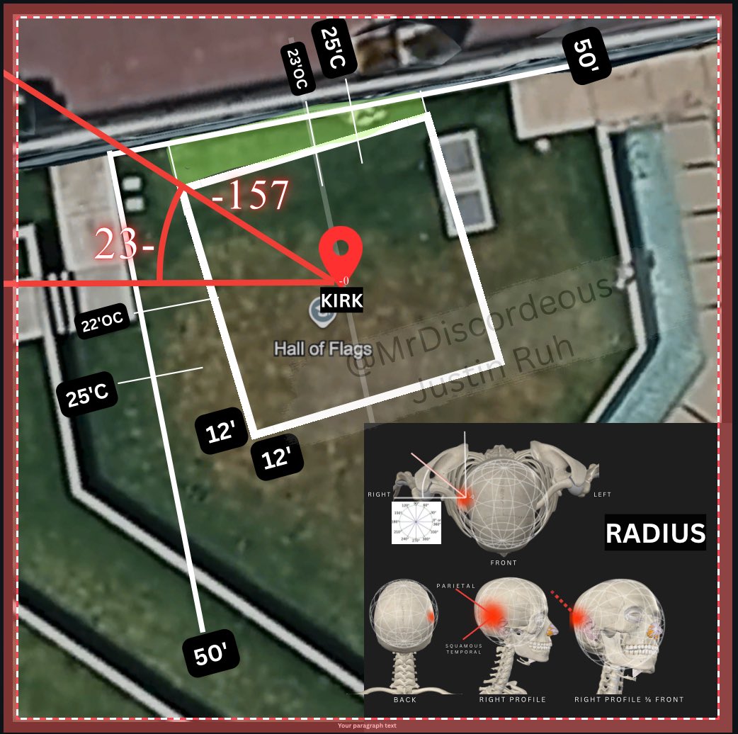
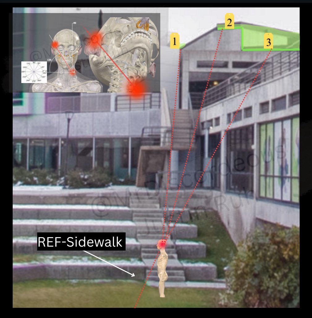
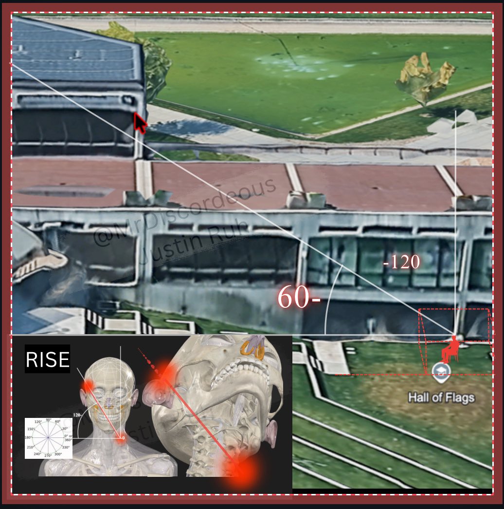
- Angles — 3 images
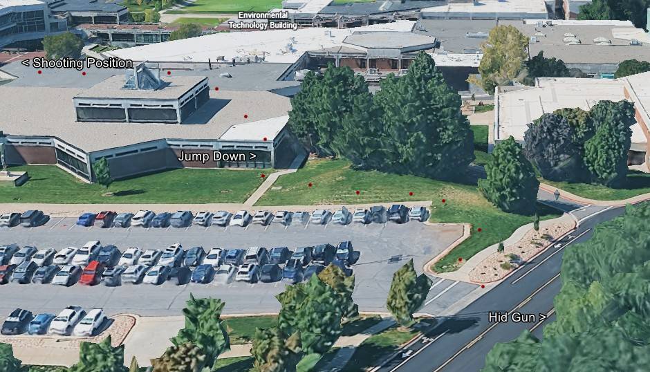
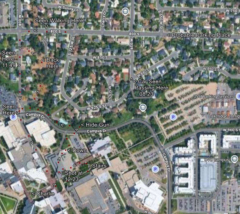
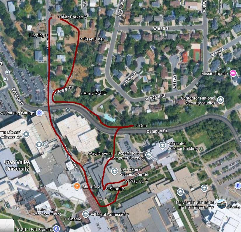
- Campus Route Map: Shooting Position to Hid Gun
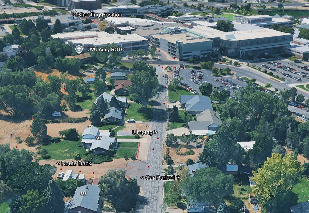
- Neighborhood Exit Route and Car Parked Question
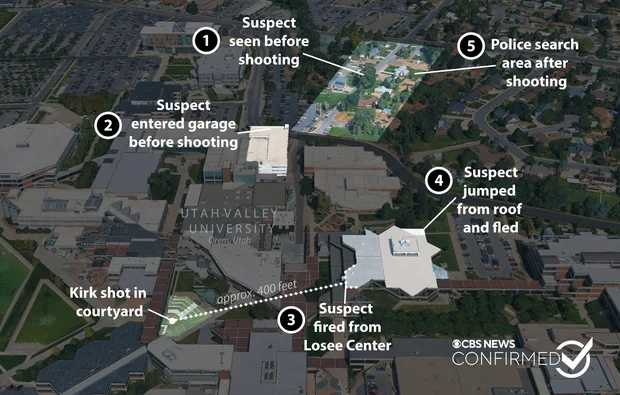
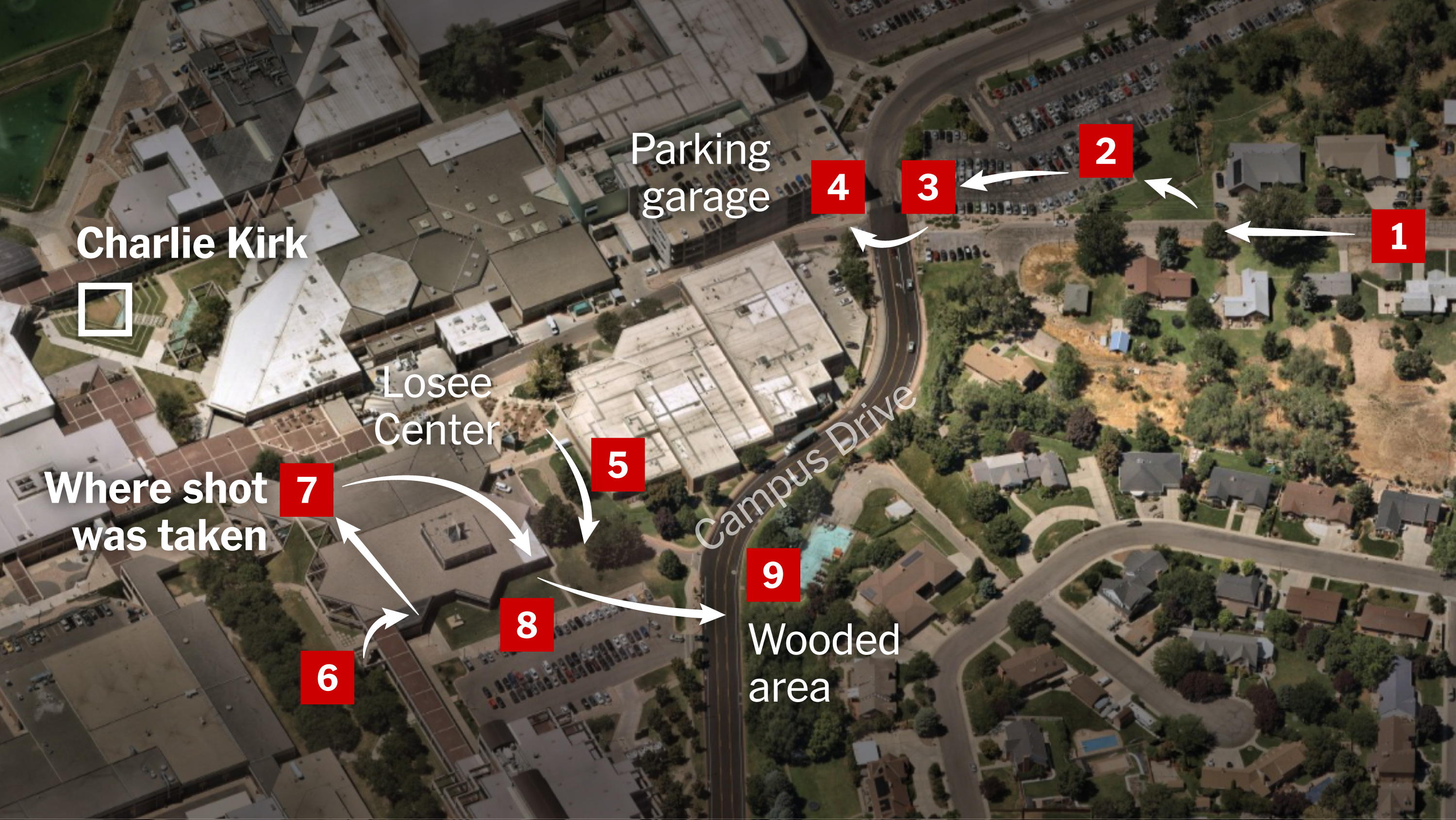
- CBS News Five-Point Map of the Shooting
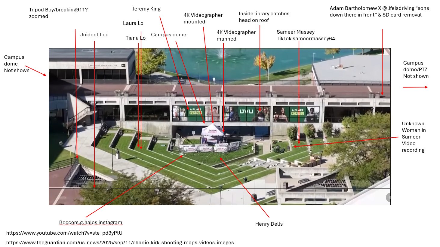
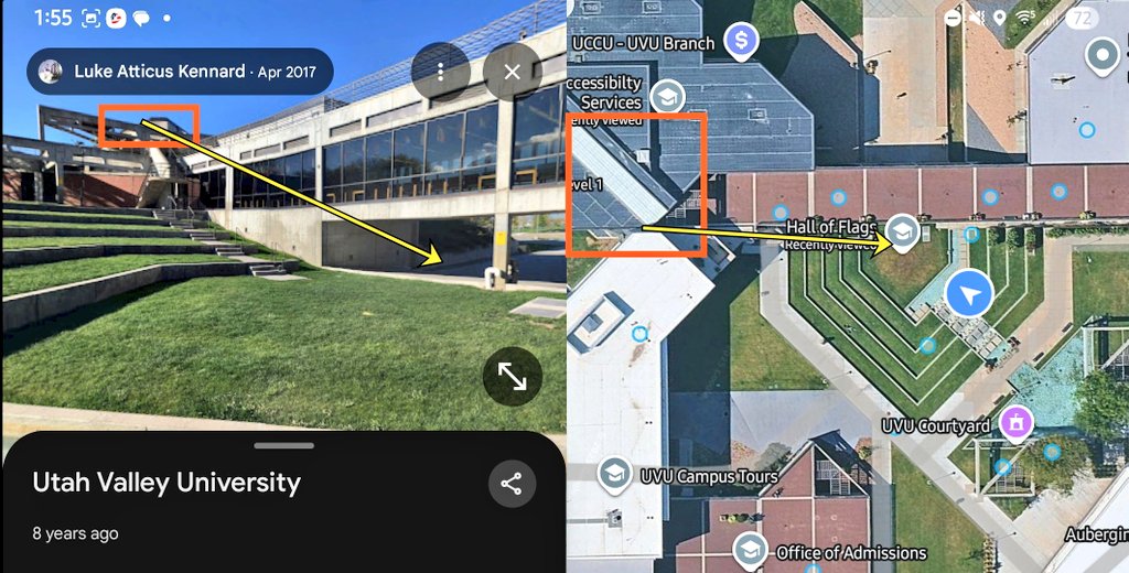
- Camera Positions Around the UVU Courtyard
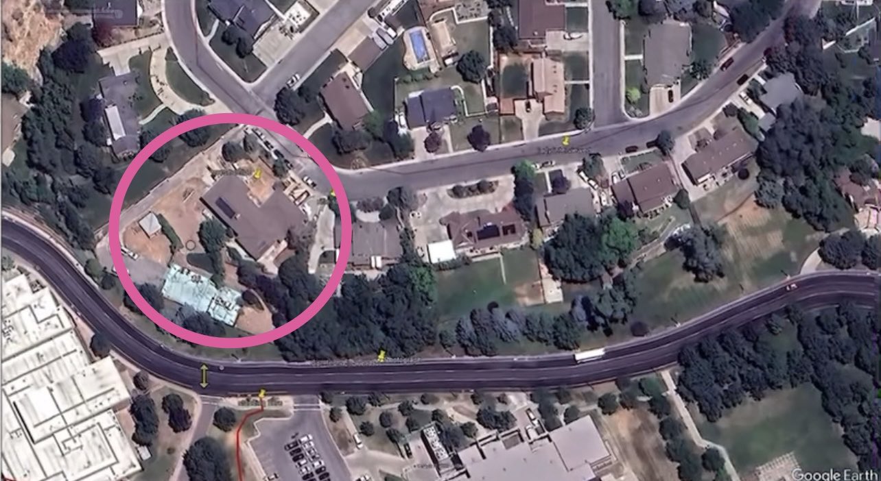
- Google Earth View of a Circled Residential Property
- Nine-Point Spatial Index of the Shooting Scene
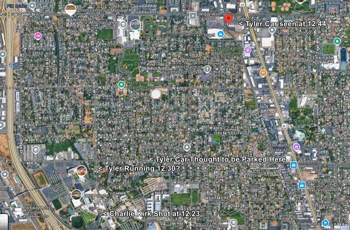
- Orem Street Map With Vehicle and Timing Notes
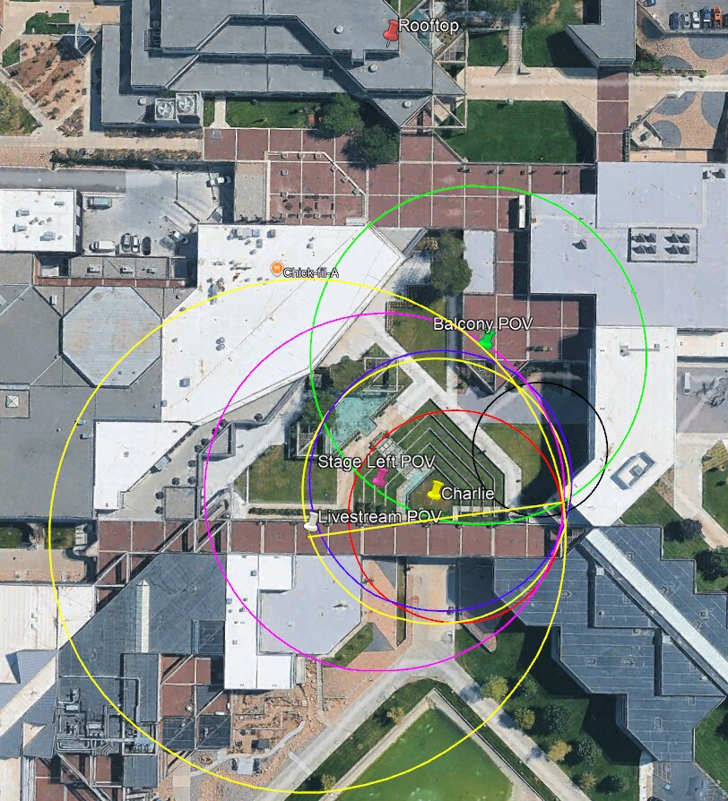
- Sound Radius Rings From Rooftop and Stage POVs
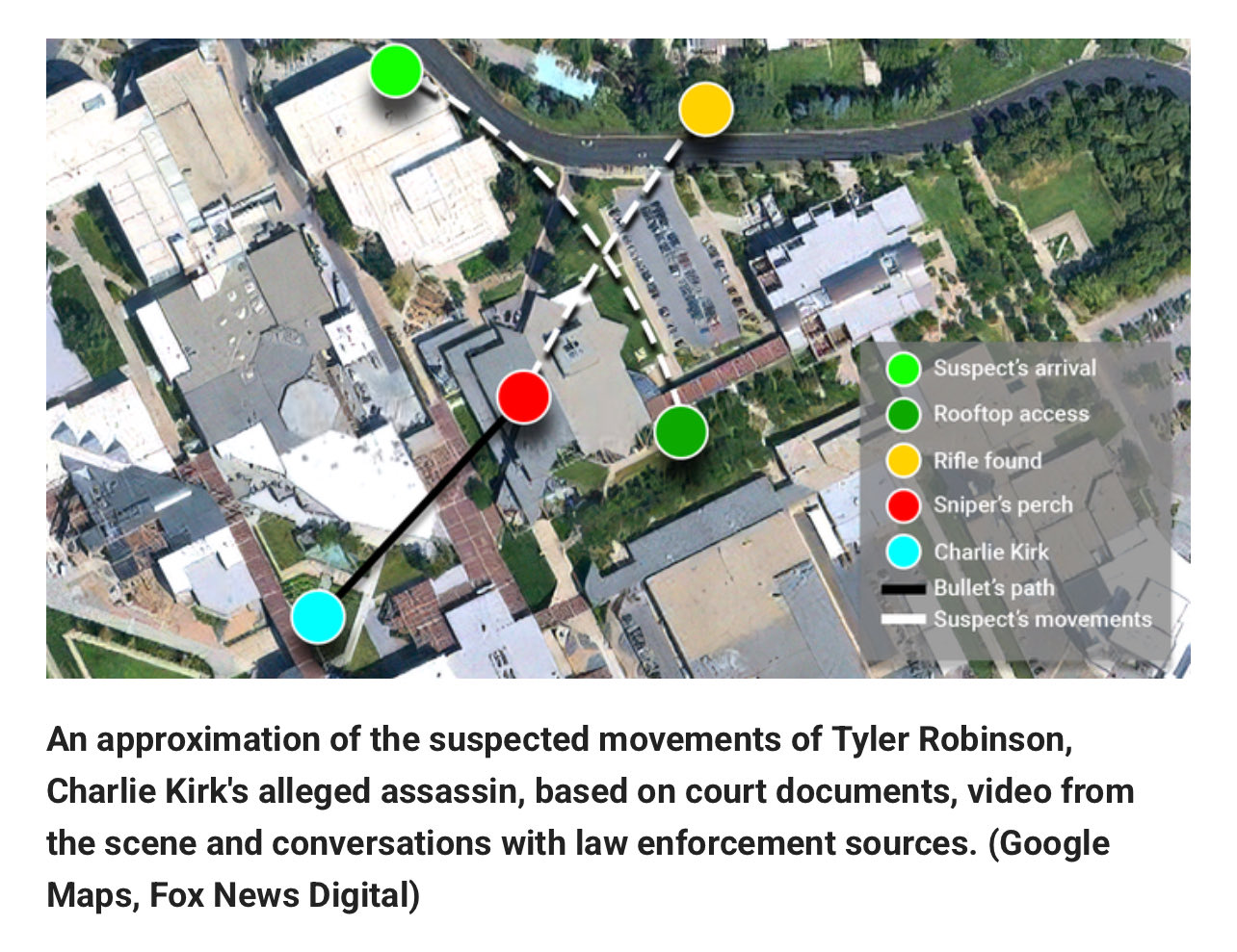
- Fox News Digital Map of Suspect Movements
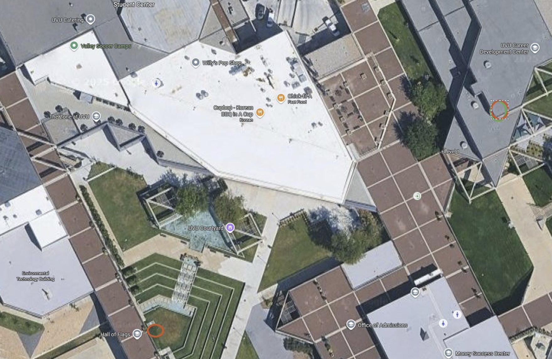
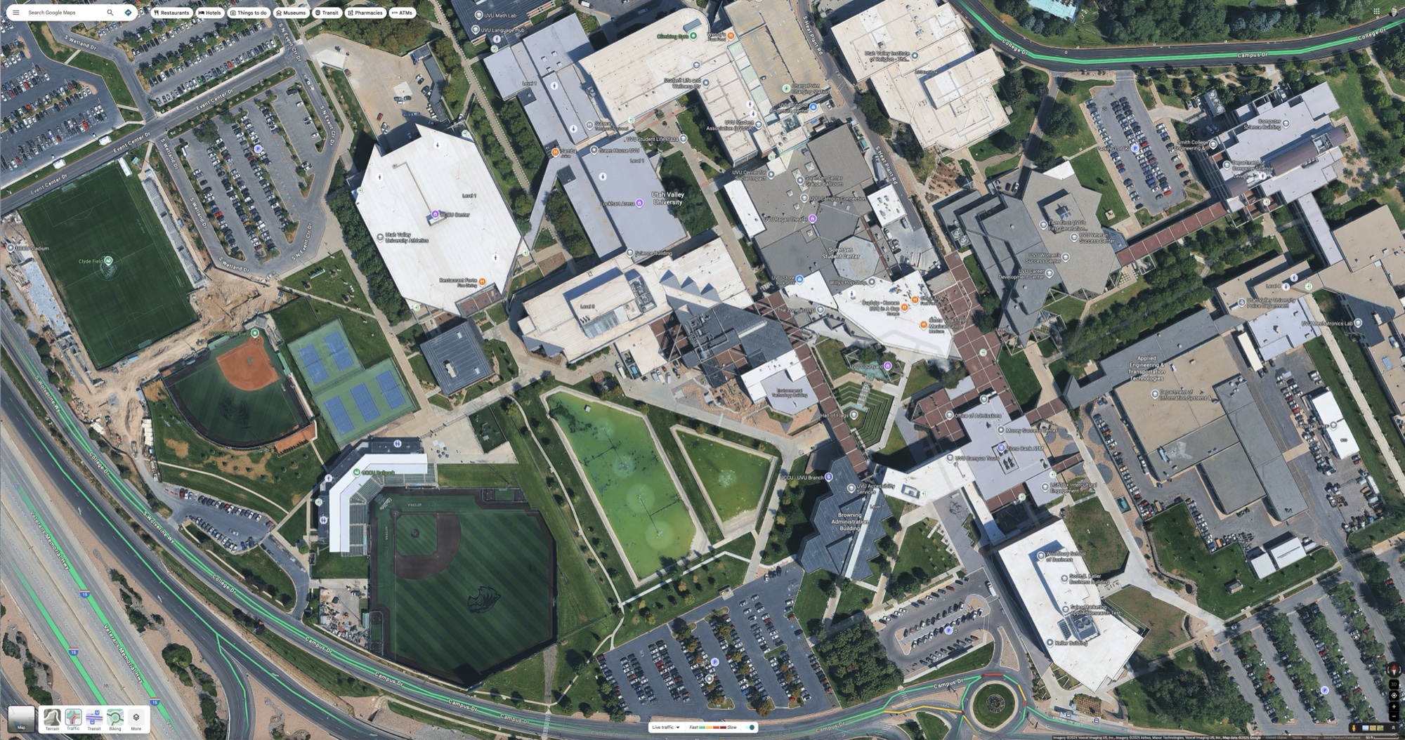
- Google Maps Overhead of the Full UVU Campus
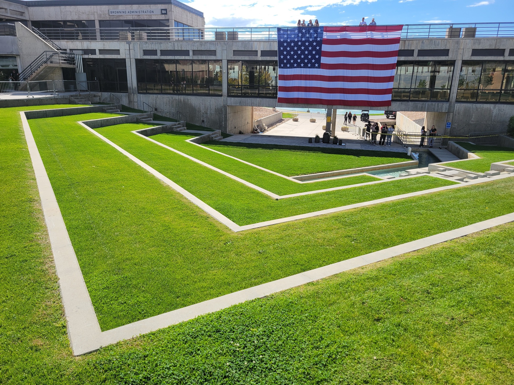
- The Empty UVU Courtyard and Flag Skybridge
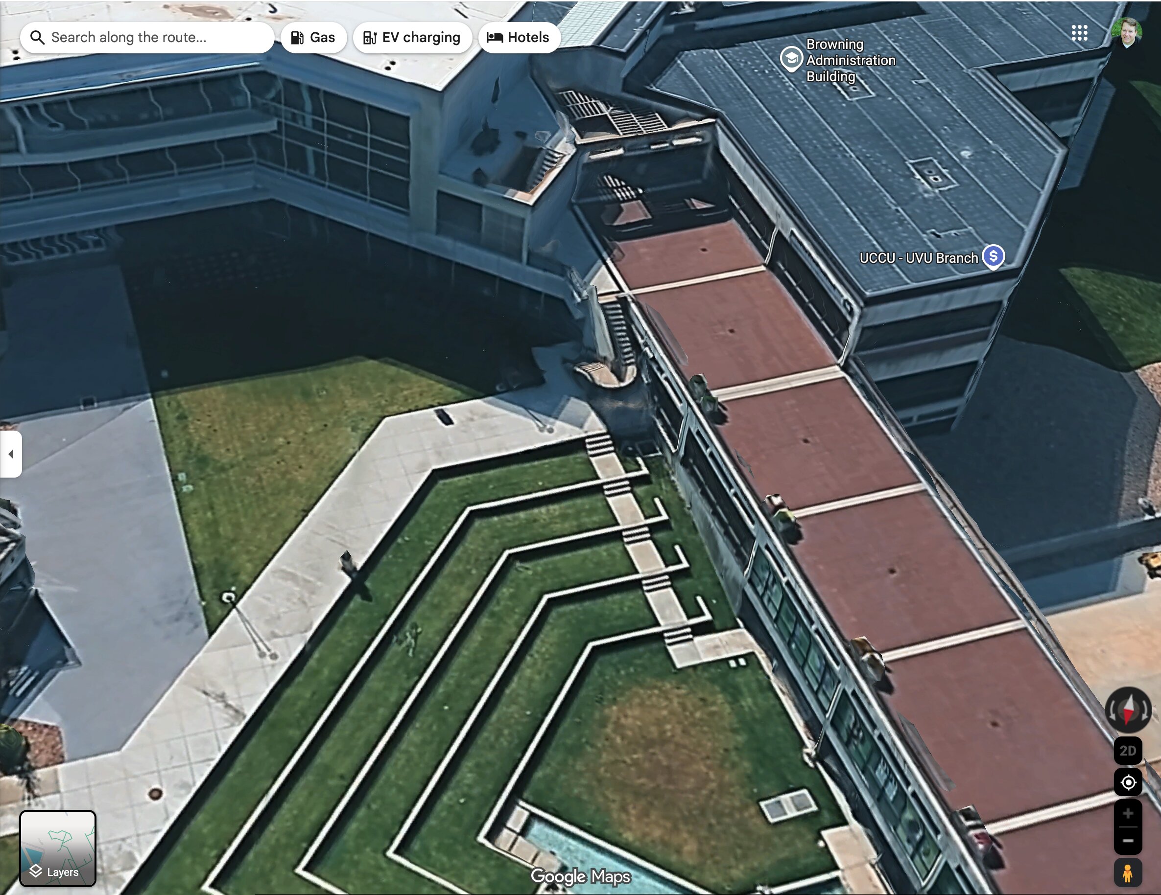
- 3D Google Maps View of the Browning Building
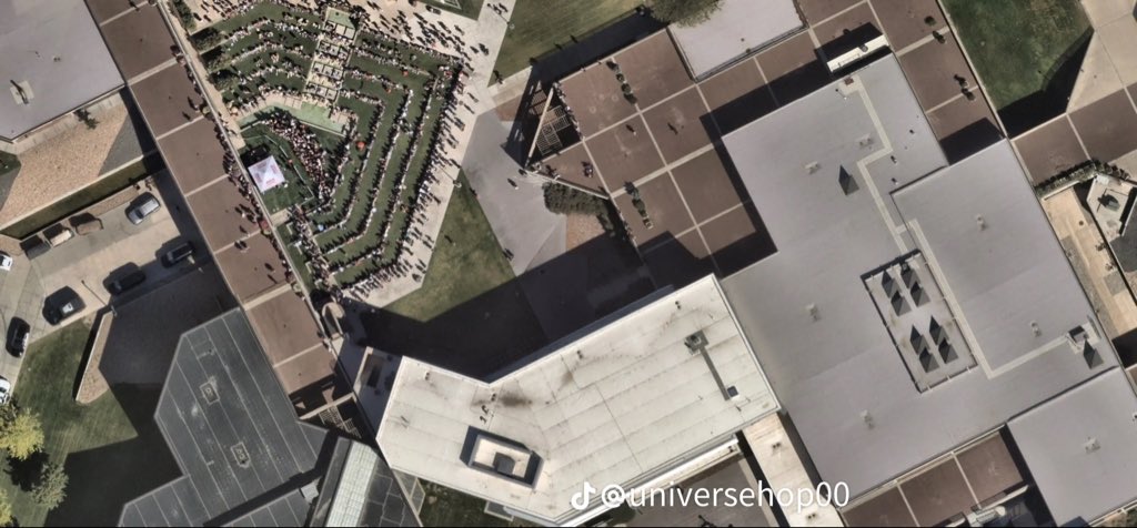
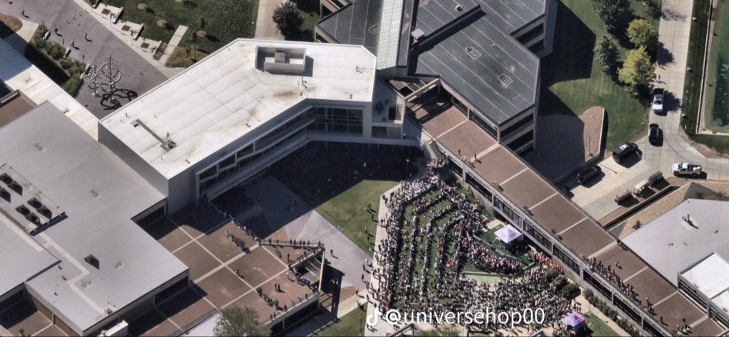
- Overhead Aerial of the Crowd in the Terraces
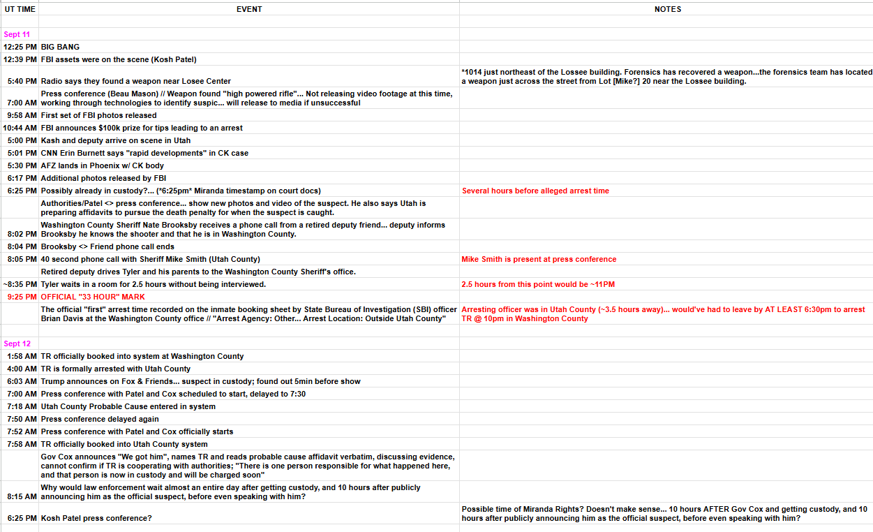
- Spreadsheet Timeline for September 11 and 12
- South Stairs Linked to the Courtyard Map
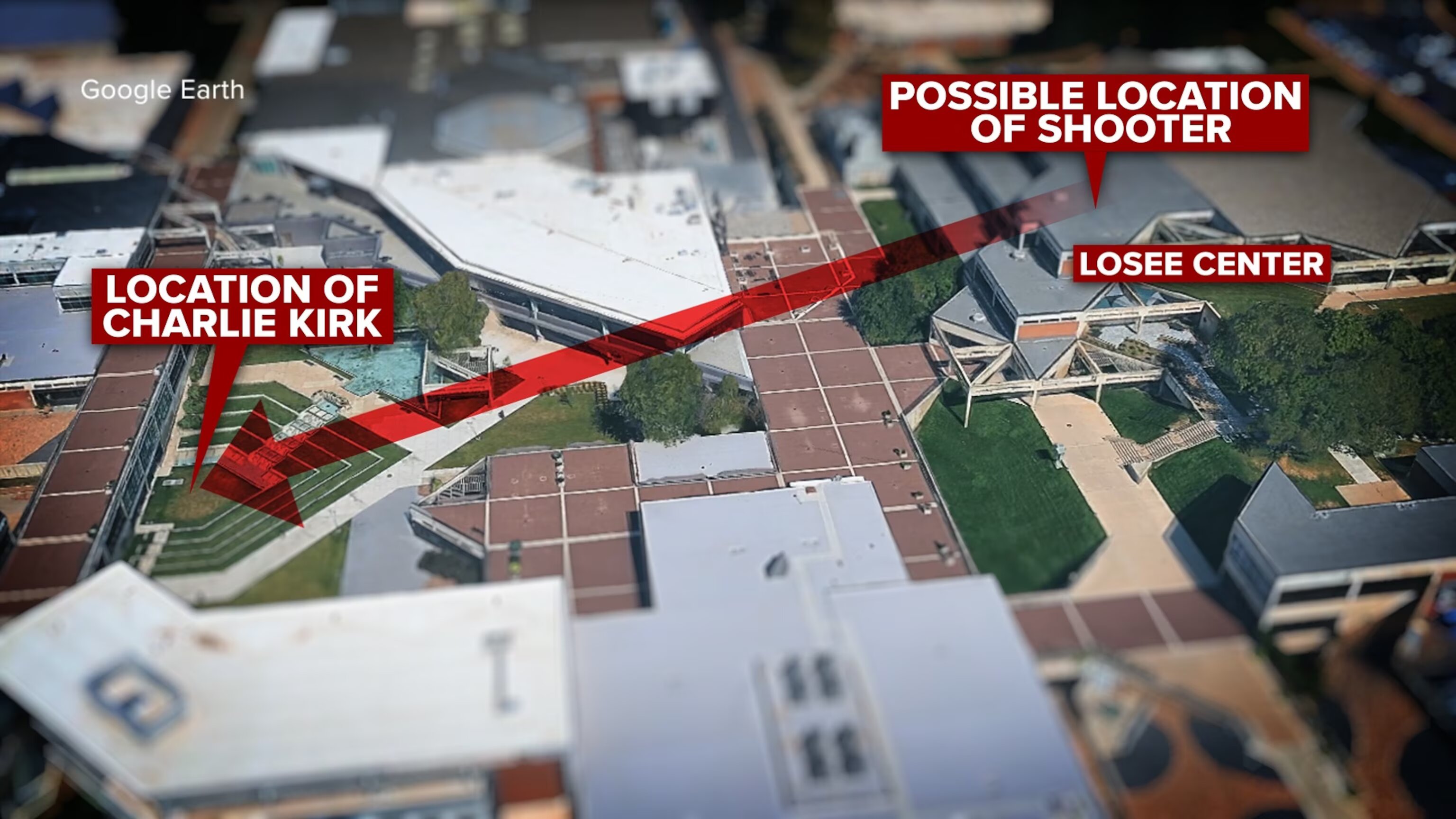
- Google Earth Line of Sight to Losee Center
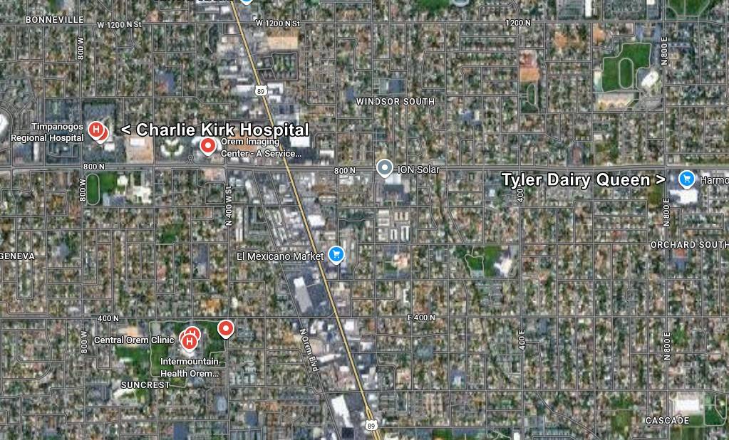
- Orem Hospital Map and the Dairy Queen Marker
- Overhead of the Packed Courtyard on Event Day
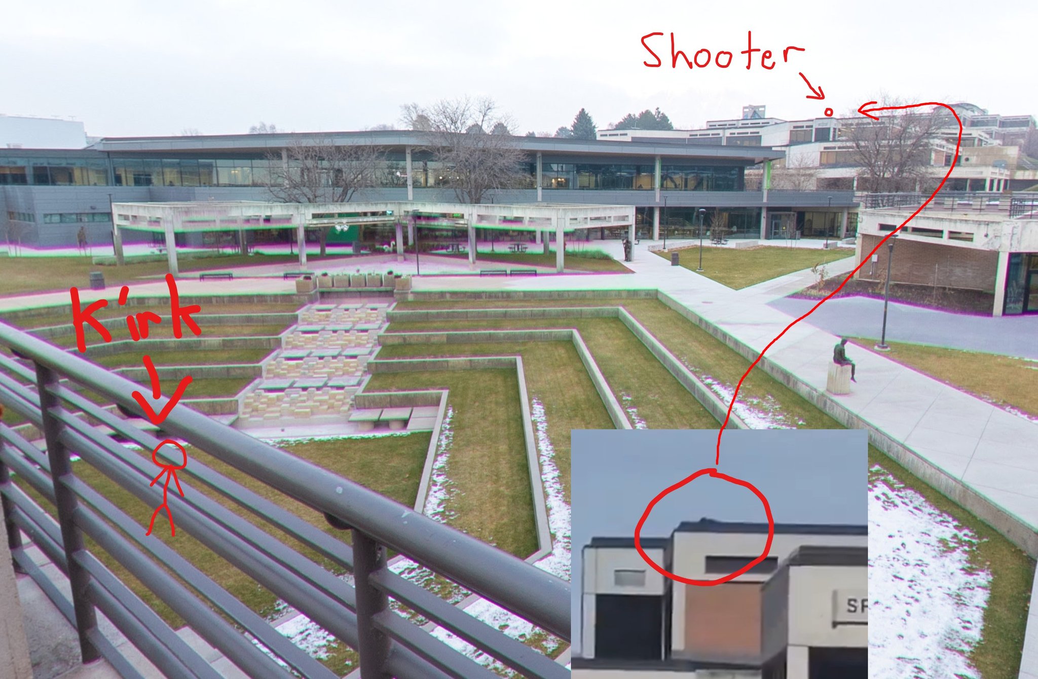
- Hand-Drawn Kirk and Shooter Positions in Courtyard
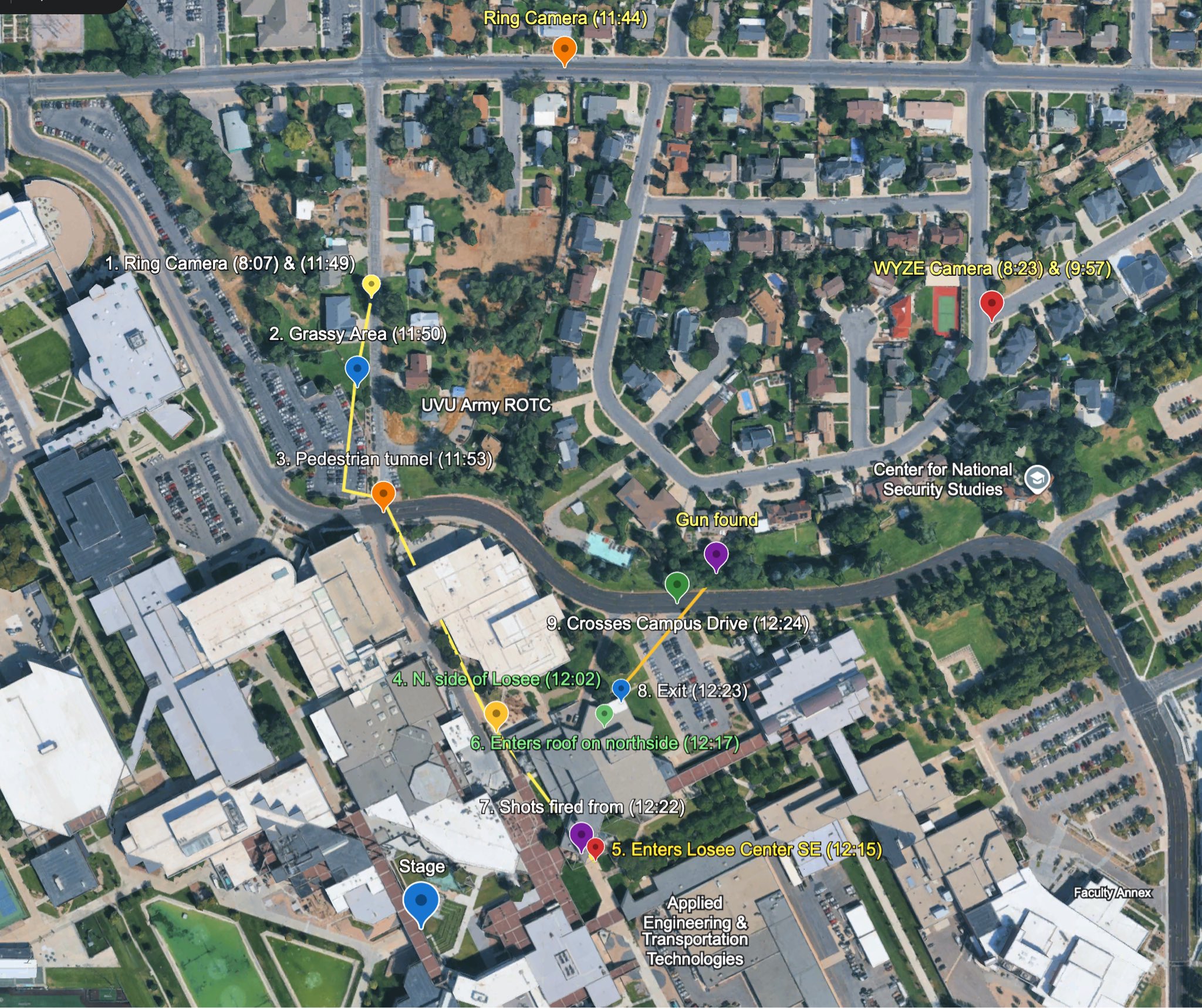
- Timed Route Map From Ring Camera to Gun Found
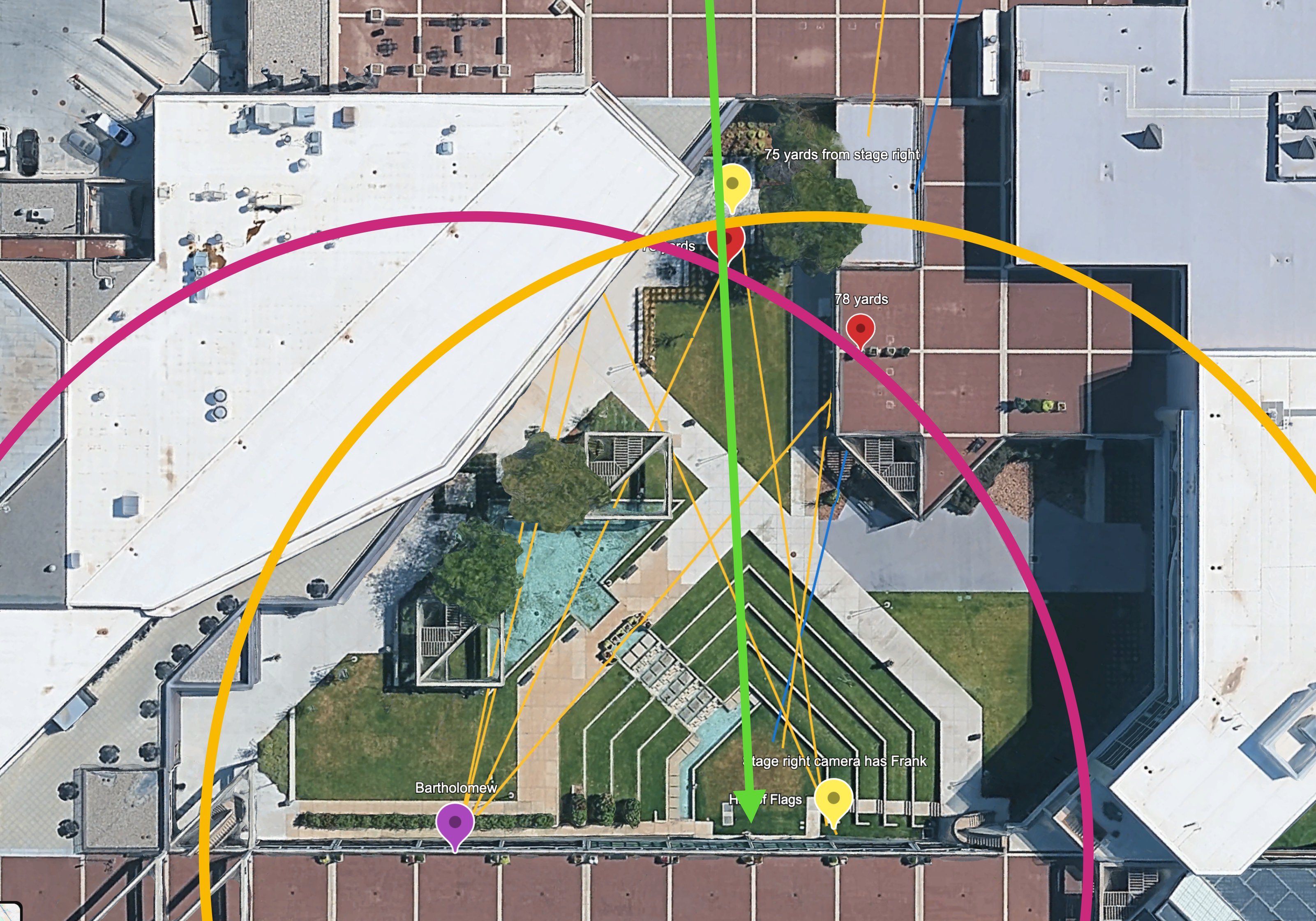
- Yardage and Camera Sightlines From Stage Right
- Annotated Movement Map With Hide Gun and Stairs
- Looped Route Map Past the Security Studies Center
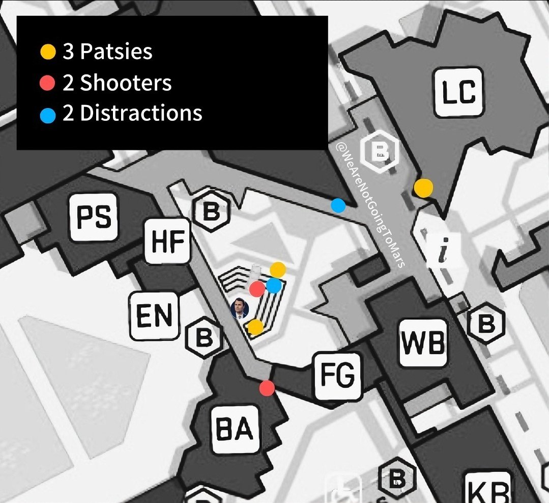
- Colour-Keyed Map of Patsies, Shooters and Distractions
- Google Maps Pins Around the UVU Courtyard
About This Cluster
Maps and Site Geometry is where the physical argument of this investigation is settled or lost. Almost every disputed question about September 10, 2025 reduces to geometry: how far the Losee Center roof is from the courtyard stage, what a shooter on that roof could actually see, whether the sound on the recordings arrives when a shot from roughly 150 yards would arrive, and what route a person could take from the roof to the wooded area where a rifle was recovered. These twenty-five aerial views, satellite captures, annotated diagrams and campus photographs are the raw material for all of it.
The set includes a CBS News graphic numbering five stages from suspect seen before shooting through to jumped from roof and fled; a Fox News Digital map keyed for suspect arrival, rooftop access, rifle found, sniper's perch, Charlie Kirk, bullet's path and suspect movements, captioned as an approximation based on court documents, scene video and law-enforcement sources; a timed route map annotated with a Ring camera at 8:07 and 11:49, a WYZE camera at 8:23 and 9:57, a pedestrian tunnel at 11:53, north side of Losee at 12:02, entering the roof on the north side at 12:17, shots fired at 12:22, exit at 12:23 and crossing Campus Drive at 12:24; a camera-position overlay naming individual filmers and mounted campus domes; and a ranging diagram marking a rooftop, balcony, stage-left and livestream point of view with distance rings, one label reading 75 yards from stage right and another 78 yards. Independent analysts have used exactly this geometry to argue that the audible report and the visible impact coincide too closely for a 150-yard shot, which would imply a much closer origin. That is a contested technical claim, and the maps let a reader test it rather than take it on trust.
Start with the labelled route maps and the ranging diagram, then open the child cluster Angles for the trajectory work. The written analysis lives in Maps, UVU Maps, Losee Center, Courtyard, Wound Trajectory and Angle, Gun Dropped Location and Surveillance Cameras.
This website's author is @HolonCitizen on X and YouTube/@HolonCitizen. Follow me there.
Related Areas
Peer clusters: FBI · The Shot and the Shooter Position · Unfiled Backlog · Patsy Candidates · Security Team · TPUSA · Court and Legal Proceedings · Aircraft and Flight Records · Tyler Robinson · Memes and Commentary · Ballistics and the Gun · The UVU Venue · Charlie Kirk Himself · People of the Investigation · The Microphone · CIA and US Intelligence · Google Search Screenshots · The Table and Charlie · Israel and Mossad · The Truck and Back of Tent · The House at 691 W 925 S, Orem (Alleged Staging Site) — Photo 1 · Before the Shooting · Security Cameras · Cause of Death · Censorship · Cover Up · Drones · Electrocution · Fix Laws · Government Mind Control · Influencers · Iran · Law Enforcement · Locations · Media Coverage · Medical · Other · Suspicious Anomalies · Theories · Timeline · Witnesses