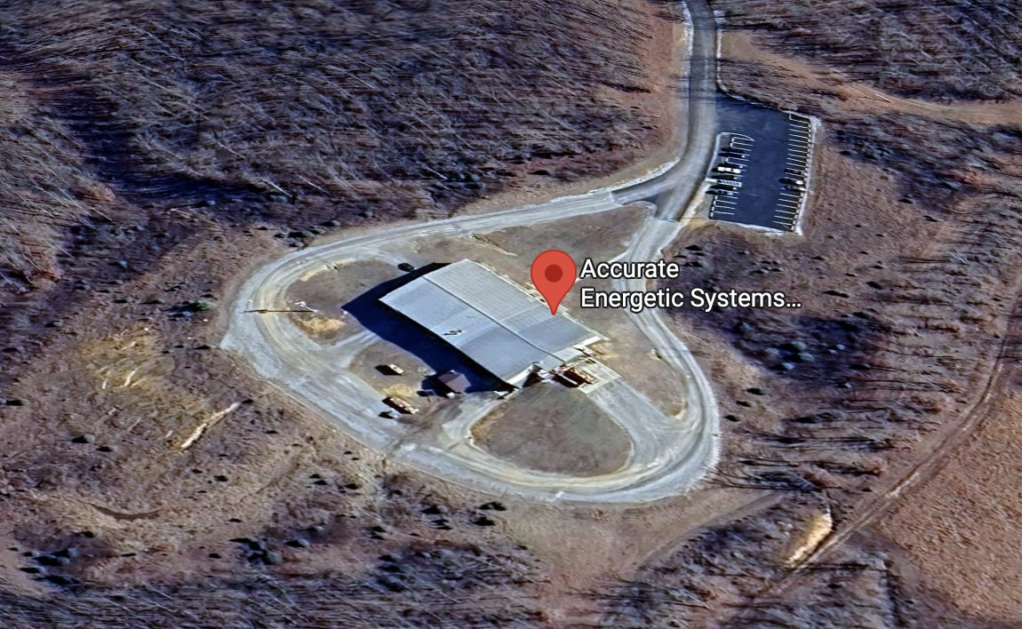
Satellite View of the AES Facility Before the Explosion
 Next Image
What This Image Shows
A three-dimensional aerial satellite view of the facility before the event. A single long rectangular industrial building with a light-grey pitched corrugated metal roof runs diagonally across the frame, its left side in shadow. A smaller dark-gabled structure and several storage containers or pieces of equipment sit on a gravel pad near its lower-left end. An unpaved gravel and dirt road forms a complete loop around the building, with a paved access road entering from the top of the frame and splitting to reach both the loop and a narrow marked parking lot holding four or five vehicles. The site sits on cleared land atop a ridge, surrounded by rough leafless winter forest, dry brown grass and exposed reddish soil, with a dirt trail winding away through the woods at the right. A red map pin overlay labels the site Accurate Energetic Systems.
This is the location record for the whole AES thread. It fixes the facility as a single isolated building on a ridge in rural Tennessee, at the address that appears on the federal purchase order in this cluster, with one road in.
Establishing where and what the facility is comes before any argument about it. The layout also explains why the destruction shown in the companion comparison image was total: a single structure with nothing adjacent to absorb the blast. No connection between this site and the events at Utah Valley University has been established. See AES, AES — Explosion Factory, and DoD Contract.
This website's author is @HolonCitizen on X and YouTube/@HolonCitizen. Follow me there.
Where This Image Appears
This image is used on the following investigation pages:
- AES — Accurate Energetic Systems (Company Profile)
- AES — Accurate Energetic Systems Factory Explosion
- Microphone — The Exploding Mic Theory
- Img AES Building Explosion 3dd9af
- overview
- overview
Related Areas
- Cluster: Accurate Energetic Systems
- All photos: Photos