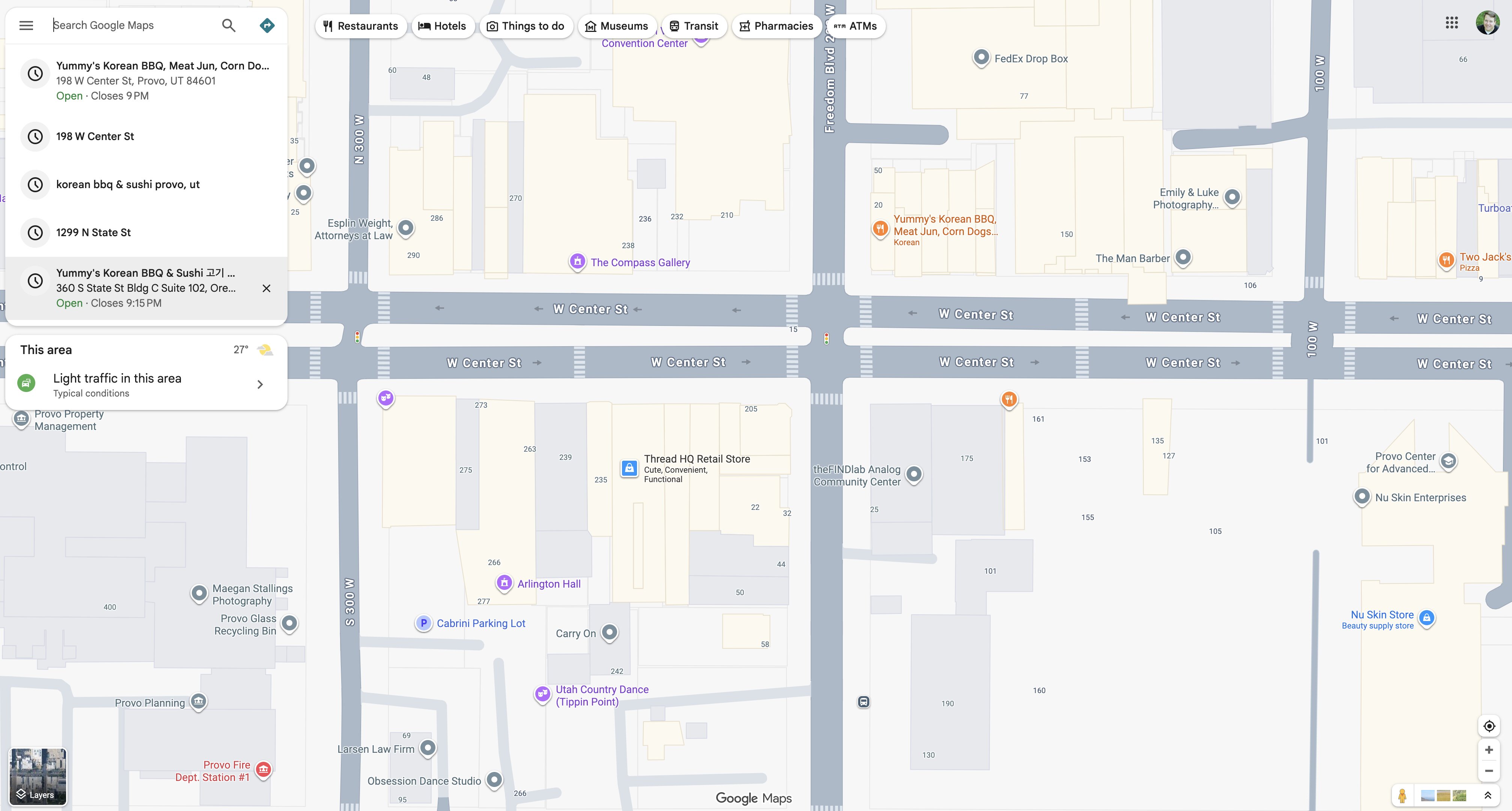
West Center Street Block Map, Downtown Provo
 Next Image
What This Image Shows
A desktop Google Maps screenshot, overhead 2D view, centred on the street grid of downtown Provo, Utah. Business names, street labels and parcel outlines are visible; a search sidebar sits on the left with recent searches and a light-traffic note.
The labelled block is W Center St between roughly 100 W and 300 W. Businesses named on the map include a Korean barbecue restaurant at 198 W Center St, Provo Fire Dept. Station #1, The Compass Gallery, Arlington Hall, the Cabrini Parking Lot, a dance studio, a law firm, and — importantly for the next frame — a business named Carry On.
That last name is the reason this map is filed. A bystander video in the Lower Pri sub-cluster carries the spoken line "I think they just found the guy right outside of carry-on," and this map is what turns that offhand remark into a fixed address. Geolocating from a business name spoken on camera is ordinary open-source method, and it is how the detention frames were pinned to this block. The addresses circulated with this thread include the area of 44 S 200 W and a point on Freedom Boulevard just south of West Center Street. See Locations and Pellet Gun Man.
This website's author is @HolonCitizen on X and YouTube/@HolonCitizen. Follow me there.
Where This Image Appears
This image is used on the following investigation pages:
- Cedar City Maverik Gas Station (I-15)
- Img Photo 12b144
- overview
- overview
- The Gun Drop Location and the Search Sequence (Claims)
Related Areas
More In This Cluster
- Previous: UVU to Downtown Provo — 11 Minutes, 5.7 Miles
- Next: Location — Photo 3