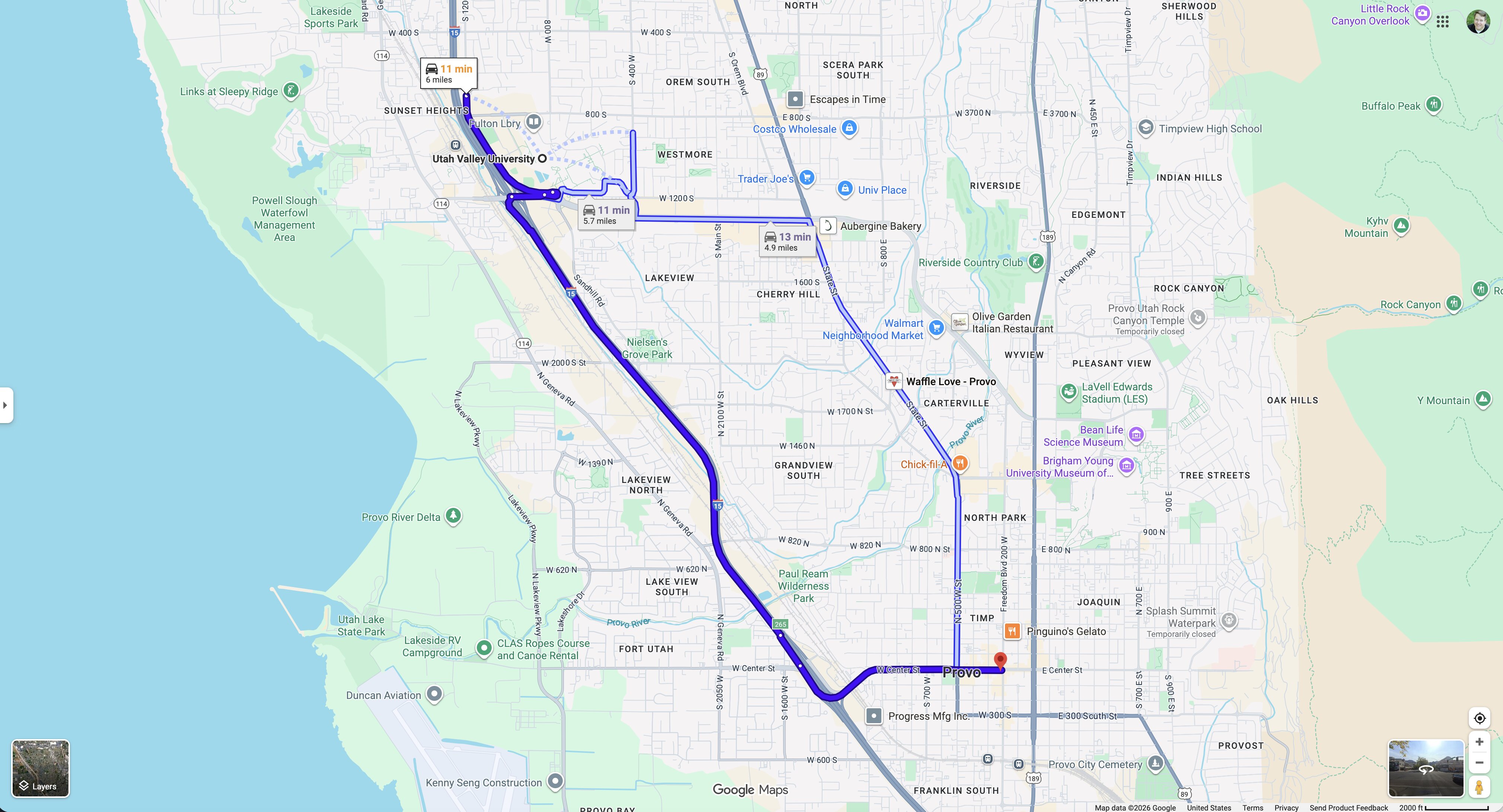
UVU to Downtown Provo — 11 Minutes, 5.7 Miles
 Next Image
What This Image Shows
A Google Maps screenshot showing driving routes between Orem and Provo, Utah. Three options run from Utah Valley University to downtown Provo, the primary route in bold dark blue and the alternatives in lighter blue. Utah Lake sits to the west and the Wasatch Range to the east. The route labels read 11 min / 5.7 miles, 11 min, and 13 min / 1.9 miles for a shorter leg.
This is a measurement, taken deliberately. The man detained on a downtown Provo sidewalk was stopped within about an hour of the shooting at Utah Valley University, and the first question any reader should ask is how far apart those two places are.
The answer is about eleven minutes by car. Close enough that the two events happened inside the same emergency response and drew from the same pool of officers, far enough that they are separate scenes in separate cities. That geography is what the whole distraction argument depends on: not that the Provo stop was connected to the shooting, but that it consumed response capacity while the shooter was unlocated. Nobody detained in Provo has been charged in connection with the shooting. See Pellet Gun Man, Locations, and Maps.
This website's author is @HolonCitizen on X and YouTube/@HolonCitizen. Follow me there.
Where This Image Appears
This image is used on the following investigation pages:
- Construction Site — 785 College Dr, Orem
- Wooded Area — Gun Recovery (North of UVU)
- Img Photo 31ae53
- overview
- overview
Related Areas
More In This Cluster
- Next: Location — Photo 2