← The Shot and the Shooter Position
 Next Image
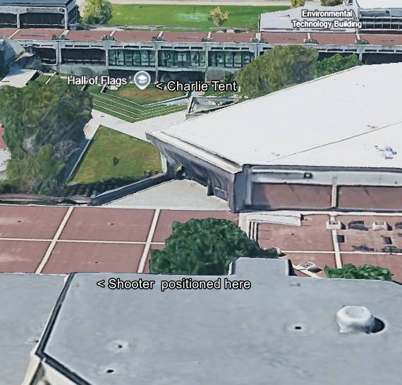
The Shot and the Shooter Position — Photo 35
Next Image
What This Image Shows
This is a digital 3D satellite map rendering, likely from Google Earth, showing an aerial, angled bird's-eye view of a university campus plaza and its surrounding buildings. The image has been annotated with black-and-white text labels indicating specific locations, including a point marked "< Shooter positioned here" on a foreground rooftop. The visual style is characteristic of low-resolution, reconstructed 3D photogrammetry common in digital mapping software.
This website's author is @HolonCitizen on X and YouTube/@HolonCitizen. Follow me there.
Where This Image Appears
This image is used on the following investigation pages:
Related Areas
- Cluster: The Shot and the Shooter Position
- Section: Real Killer
- All photos: Photos