← The Shot and the Shooter Position
 Next Image
The Shot and the Shooter Position — Photo 37
Next Image
What This Image Shows
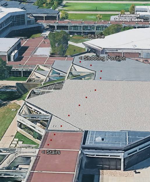
This image is a high-angle, three-dimensional satellite map or aerial rendering of a modern educational or corporate campus. The graphic overlay features several text labels and a sequence of red dots indicating a path or trajectory across a series of interconnected flat rooftops and outdoor plazas. The rendering depicts the complex geometry of brutalist or late-modernist architecture, with multiple levels, angular roofs, and concrete walkways.
This website's author is @HolonCitizen on X and YouTube/@HolonCitizen. Follow me there.
Where This Image Appears
This image is used on the following investigation pages:
Related Areas
- Cluster: The Shot and the Shooter Position
- Section: Real Killer
- All photos: Photos