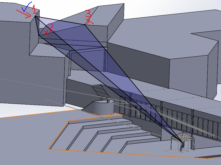
3D Model With Sight Cone to the Tent
 Next Image
What This Image Shows
A rendering from a 3D CAD model of the plaza and its surrounding buildings. A semi-transparent blue triangular cone is projected from a high point on one of the buildings down to a small structure in the lower right foreground. Hand-drawn red and blue annotations in the upper left — numbers, a checkmark and an arrow — mark specific architectural vertices.
This is the most rigorous form of argument in the whole cluster. Building a measured model and projecting a sight cone through it tests whether a given elevated point could actually see a given spot on the ground, taking account of parapets, overhangs and intervening structure in a way that a line drawn on a photograph cannot.
The caveat is that a model is only as good as its inputs. Whoever built this has not published the source dimensions, the software, or the coordinates of the two endpoints, so the result is not independently reproducible from the image alone. The annotated vertices suggest the author was working through exactly that problem.
See the ranked-position diagrams at Justin Ruh Diagram: 120 Degrees Facial Radius, the cluster at Other, and Proof Not Tyler.
This website's author is @HolonCitizen on X and YouTube/@HolonCitizen. Follow me there.
Where This Image Appears
This image is used on the following investigation pages:
- Electrocution — The B-Field Resonant Cascade Hypothesis
- Making a Shooter — Playbook (Theoretical)
- Img G3VNEZ aQAA ca09f5
- overview
- overview
Related Areas
More In This Cluster
- Next: Other — Photo 2