Campus Map With Route and Marker Legend
 Next Image
What This Image Shows
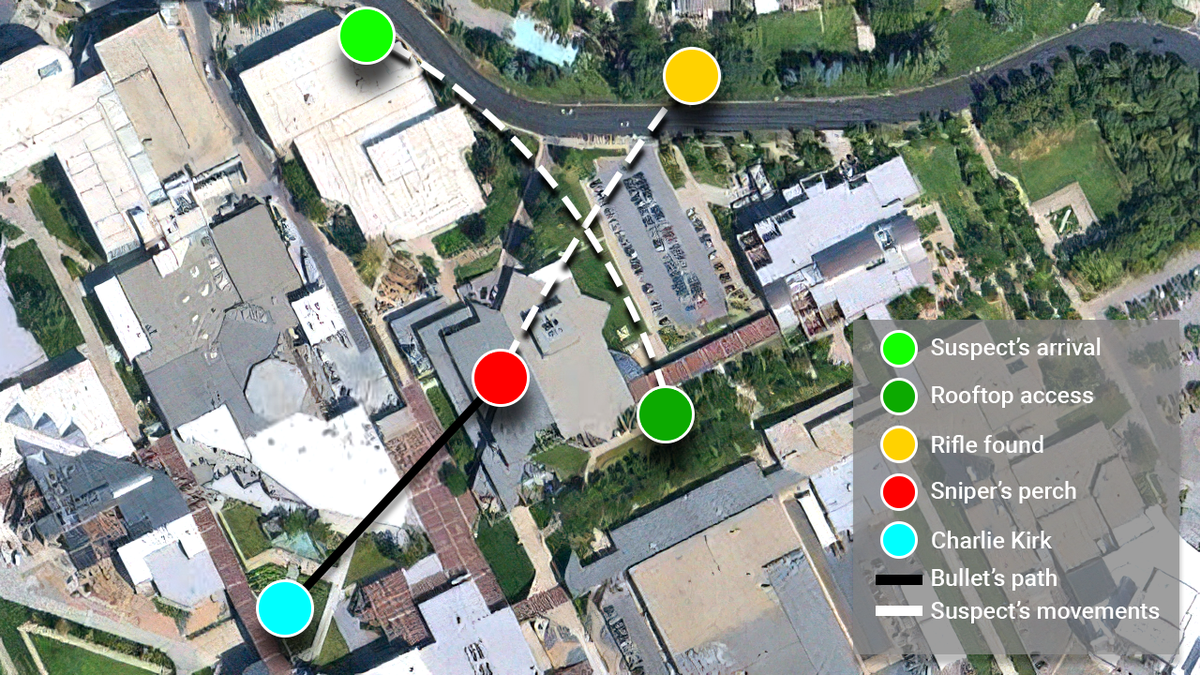
An annotated satellite map of the Utah Valley University campus, overlaid with colored markers and path lines. The legend at lower right reads, in order: Suspect's arrival, Rooftop access, Rifle found, Sniper's perch, Charlie Kirk, Bullet's path and Suspect's movements.
That legend is the official account compressed into seven labels, and it is the most efficient orientation available for everything else in this section. It fixes the arrival point where the gray Dodge Challenger was parked at 8:29 a.m., the roof of the Losee Center where the affidavit places the firing position at about 12:23 p.m. on September 10, 2025, the courtyard where Charlie Kirk was speaking roughly 430 feet away, and the wooded ground beyond campus where the Mauser Model 98 was reported recovered.
A published map is a summary of an official narrative, and the bullet path line in particular is a depiction rather than a survey. Use it to place the surveillance frames in this cluster and in Walking, then read Trajectory and Wound Mismatch, Gun Discovery Sequence and Maps.
This website's author is @HolonCitizen on X and YouTube/@HolonCitizen. Follow me there.
Where This Image Appears
This image is used on the following investigation pages:
- Rifle Found Only After a Federal Redirect (Claims)
- Img charlie kirk uvu 1fd519
- overview
- overview
- Feds Directed the Re-Search That Found the Rifle (Claims)
- Tyler Robinson's Clothing Changes That Day (Claims)
- Tyler Robinson: Pre-Shot UVU Campus Movements Timeline
- Losee Center (Alleged Sniper Rooftop)
Related Areas
More In This Cluster
- Previous: Stairwell Descent Beside the Concrete Wall
- Next: Clothing — Photo 4