3D Map: Jump Down and Hid Gun
 Next Image
What This Image Shows
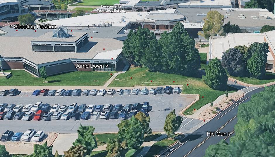
An overhead 3D rendering of the campus buildings with red marker dots and three labels: Shooting Position, Jump Down and Hid Gun, with the Technology Building identified alongside.
Those three labels compress the most physically demanding part of the official account. The affidavit describes a single shot fired at about 12:23 p.m. on September 10, 2025, then the suspect standing and running north to the roof edge, placing a dark item — described as a rifle wrapped in a dark towel — on the rooftop at 12:24, lowering himself to the grass below and running north toward the parking lot and on into wooded ground where the Mauser Model 98 was later recovered. A researcher circulating stills of the same window has argued that the movement from the firing position to the northeast corner of the Losee Center took twenty-five seconds.
The map is a reconstruction and the Hid Gun marker is the compiler's placement, not a surveyed find location. Read Gun Discovery Sequence, Weapon and Rifle and Tyler Robinson on September 10, 2025.
This website's author is @HolonCitizen on X and YouTube/@HolonCitizen. Follow me there.
Where This Image Appears
This image is used on the following investigation pages:
- Construction Site — 785 College Dr, Orem
- Img Photo 40b69a x
- overview
- Img Photo 40b69a
- overview
- overview
Related Areas
More In This Cluster
- Previous: Street View Along West 800 South
- Next: Gun Found — Photo 6