Overhead Map: Parking on West 800 South
 Next Image
What This Image Shows
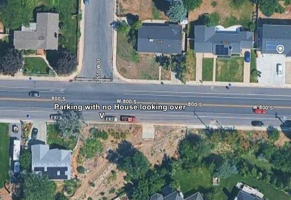
A straight-down satellite view of a suburban intersection near the campus, with street labels reading S 550 W St and W 800 S, and a custom annotation pointing at roadside parking with the note that no house overlooks that stretch of 800 South.
The annotation is a sightline argument. If a vehicle can be left where no residence has a view of it, then no doorbell or porch camera covers it — and doorbell footage is precisely what produced several of the key frames in this case. Researchers mapping the route are trying to establish which stretches of the neighborhood are camera-blind, which is the same question as where items could be moved or left unrecorded. This connects directly to the observation that the official timeline never states when the suspect's car left the campus lot.
This is a citizen-made map annotation, unverified, and no claim is made here about any specific residence or vehicle. Read the route imagery at Drop Off Locations, then Gun Discovery Sequence and Cameras.
This website's author is @HolonCitizen on X and YouTube/@HolonCitizen. Follow me there.
Where This Image Appears
This image is used on the following investigation pages:
- Rifle Found Only After a Federal Redirect (Claims)
- University House Ownership Claims
- Img Photo 40fad2
- overview
- overview
- Feds Directed the Re-Search That Found the Rifle (Claims)
- Baron Coleman: Early Turn-In & the Refused Surrender Video
Related Areas
More In This Cluster
- Previous: 3D Map: Route Back From the Shooting Position
- Next: Gun Found — Photo 4