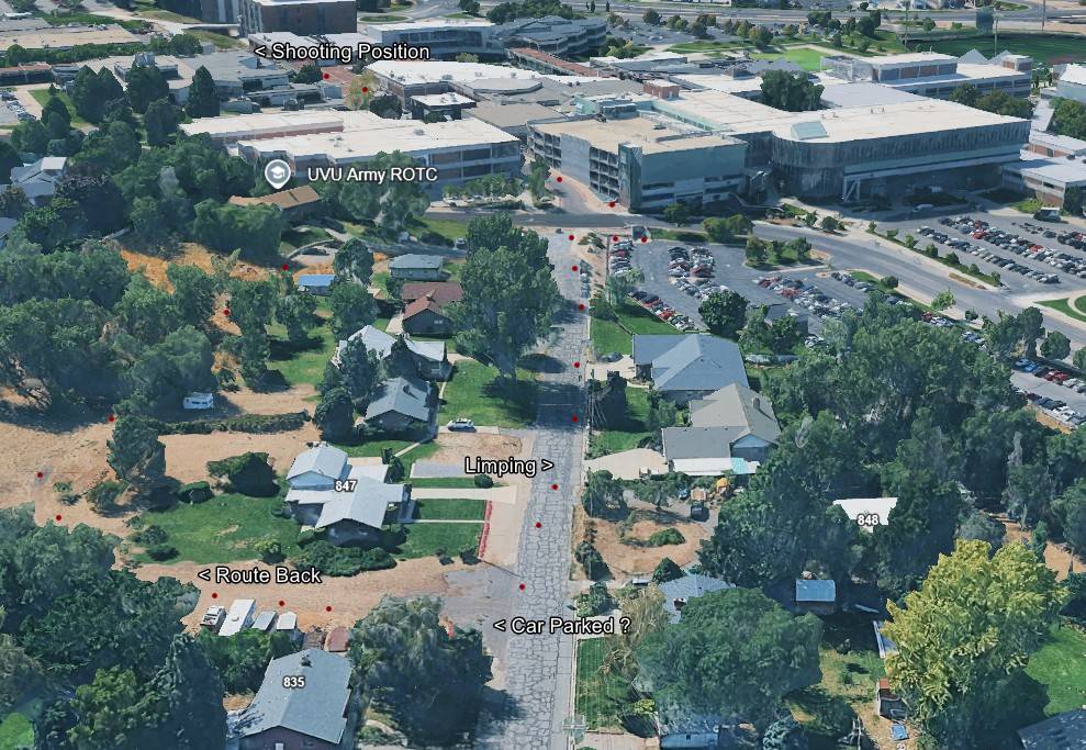
3D Map: Route Back From the Shooting Position
 Next Image
What This Image Shows
An annotated 3D aerial rendering looking north-northwest across the boundary between the residential streets and the Utah Valley University campus, with red dots tracing a route down a central street. The white labels read Shooting Position, UVU Army ROTC, Limping, Route Back and Car Parked with a question mark.
The question mark is the honest part. The charging documents record the gray Dodge Challenger arriving on campus at 8:29 a.m. on September 10, 2025 but do not state when it left the lot, and researchers have pressed that gap repeatedly — asking why a timeline built with camera and cell data leaves the vehicle's departure unrecorded. The Limping label refers to the affidavit's own description of a stiff right leg at a slow pace in the late-morning frames, a detail described as no longer noticeable by the time of the rooftop sequence.
Every label on this map is a citizen researcher's reconstruction, not an official exhibit. Compare with the news-produced maps at Walking and Clothing, then read Gun Discovery Sequence and Tyler Robinson on September 10, 2025.
This website's author is @HolonCitizen on X and YouTube/@HolonCitizen. Follow me there.
Where This Image Appears
This image is used on the following investigation pages:
- Wooded Area — Gun Recovery (North of UVU)
- Img Photo 9cc683 x
- overview
- Img Photo 9cc683
- overview
- overview
- Maps
Related Areas
More In This Cluster
- Previous: Aerial: Street Beside the Wooded Greenbelt
- Next: Gun Found — Photo 3