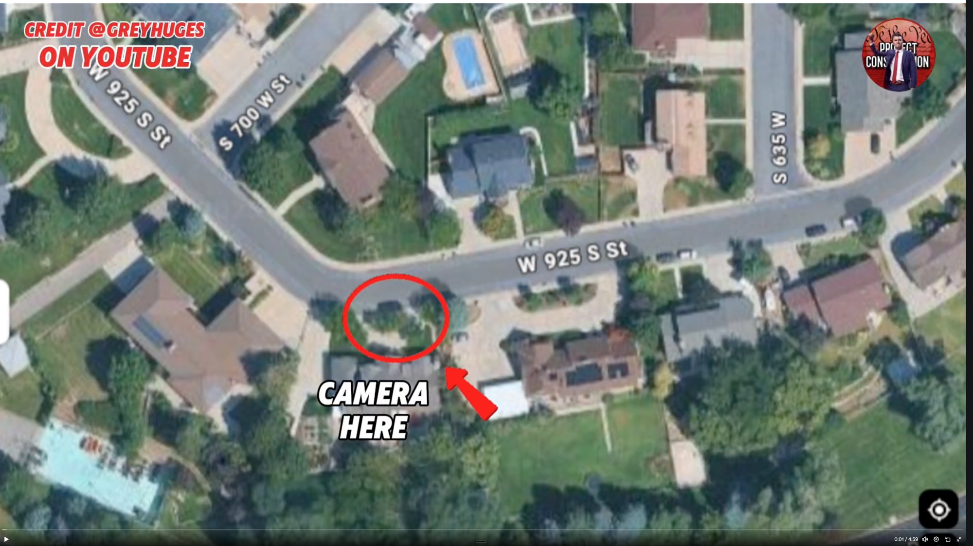
Neighborhood Map Marking a Camera Location
 Next Image
What This Image Shows
This is a satellite map of the residential streets immediately west of the Utah Valley University campus, annotated by a citizen researcher. Street labels visible in the frame include W 925 S St, S 700 W St and S 635 W St. A red circle with an arrow is drawn onto one property and labeled CAMERA HERE, marking the position of a private security camera whose footage entered the public record.
The neighborhood matters because the charging timeline places a sighting at 11:49 a.m. on September 10, 2025 in a nearby neighborhood, roughly a minute before the walk across the grass north of Campus Drive. Doorbell and porch cameras on these streets are the source of several of the most-shared stills in the case, and identifying exactly which house each camera sits on is what allows a viewer to work out the direction of travel rather than guessing from a cropped frame.
Annotations like the circle and label are the researcher's own work and have not been verified against any filing. Use the map to orient the porch and driveway frames elsewhere in this cluster and in Walking, then follow the route past campus in Drop Off Locations. Camera coverage as a general question is treated at Cameras.
This website's author is @HolonCitizen on X and YouTube/@HolonCitizen. Follow me there.
Related Areas
- Cluster: Tyler Robinson
- Section: Tyler Robinson
- All photos: Photos
More In This Cluster
- Previous: Tyler Robinson in a Bedroom
- Next: Tyler Robinson — Photo 9