Orem Route Map: Campus to Dairy Queen
 Next Image
What This Image Shows
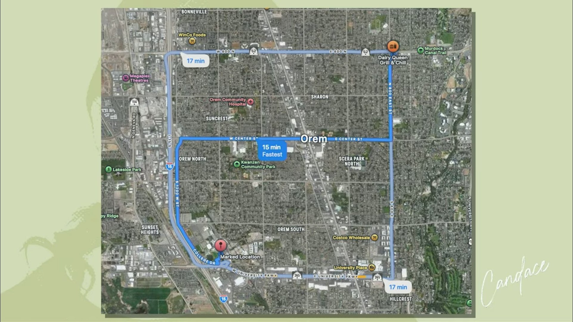
This is a navigation map of Orem, Utah, presented as a graphic on a pale green background with a stylized silhouette and the handwritten name Candace. It shows three driving routes between a point labeled Marked Location in the southwest, near the Utah Valley University area, and a Dairy Queen Grill and Chill in the northeast, with travel times of 15 and 17 minutes and the fastest route highlighted.
The map exists to make one claim checkable. Investigation records note a reported sighting on CCTV at a Dairy Queen in Orem at 6:38 p.m. on September 10, 2025, roughly six hours after the shooting. The distance shown here is the basis for asking a further question that researchers have raised repeatedly: if someone was in Orem at 6:38 p.m., what vehicle carried him the 250-plus miles south to Washington County, and how does that fit the surrender on the evening of September 11.
The map is a graphic prepared by a commentator, and the identification of the Marked Location is that commentator's assertion. The still frame the claim rests on is filed separately in this cluster, along with the X post that discusses it. See also Travel, Surrender and Timeline.
This website's author is @HolonCitizen on X and YouTube/@HolonCitizen. Follow me there.
Where This Image Appears
This image is used on the following investigation pages:
Related Areas
- Cluster: Tyler Robinson
- Section: Tyler Robinson
- All photos: Photos
More In This Cluster
- Previous: Rooftop View With Two Marked Points
- Next: Tyler Robinson — Photo 21