Orem Route Map, Second Version
 Next Image
What This Image Shows
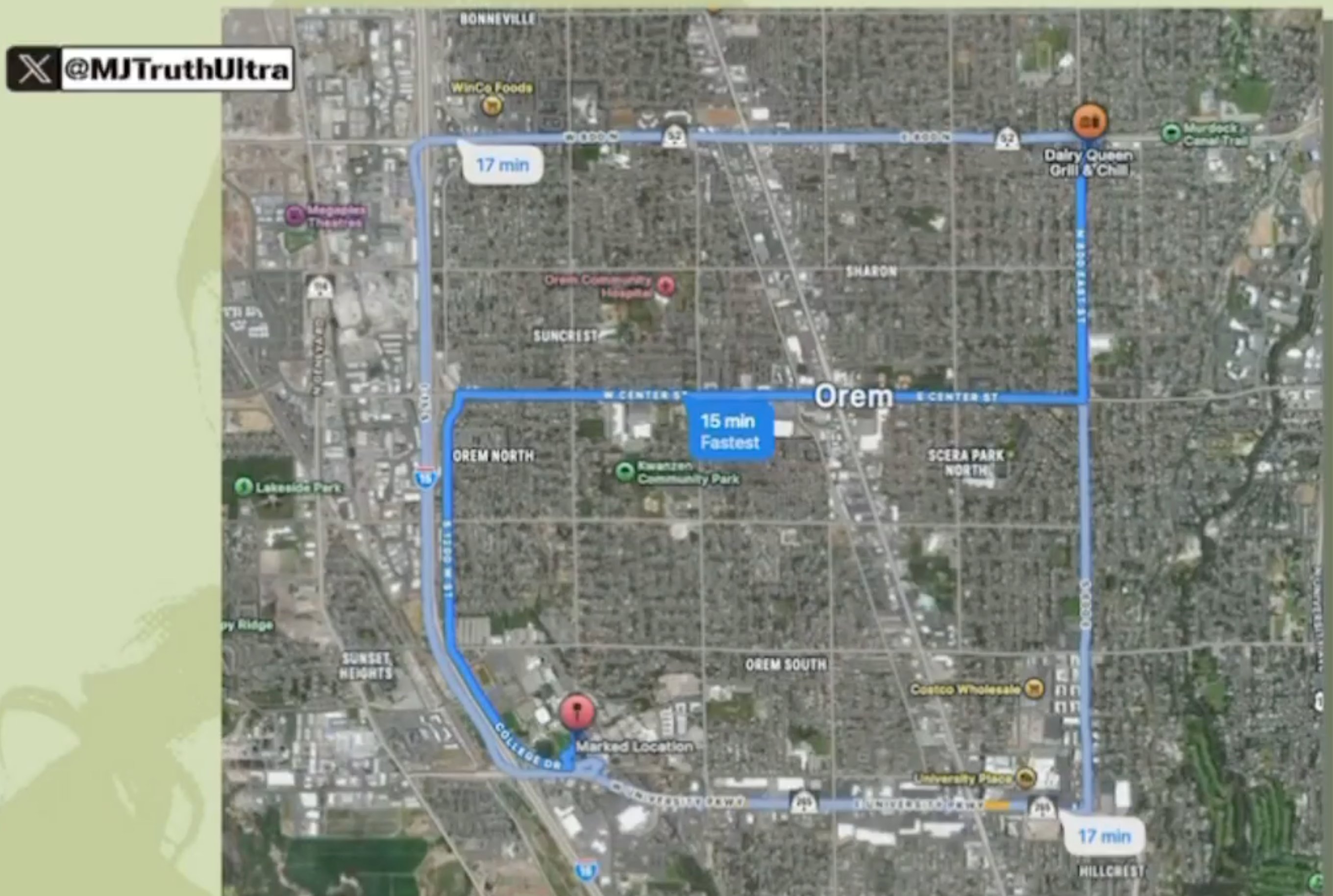
This is a second circulated version of the Orem route map, posted by a different account. Three blue routes run between a red pin labeled Marked Location near College Drive and University Parkway and an orange icon marking a Dairy Queen Grill and Chill to the northeast, with the fastest given as 15 minutes and two alternatives at 17 minutes.
The purpose is the same as the other map in this cluster: to make the reported 6:38 p.m. sighting on September 10, 2025 checkable against the campus. Two independent posters producing the same route with the same times is worth noting on its own, because it means the distance figure is not one person's claim. What the distance cannot settle is whether the person in the security still is who the poster says it is.
The Marked Location pin reflects the poster's chosen starting point rather than an established position. See the security still filed beside it in this cluster, then read Travel, Timeline and Surrender.
This website's author is @HolonCitizen on X and YouTube/@HolonCitizen. Follow me there.
Where This Image Appears
This image is used on the following investigation pages:
Related Areas
- Cluster: Tyler Robinson
- Section: Tyler Robinson
- All photos: Photos
More In This Cluster
- Previous: Hand-Annotated Route Map of the UVU Campus
- Next: Tyler Robinson — Photo 38