Hand-Annotated Route Map of the UVU Campus
 Next Image
What This Image Shows
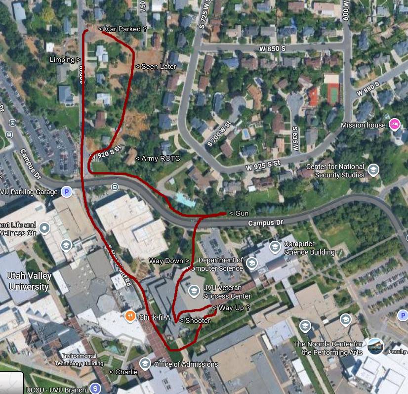
This is a citizen-made route map: a satellite view of the Utah Valley University campus and the residential blocks north of it, with a hand-drawn red line traced across streets, walkways and plazas and a set of text labels attached to points along it. The labels include Car Parked, Limping, Seen Later, Mission house, Gun, Way Down, Way Up, Shooter and Charlie, sitting alongside the map service's own building names — the UVU Parking Garage, the Center for National Security Studies, the Computer Science Building, the Noorda Center for the Performing Arts and the Army ROTC location.
What the map does is convert the affidavit's list of times into geography. The official sequence runs from an 8:29 a.m. arrival through an 11:49 a.m. neighborhood sighting, the 11:50 a.m. walk with a stiff right leg north of Campus Drive, stairwell and garage frames at 11:52 and 11:53, entry to the Losee Center at 12:02, the roof at 12:15, the shot at about 12:23 p.m., and a flight north at 12:24 toward the wooded ground where the rifle was reported recovered. Drawing that on a map is how researchers test whether the distances and the minutes agree.
The route and every label on it are the map-maker's reconstruction, not an official exhibit, and question marks appear on the drawing where the maker was unsure. Compare it against the news-produced maps in Walking and Clothing, the outward route in Drop Off Locations, and read Tyler Robinson on September 10, 2025 and Maps.
This website's author is @HolonCitizen on X and YouTube/@HolonCitizen. Follow me there.
Where This Image Appears
This image is used on the following investigation pages:
- State Department and Diplomatic Response (Claims)
- UVU Campus & Location Searches
- Joshua_the_car — X Posts
- Img Photo f4e71c x
- overview
- Img Photo f4e71c
- overview
- UVU Faculty Statements
- UVU Campus Maps
Related Areas
- Cluster: Tyler Robinson
- Section: Tyler Robinson
- All photos: Photos