Flight Data Grid on the N1098L Descent
What This Image Shows
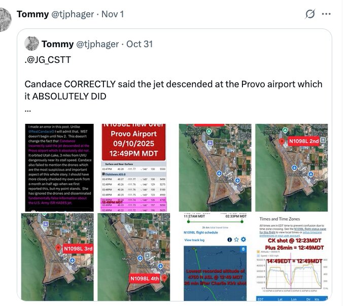
A screenshot of a post from an account shown as Tommy, handle @tjphager, dated Nov 1 and quoting his own post from Oct 31. The attached grid holds eight small screenshots of flight tracking data, satellite views of Provo Airport, schedule panels and a text block with purple highlighting.
The post text reads: "Candace CORRECTLY said the jet descended at the Provo airport which it ABSOLUTELY DID," and adds "It orbited Utah Lake, 3 miles from UVU, dangerously near its stall speed." The panels are labelled "Provo Airport 09/10/2025 12:49PM MDT," "N1098L 2nd," "N1098L 3rd," "N1098L 4th," with annotations reading "CK shot @ 12:23MDT, Plus 26min = 12:49MDT" and "lowest recorded altitude of 4750 ft ASL @ 12:49 MDT, 26 min after Charlie Kirk shot."
This is careful work by the standards of the material: it fixes the shooting time, converts time zones explicitly, and cites a specific altitude at a specific minute. N1098L is one of the aircraft this archive tracks most closely. The interpretation of low, slow flight near an airport is where the argument becomes contestable, since aircraft descend and orbit near airfields as a matter of routine. See Planes and the Aircraft photo cluster.
Related Areas
- Cluster: Unfiled Backlog
- All photo evidence: Photos