3D Campus Rendering With a Marked Path
What This Image Shows
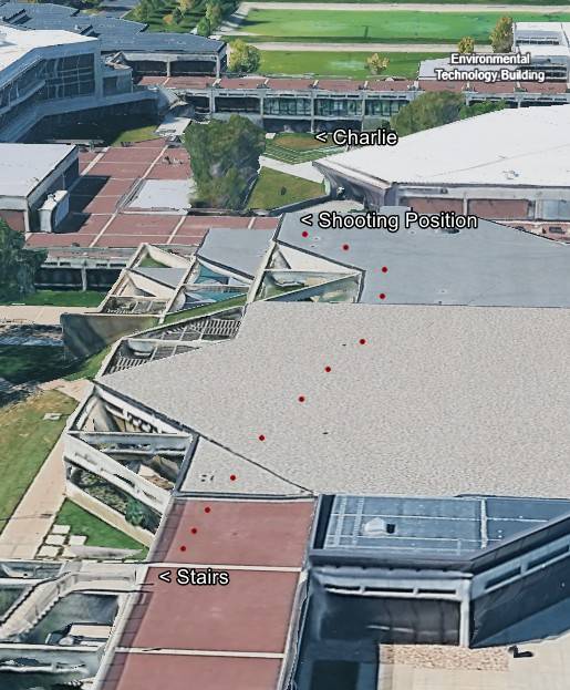
A high-angle three-dimensional satellite rendering of the campus, showing the interconnected flat roofs, angular levels and concrete walkways of the complex. A sequence of red dots traces a path across the rooftops and plazas.
The annotation labels read: "Environmental Technology Building," "Charlie," "Shooting Position" and "Stairs."
This is the most complete of the annotated site renderings in the cluster, because it marks not only a claimed firing position and the target but also the route and the stair access connecting them. The stairs are a live thread in this archive on their own, including the disputed figure on stairs with a backpack and the question of how roof access was controlled. Every label here is the annotator's assertion, and the text exchange about student roof access held elsewhere in this cluster bears directly on it. See The Shot and the Shooter Position, Proof Not Tyler and UVU.
Related Areas
- Cluster: Unfiled Backlog
- All photo evidence: Photos
More In This Cluster
- Previous: Post on a Florida Phantom Voter Report
- Next: Unfiled Backlog — Photo 332