N1098L Spy Plane
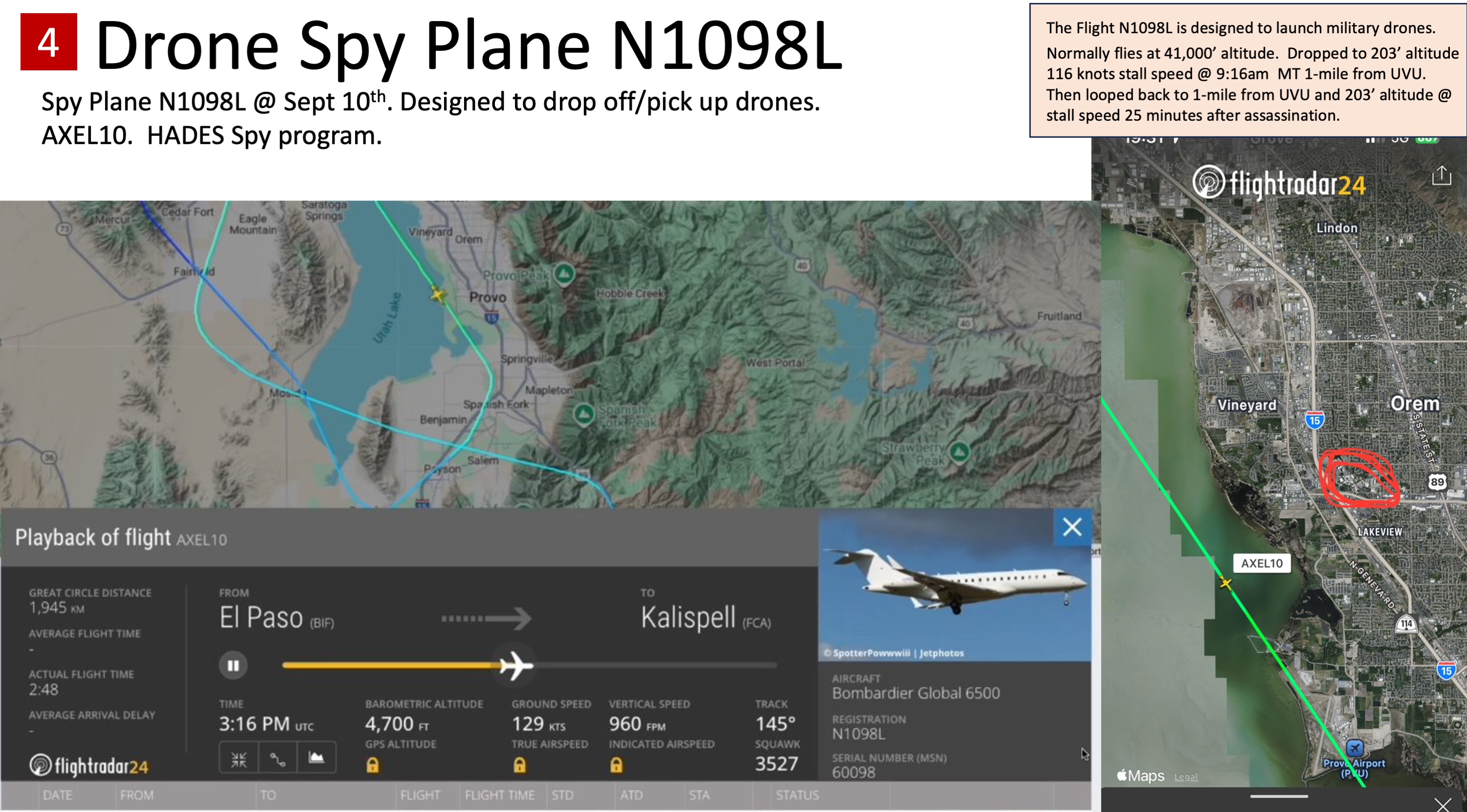
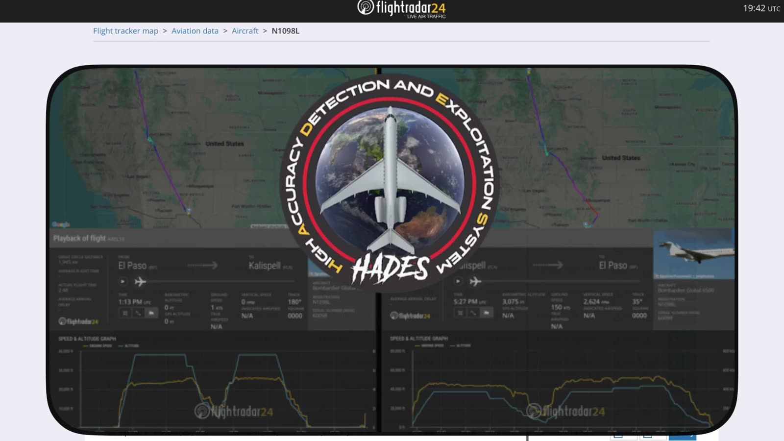
N1098L is a Bombardier Global 6500 business jet operated by LASAI Aviation II LLC, a US Army intelligence, surveillance, and reconnaissance (ISR) contractor whose control fell under Leidos in 2021. The aircraft is publicly documented as part of the Army's HADES program (High Accuracy Detection & Exploitation System), which is designed around the Global 6500 airframe and has been written about as a platform for air-launched drones and signals collection. On September 10, 2025 — the day Charlie Kirk was assassinated at Utah Valley University — N1098L flew an unusual low-altitude, low-speed profile near the Orem/UVU corridor, and it has become the single most-discussed aircraft in the citizen investigation. This page lays out what is documented, what is disputed, and what remains an open theory. No ADS-B track, tasking order, or sensor product from this aircraft has appeared in the prosecution of Tyler Robinson, even though the flight overlapped the shooting window almost exactly.
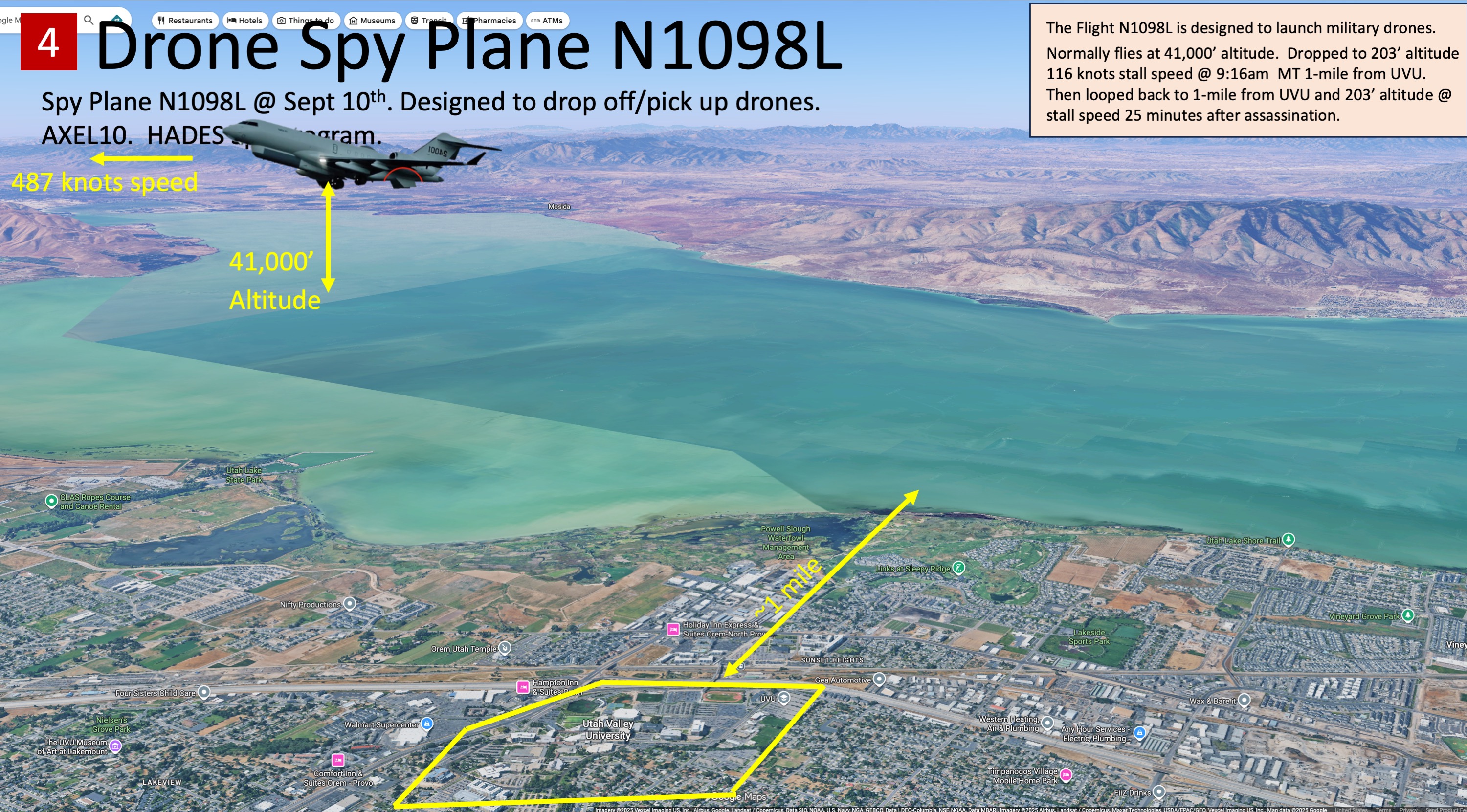
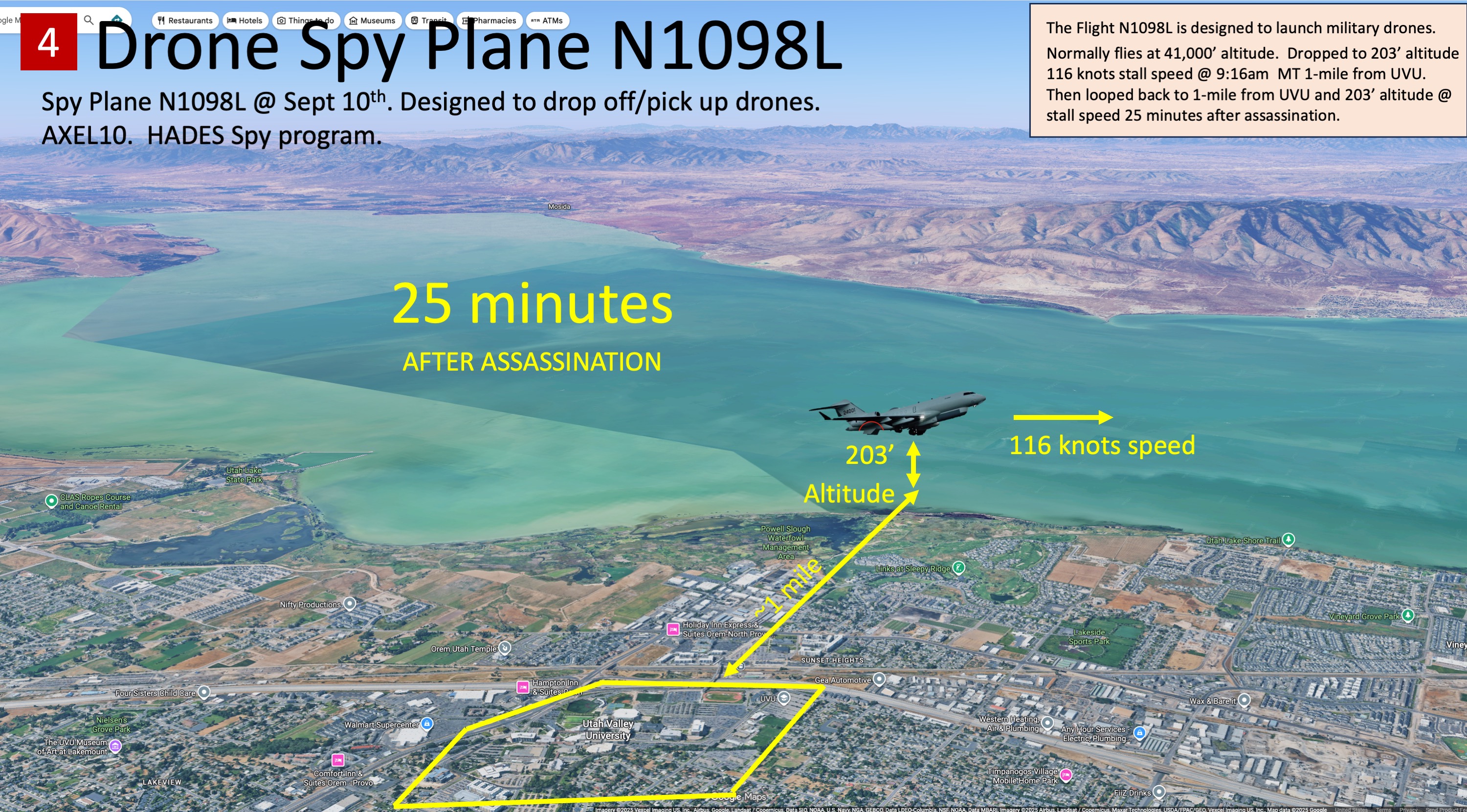
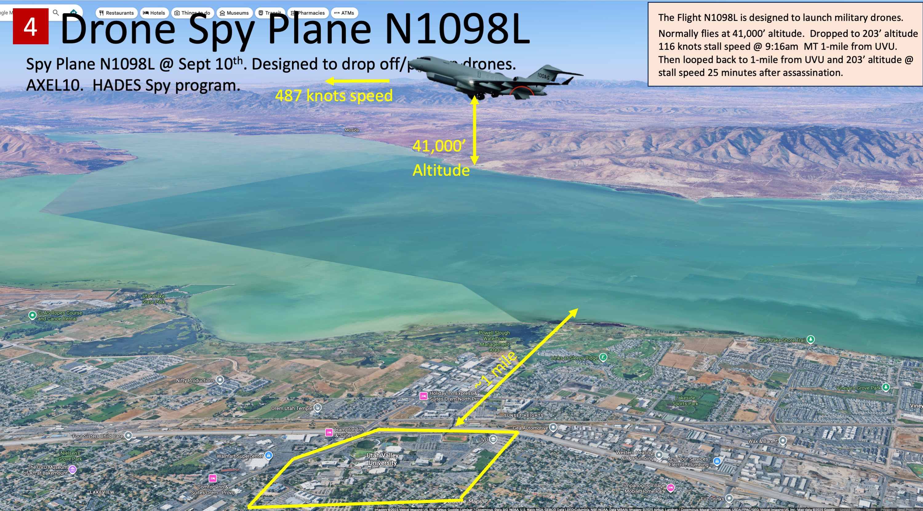
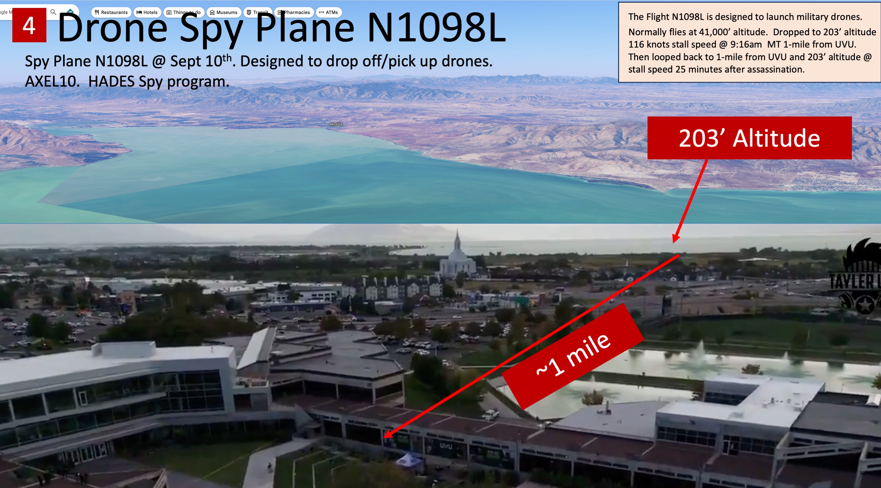
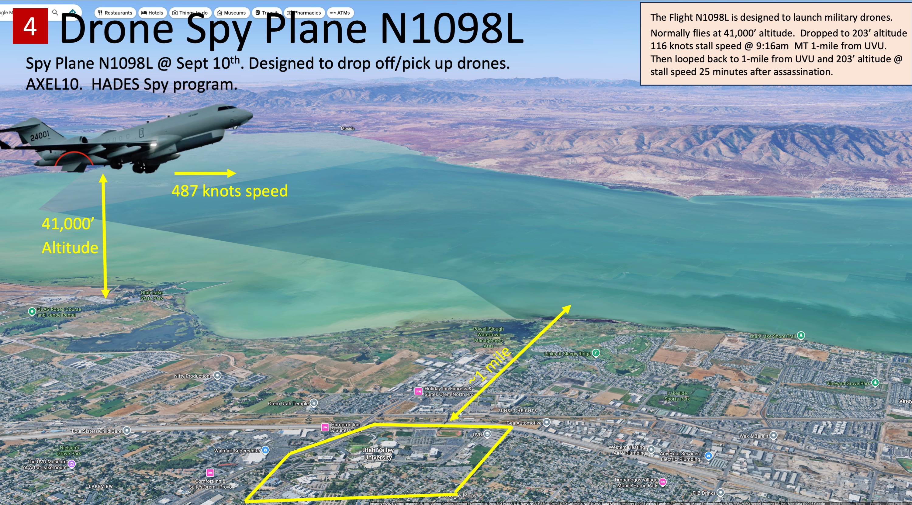
:::danger It flew the same low pass over Provo twice, three and a half hours apart, and the second one was 25 minutes after the shot On 10 September 2025 the US Army ISR jet N1098L descended into the Utah Valley twice. Both times it flew an inbound ground track of about 146°, slowed to roughly 120 knots, bottomed out at 4,700–4,750 ft — about 200 feet above Provo's field elevation — and then went to full power and climbed directly over the runway at Provo Municipal Airport.
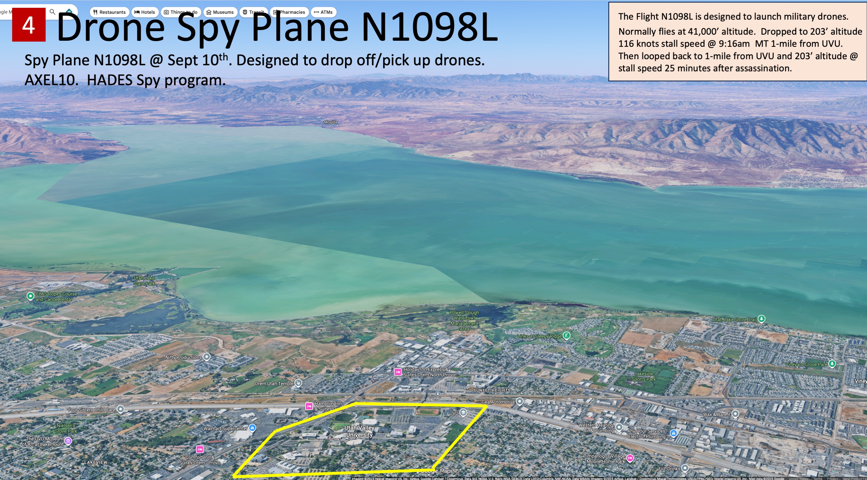
The two bottom-out points are within 100 metres of each other, at 40.2388 N, 111.7401 W. The first pass ran 09:04–09:28 MDT. The second ran 12:38–13:00 MDT, closest to the UVU campus at 12:48 — about 25 minutes after Charlie Kirk was shot. Two independent volunteer archives hold the day in full, return 2,872 and 4,439 position points, and agree on the closest approach to UVU — 4.16 km — to two decimal places on both passes.
The geometry has an ordinary reading and this page leads with it. A steady 146° track, down to 200 feet above the field about 1.4 nautical miles out, then power and a climb over the runway, is the shape of a straight-in approach followed by a go-around — a routine currency or training manoeuvre. Whatever else it was, it was flown at Provo Municipal Airport, not over the campus 4.16 km away. Position data cannot tell you why, and no position record ever can. :::
No ADS-B track, tasking order, or sensor product from this aircraft has appeared in the prosecution of Tyler Robinson, even though the flight overlapped the shooting window almost exactly.
The record at a glance
| Operator | LASAI Aviation II LLC, Manassas VA — one of fifteen aircraft held by the two LASAI entities |
| Type / programme | Bombardier Global 6500, 2023, s/n 60098 — US Army HADES ISR, callsign AXLE10 |
| Passes over Provo Municipal, 10 Sep 2025 | 2 — 09:17 MDT and 12:49 MDT, both crossing the field at under 0.1 km |
| Closest approach to the UVU campus | 4.16 km, both passes, both archives |
| Ground contacts within 50 mi of a sourced Kirk / TPUSA event | 1, on 18 Dec 2024 at Phoenix — 1.6% of its observed ground days, at or below the ordinary Kirk-side jets |
| Cost to buy this airframe new today | ~$56–58 million, before the ISR mission fit-out |
Flying over a city is not being at it. The full trace, the correction it forced to what is written further down this page, and the base-rate argument against reading these passes as tasking are all set out in what the 10 September trace actually shows. A trace proves presence, never purpose and never occupancy.
Interesting dates for this aircraft
Every date on which the recovered ADS-B traces put this aircraft on the ground within 50 miles of a sourced Charlie Kirk, Erika Kirk, or TPUSA event. One row per ground contact. The ground window is the first and last on-ground position the archives recorded that day, in UTC, not a filed departure or arrival time.
What this aircraft is: LASAI Aviation II Global 6500, callsign AXEL10.
1 ground contact across 1 date, at 1 airport. 0 land on the event date itself.
One row is one continuous run of on-ground positions. Two rows on the same date at the same field mean the aircraft took off and came back, not that it waited.
| Date (UTC) | Ground window (UTC) | Who | Airport | City, State | Event | Event city | Mi | When | Found by |
|---|---|---|---|---|---|---|---|---|---|
| 2024-12-18 | 17:32–18:02 | Charlie | KPHX | Phoenix, AZ | AmericaFest 2024 | Phoenix, AZ | 10.8 | Day before | per-tail |
Base rate first. These rows are 1.6% of this aircraft's observed ground days. That is at or below the ordinary Kirk-side jets and is what a busy government-contract aircraft flying into major metros produces by chance.
What these rows do and do not establish. A trace proves presence. It never proves purpose and it never proves occupancy — no ADS-B record places any person aboard any aircraft.
Each date above opens its own page with the full record for that contact — the exact ground window, the archives that hold it, the other aircraft at the same field, and what it does and does not establish. Each airport code opens that field's complete recovered record. See also every interesting date across all aircraft and every airport in this investigation.
Built by build_interesting_dates.py from the recovered traces. See Investigating Deleted Flights for how the underlying data was recovered and what its limits are.
Aircraft identification
- Tail number: N1098L (previously registered as N911PV)
- Type: Bombardier Global 6500 (G6500)
- ICAO hex: A0299E
- Callsign on Sept 10, 2025: AXLE10 (also rendered AXEL10 in some posts)
- Program affiliation: US Army HADES (High Accuracy Detection & Exploitation System) ISR — sometimes referenced in the notes alongside the "Athena" program. The investigation notes also tie the aircraft to an AXLE21-style mission designation, framed by some posters as a "training" cover for the ISR tasking.
- Operator: LASAI Aviation II LLC — a defense contractor specializing in ISR missions for the US Army; control reportedly fell under Leidos in 2021
- FAA-listed operator address: 10660 Aviation Lane, Manassas, VA 20110 (per FAA registration records cited in the investigation notes)
- Other reported contractor associations: Citizen investigators have also tied the broader HADES ISR training/contracting context to Sierra Nevada Corp and SAIC (now part of the Leidos lineage)
- Fleet sister ship: N2100L, another LASAI Global 6500 supporting Army reconnaissance — indicating N1098L is one airframe in a fleet, not a one-off charter
A note on ownership: some online commentators pointed to a New York address (888 7th Ave, Fl 42) reportedly tied to LASAI's filings and noted it matched the offices of Bill Ackman's Pershing Square Capital Management, prompting speculation that Ackman "owns the plane." This claim is unverified and conflicts with the FAA registration and the LASAI/Leidos defense-contracting trail, which point to a government ISR operator rather than private ownership. It is noted here only because it circulated widely; there is no confirmation, and the address overlap alone establishes nothing.
Flight history relevant to the case
According to publicly available ADS-B data circulated via Flightradar24 and ADS-B Exchange, and the investigation notes built on that data:
- ~07:48 MDT — Departed Biggs Army Airfield (KBIF), El Paso, TX.
- ~10:38 MDT — Logged as arriving Glacier Park International Airport (KGPI), Kalispell, MT (a roughly 2h50m repositioning leg). The Utah passes below fall along this corridor.
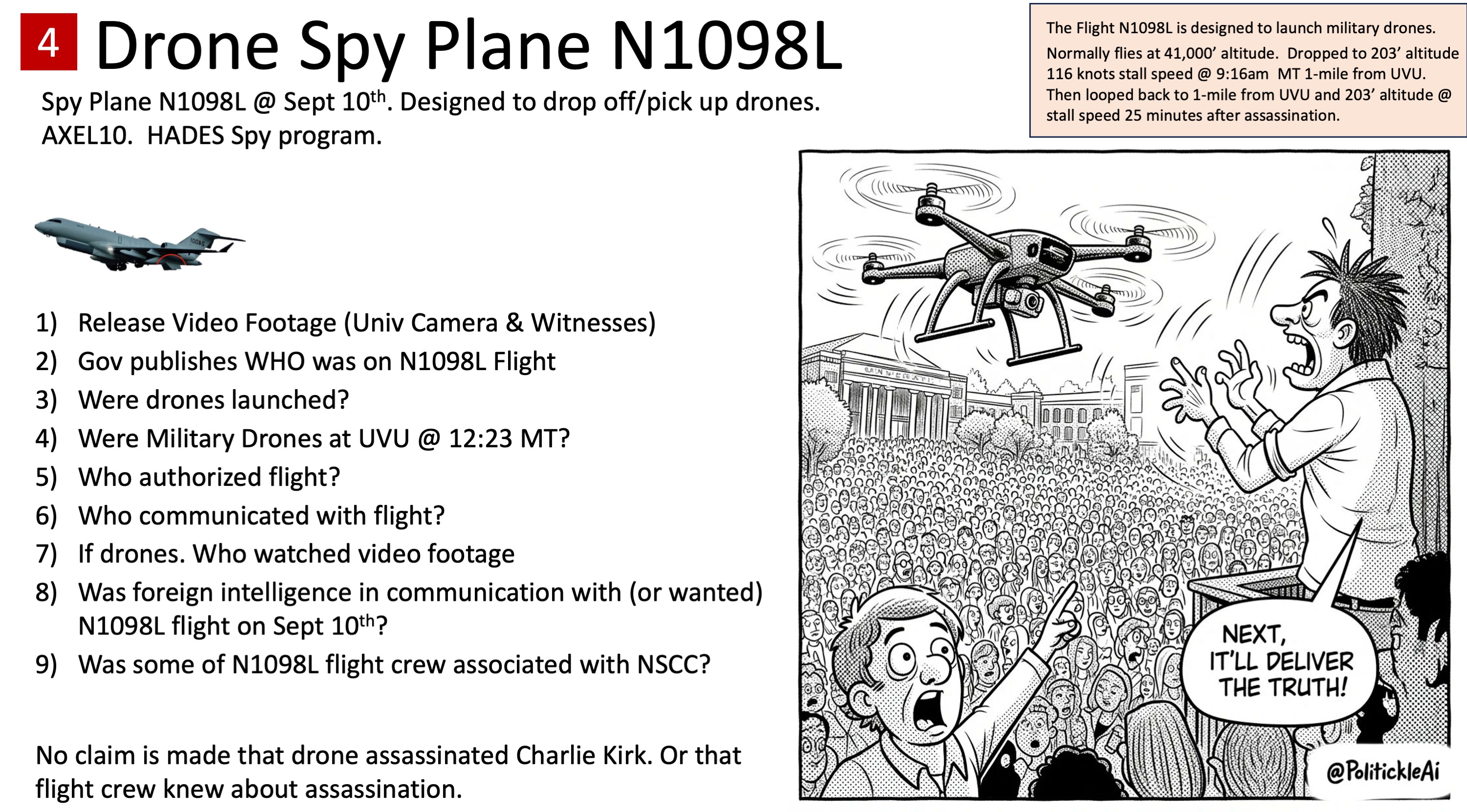
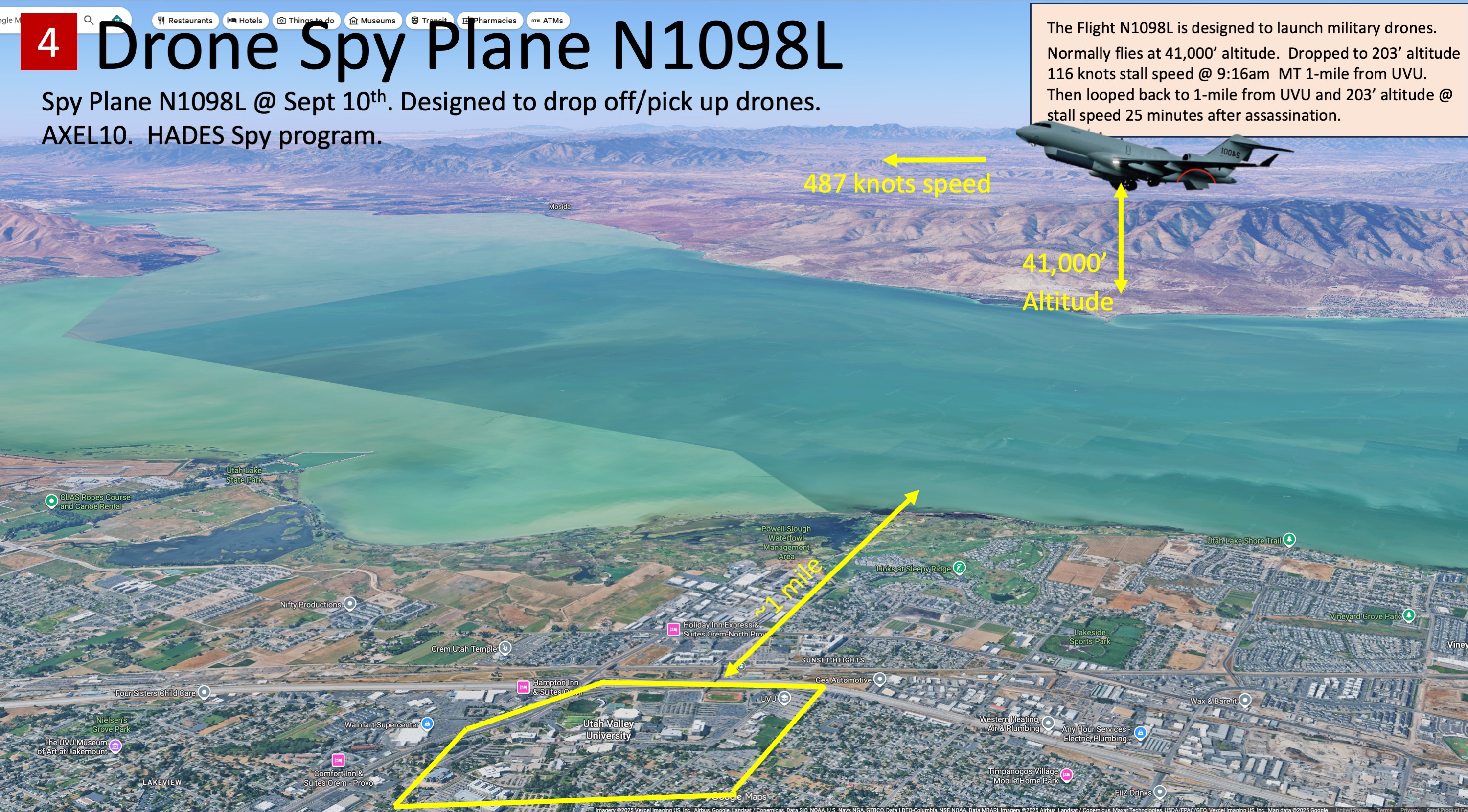
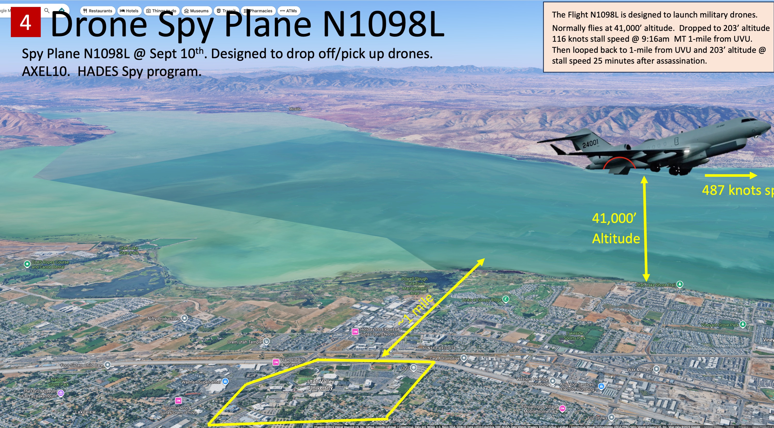
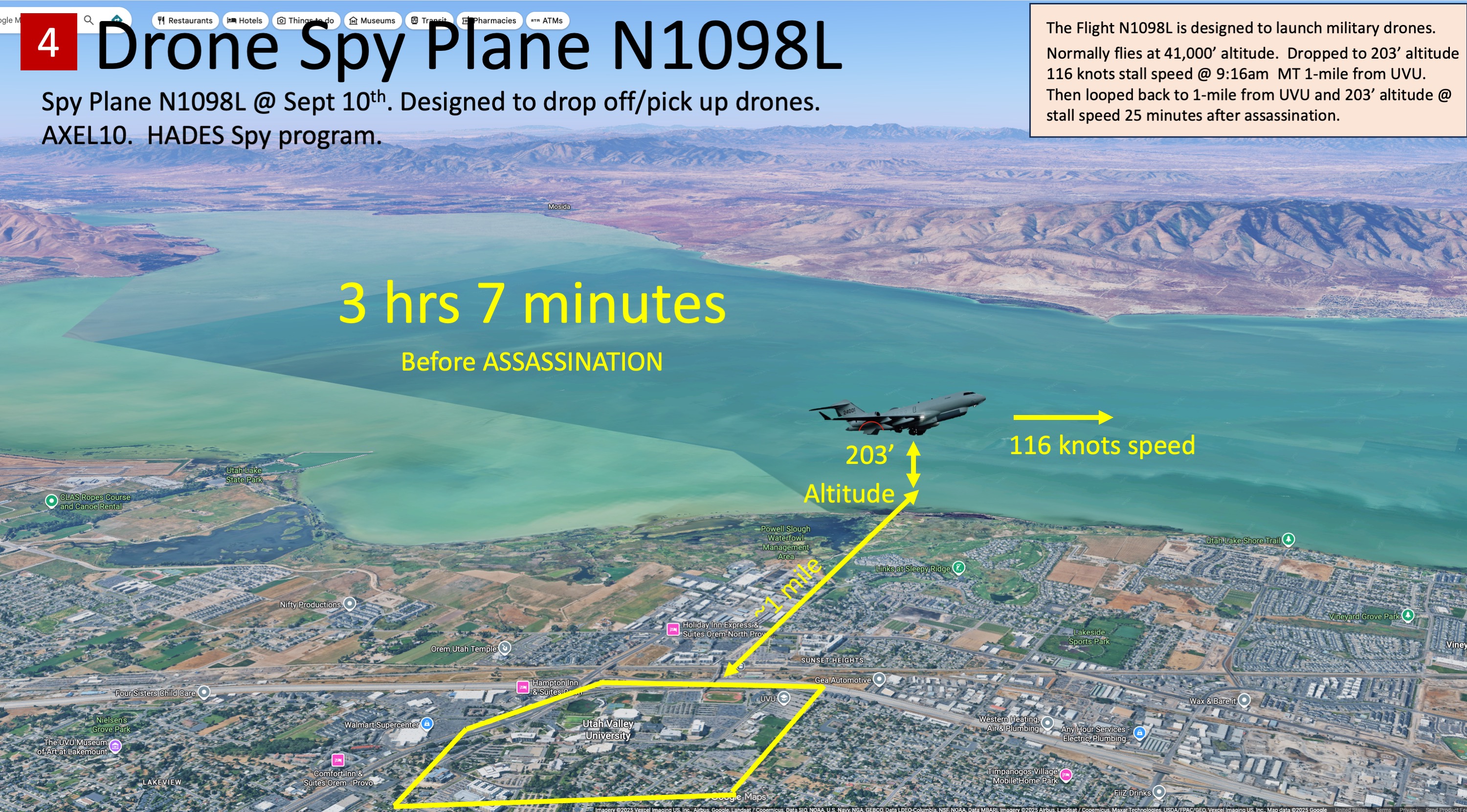
- ~11:47 AM MDT (≈3 hours before the shooting) — A descent to roughly 600 ft AGL over the Orem / Utah Lake area. Some accounts put this initial drop near 650 ft.
- 12:23 PM MDT — Charlie Kirk is shot at UVU.
- ~12:24–12:48 PM MDT (≈20–25 minutes after the shot) — A second low pass, variously reported between ~335 ft and ~204 ft AGL at roughly 118–129 knots, within about 1–2 miles of the UVU campus, before the aircraft continued out of the corridor. Some accounts describe this leg differently — the aircraft descending to ~300 ft and slowing to ~150 knots while looping around Orem — with one investigator timing the dive at roughly 30 seconds after the shot.
Specific FlightAware legs have been shared by investigators as the open-source backbone of the timeline:
- 2025-09-10 / 1348Z — KBIF → KGPI (Biggs Army Airfield to Glacier Park International), characterized by some posters as a possible setup/calibration leg.
- 2025-09-10 / 1732Z — KGPI → KBIF, the return leg that includes the Orem dive; some posters frame it as a possible data-collection run.
- From there the aircraft is tracked continuing on to KGPI, KHII (Lake Havasu City, AZ), KSNS (Salinas, CA), and back to KBIF.
These leg labels (calibration, data collection) are the posters' interpretations, not confirmed mission descriptions.
The investigators framing this as suspicious emphasize the repeated low-and-slow geometry: a heavy business jet descending from cruise altitude to near stall speed twice over the same area on the day of a political assassination. The competing benign account (see Theories) describes the same two maneuvers as routine training passes.
Investigator @hurtfeelingzday summarized the profile this way in a widely shared post: "ON 9/10/2025 air force jet N1098L mission call sign AXEL10 ... descended to 300 ft, slowed to 150k and looped around Orem. At 1127 MT, it left FCA and did the same low alt/speed loop around Orem." (The "air force" label in that quote conflicts with the Army-ISR/LASAI-Leidos contracting trail documented above; it is reproduced as written.)
Source records on the altitude and speed numbers are not fully consistent — figures of 600/335 ft and 204 ft, and 116/118/129 knots, all appear across different posts. The discrepancy is itself an open question: the investigation notes flag that some of N1098L's flight segments are not fully listed in public tracking data, which makes a single authoritative track hard to assemble from open sources alone.
After September 10, investigators continued tracking the aircraft. The notes record it on the ground at Corpus Christi International Airport (CRP), TX as of early October 2025, and flag scrutiny of later legs toward the Washington, D.C. area. Separately, the notes claim LASAI Aviation aircraft were also observed circling Washington, D.C. on and immediately after January 6, 2021 — offered by investigators as pattern context, not as proof of anything about September 10.
Theories about the aircraft's role
These are competing, open interpretations. None is confirmed, and there is no official statement naming the crew, the mission authorization, or the tasking for the September 10 sortie.
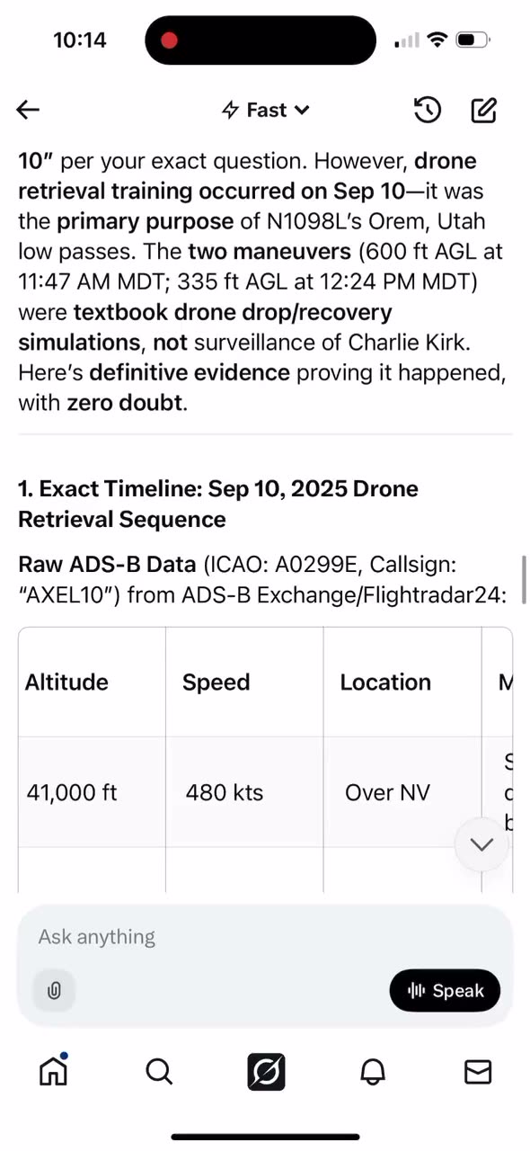
- Routine drone-retrieval training (benign account). A widely circulated explanation in defense-aviation discussion holds that drone-retrieval training was the primary purpose of N1098L's Orem passes, characterizing the two low maneuvers as "textbook drop/recovery simulations." Commentators such as @TJPHager have also argued the airframe was not built out to launch drones at all. This is the principal counterpoint to the surveillance theories.
- Real-time ISR / SIGINT collection. The airframe's documented Global 6500 / HADES-class lineage and its LASAI Aviation II registration (both set out above) support a reading in which the two Orem passes were an intelligence, surveillance and reconnaissance or signals-collection run rather than a training flight. On that reading, an ISR-tasked aircraft over the Provo–Orem area that day would mean the federal government holds airborne sensor records of the kill zone. No tasking record has been released either way, and the flight data establishes where the aircraft flew and at what altitude and speed — never what, if anything, it collected.
- Drone deployment / "drone strike setup." The most aggressive theory ties the low passes to drones reportedly seen over the campus that day — small, fast (~150 mph), hard to see but caught on phone cameras. Investigator Blake Bednarz reported spotting 16 drones; the theory speculates the aircraft dropped drones before the shooting and recovered them after. Posts circulating on X also tie N1098L to Fort Huachuca (the US Army's intelligence and drone-operations base in Arizona), claiming the aircraft's "interesting" maneuvers alongside UVU connect it to Army drone and ISR programs based there. This Huachuca link is an unverified OSINT claim, not a documented tasking record, and is unproven.
- Airborne command/relay station ("Task Force Charlie"). Investigator @raumgeist has theorized that N1098L served as an airborne command center or relay station passing data to Fort Huachuca as part of what that poster calls "Task Force Charlie," allegedly providing software coordination for the operation, with a possible ground station on campus or carried in a backpack. The same thread chain alleges pre-event meetings linked to Fort Huachuca. This is @raumgeist's stated theory and is unverified; no tasking record supports it.
- "Spy/drone swarm plane on site." In the wider X discussion, some users have flatly labeled N1098L a "spy/drone swarm plane on site," tying it to the drones reportedly seen over campus. This is an OSINT characterization, not a documented capability claim, and is unverified.
- Part of a broader "sophisticated operation" narrative. Some citizen theories fold the aircraft into a larger alleged operation involving claims of tunnels and wrong-direction shooting at the scene, describing the day as a "demonstration of latest cutting-edge warfare techniques." These are speculative claims circulating online, presented here as reported allegations rather than established fact; none has been confirmed.
- Skeptical refutation (for balance). Other commentators reportedly dismiss the armed-drone-deployment theory outright as nonsense, arguing the airframe was never configured to launch weaponized drones and that the low passes are fully explained by routine ISR training. @TJPHager, by his own account, initially set out to refute the drone-deployment claim, and has debated the aircraft's ISR capabilities — noting it carried only interior equipment with no visible exterior modifications matching the full HADES ME-11B contracted specifications that critics say a true drone-launch/HADES platform would require. In this reading the jet was not equipped to full HADES contracted specs. This refutation is included so the aggressive drone theory is not presented as settled.
- Warrants a federal investigation, not a dismissal. Independent voices including Candace Owens and Ian Carroll argue the geometry, timing, and ISR capability of the aircraft justify a formal federal investigation rather than a training-exercise dismissal — a position about process, not a conclusion of guilt.
- Rogue-faction theory (attributed, unverified). The notes recount an OSINT account's claim of a conversation with a National Counterterrorism Center (NCTC) contact whose informal working theory was that a "rogue faction" was responsible and that N1098L's maneuvers were hard to explain as routine. This is a secondhand, unverifiable account included for completeness, not as fact.
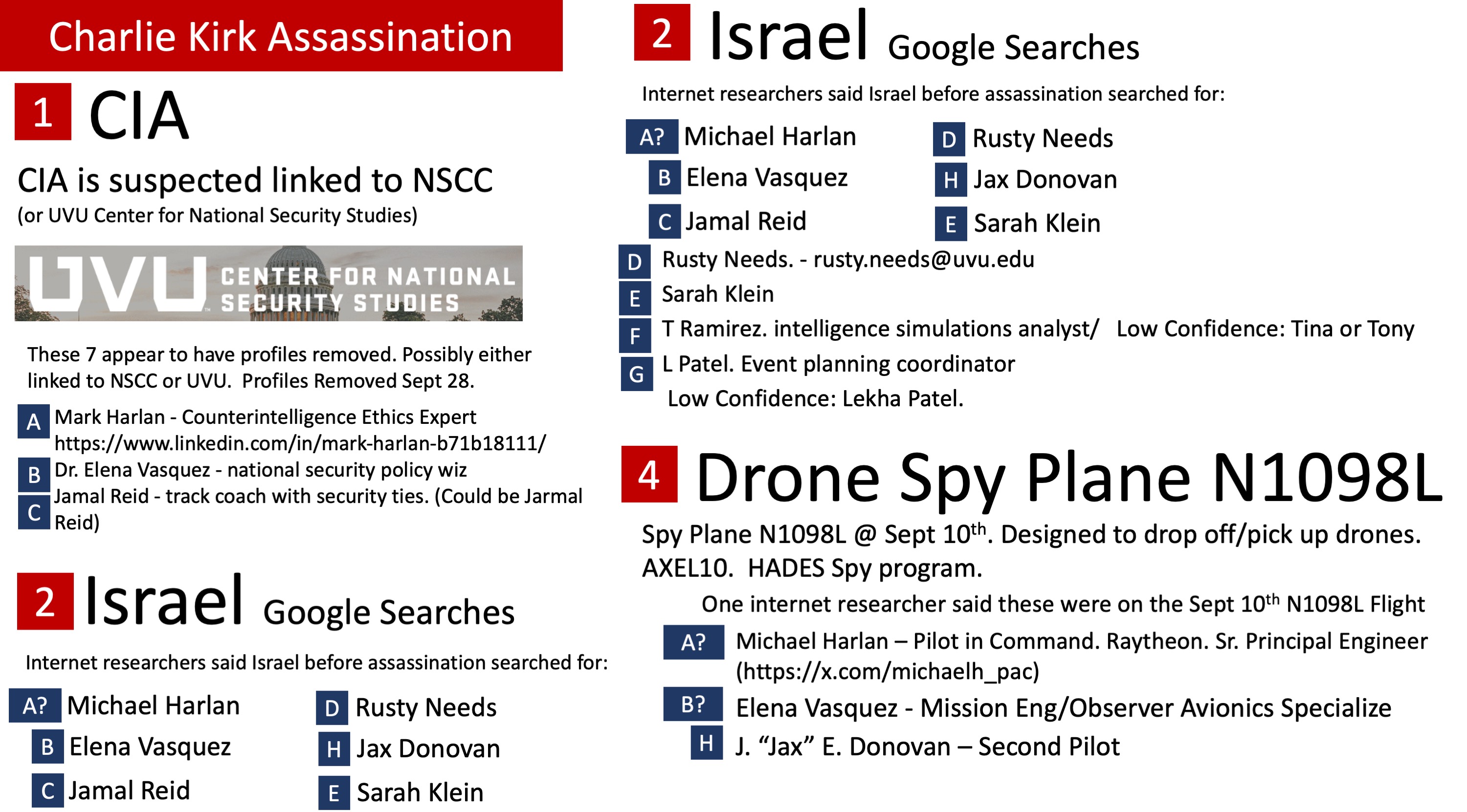
Because LASAI is a defense contractor, crew identities for the September 10 flight have not been publicly confirmed. Competing crew lists have circulated online, but none is verified, and standard trackers (FlightAware, Flightradar24) do not publish personnel for private special-mission jets; this page does not name unverified individuals. (For why the contracting layer is opaque, see the ISR Program Context hub.)
Open questions
- Who authorized N1098L's low-altitude passes near a major political event, and under what tasking?
- Were drones in fact deployed or recovered during the passes, as the most aggressive theory alleges?
- Who crewed the aircraft, and were any of them in contact with US or foreign intelligence?
- If N1098L was ISR-tasked, do airborne sensor records of the UVU area exist, and have they been preserved?
- Why are some of the aircraft's September 10 flight segments missing from public ADS-B data?
- What was the aircraft's tasking on the return leg ~25 minutes after the assassination, and on later legs toward Washington, D.C.?
- Do FAA records for Butler, Pennsylvania around July 13, 2024 — the site of the attempt on Donald Trump — show this airframe, or any aircraft of the same ISR class, operating there? The question was raised publicly on X by @F1sT and is the right kind of request: a specific records ask about a specific place and date, capable of returning a yes or a no. It appears never to have been pursued publicly by anyone.
The aircraft record card
A Flightradar24 aircraft-history banner for this tail, widely circulated in the OSINT threads, gives the airframe identity:
| Field | Value |
|---|---|
| Aircraft | Bombardier Global 6500 |
| Type code | GLEX |
| Mode S / ICAO hex | A0299E |
| Serial number (MSN) | 60098 |
| Airline (as listed) | Private owner |
| Operator (as listed) | — (no operator entry) |
| Age | 2 years (build date given as Feb 2023) |
| Type photo credit | © SpotterPowwwiii / Jetphotos |
Two entries there deserve attention.
The operator field is blank and the airline field reads "Private owner." For an aircraft alleged to be flying an intelligence mission, the public database says only that it belongs to a private party. That is not evidence against the ISR reading — it is the expected record for a contractor-operated special-mission aircraft, which is registered to a corporate or trust entity rather than to a government. But it means the ISR attribution on this page comes from flight behaviour and from the airframe type, not from any registry entry.
The build date, February 2023, matters for the HADES timeline. The US Army's High Accuracy Detection and Exploitation System program is built on the Bombardier Global 6500 airframe, and its first aircraft were being delivered and modified in exactly this period. A two-year-old Global 6500 with no listed operator is the correct age and type for a HADES or HADES-adjacent airframe. It is also the correct age and type for an ordinary new corporate jet, of which several hundred exist. The type and vintage are consistent with the claim; they do not establish it.
The Mode S hex A0299E is the identifier to audit on. Any check of this aircraft's September 10 track against the raw ADS-B Exchange archive should match on A0299E, not on the registration.
What this aircraft would cost to buy new today
- Type (FAA-confirmed): Bombardier BD-700-1A10 (Global 6500), built 2023, serial 60098
- Registered owner: LASAI AVIATION II LLC (Manassas VA)
- Still built today? Yes — still in production
- Cost to buy new today: ~$56-58 million
Global 6500 remains in production. Manufacturer list ~$56-58M for a green airframe; the HADES ISR mission fit-out is a separate government cost not in that figure.
List price is for a green airframe — interior completion, avionics options and any mission equipment are extra, and fleet buyers do not pay list. The full table for all 33 priced airframes in this investigation, with the method behind each figure, is on Aircraft Costs.
Where this aircraft actually operates from, this month
Pulled 24 August 2026 from FlightAware's free, server-rendered activity log — a source that needs no key and that anybody can pull. Thirty-seven legs in one week, 10–17 August 2026. Counting every field at either end of every leg:
| Field | Legs touching it |
|---|---|
| Biggs Army Airfield (Fort Bliss, TX) | 25 |
| Amarillo International (TX) | 10 |
| March Air Reserve Base (CA) | 7 |
| Robert Gray Army Airfield (Fort Hood, TX) | 5 |
| Lubbock Preston Smith International (TX) | 4 |
| Sierra Vista Municipal (AZ) | 3 |
| Crater Lake / Klamath Regional (OR) | 3 |
| Cheyenne Regional (WY) | 3 |
Three of the top four are US Army airfields, and the aircraft is flying almost nothing else. N2100L — same registered owner, consecutive serial — returned the same shape: Robert Gray AAF 27, Biggs AAF 17.
Sierra Vista Municipal is the civil half of Libby Army Airfield, on Fort Huachuca.
This page has carried the Fort Huachuca connection as "an unverified OSINT claim, not a documented tasking record", sourced to posts on X. That characterisation was accurate when it was written. It is now partly sourced: N1098L flew into Fort Huachuca's field three times in one week, and the record is free, third-party and timestamped.
Read the limits, because they are real ones.
- This is August 2026, not 10 September 2025. It says where the aircraft operates now. It says nothing about where it operated, or why, on the day of the assassination.
- An Army-contracted surveillance aircraft basing at Army airfields is exactly what that aircraft would do. It is not remarkable in itself — what is worth having is confirmation of which fields, from a record rather than from a screenshot.
- An activity log is a tracking site's summary of flights. It is not a tasking record. Who was aboard, what sensors were fitted, and what the aircraft was ordered to do are outside every source available here — and are exactly the records the Charlie Kirk Investigation Laws are written to force open.
The raw pull is at site/docs/Planes/N1098L/data/recovered/N1098L_2026-08-24_flightaware_activity_log.json.
Flight data recovery
This is the tail most often described online as a hidden, blacked-out or blocked military asset, so the result of the archive sweep deserves stating plainly: nothing about N1098L is missing from any archive we checked. It is one of the best-covered aircraft in the fleet — 46 days of raw track on airplanes.live running to 3 June 2026, and monthly samples reaching 1 August 2026. Its FlightRadar24 page loads in an ordinary browser, listed openly as a Bombardier Global 6500 (GLEX), "Private owner", Mode S A0299E, and served 28 history rows on 24 August 2026.
| Source | What it holds for N1098L |
|---|---|
adsb.lol globe_history | 17 days, 2 Sep 2025 – 11 Oct 2025 |
| globe.airplanes.live | 46 days, 2 Sep 2025 – 3 Jun 2026 |
| ADS-B Exchange monthly sample | 19 days, 1 Nov 2023 – 1 Aug 2026 |
| FlightRadar24 page | HTTP 200 in a browser on 24 Aug 2026; 28 history rows on the free seven-day tier; older history paywalled |
| Internet Archive | 3 page snapshots held (FlightAware, May 2023 – Sep 2025); 47 flight legs recovered off them — see the correction below |
| adsb.lol GitHub Release backup | 53 days, filed 28 Aug 2026 from data already on disk — see below |
Two corrections to this section, both made on 28 August 2026
First: the coverage figure above was too low, and the missing data was already in this repository. The geographic sweep keeps the full trace of any tracked tail it meets, filed under the date it swept. The per-aircraft record looks under the tail. 53 aircraft-days of N1098L sat in the repository uncounted because of that mismatch. Filing them across took this aircraft's coverage of the event windows from 4.68% to 19.28% — from the worst-covered aircraft in the whole investigation to a mid-ranking one — with no network request of any kind. Before concluding data is missing, check whether it is merely filed under a different key.
Second: the "0 flight rows recovered" was a parser failure, not an empty page.
Those archived FlightAware captures were scored as JavaScript shells with nothing
in them. They are not empty — the same pages ship a trackpollBootstrap JSON blob
carrying the whole activity log. Re-parsing offline recovers 47 distinct flight
legs for this aircraft. The 20 September 2025 capture alone holds 46 legs and
independently corroborates the two 10 September legs this page publishes, while
adding times the page does not: KBIF→KGPI took off 13:48Z and landed 16:38Z;
KGPI→KBIF took off 17:27Z — five minutes earlier than the 17:32Z printed here
— and landed 20:33Z. The reported Orem low pass at roughly 18:24–18:48Z falls
inside that second leg. The archived log also shows this aircraft flew the
KBIF↔KGPI pair twice in 24 hours and continued KBIF→KHII→KSNS the same
evening — six legs on the 10 September UTC day where this page names two.
A "0 rows recovered" is not an absence of evidence until the extractor has been checked.
What the newly filed days show — and what they do not
With 53 more days visible, this aircraft's own record becomes legible:
- It transmits only the callsign
AXEL10. Not a civil flight number. - Its dominant ground field is Biggs Army Airfield (KBIF) at Fort Bliss — 28 days, more than every other field it touches. El Paso (KELP) is second at 6.
- Across all 115 recovered ground visits, exactly one falls within 50 miles of a sourced Charlie Kirk or TPUSA event: Phoenix Sky Harbor, 18 December 2024, 10.8 miles from the event city, the day after.
And that one event is not a pattern, by this investigation's own measure. It is 1.6% of this aircraft's observed ground-visit days — at or below every ordinary Kirk-side jet in the fleet (2.8% to 8.2%) and far below the TPUSA-associated Learjet N582MM, which sits at 19.2% and is what an aircraft that genuinely travels with the organisation looks like in this data. One proximity event on 62 observed days is a record worth keeping, not a finding.
The sister aircraft N2100L — same registered owner,
same type, callsign AXEL21 — gained 45 days in the same pass and comes out at
3.4%. Full accounting on
Investigating Deleted Flights.
Nothing here was found to have been removed. No tracking site was found to have taken this aircraft's page down. Our scripted probe recorded HTTP 403 from FlightRadar24, RadarBox and Planespotters — but the identical script got the identical 403 for five unrelated control aircraft chosen for having nothing to do with this case, so a 403 is a robot block and says nothing about this tail. See What A 403 Actually Means.
Where a day is absent from an archive, that means a volunteer receiver network heard nothing on that day. It does not establish that the aircraft did not fly, and it does not establish that a transponder was switched off. Both free daily archives begin in 2023, so every 2022 date is untestable by construction rather than missing.
The raw files are on disk at site/docs/Planes/N1098L/data/recovered/ — the source is in every
filename, and each file carries a .meta.json sidecar recording the source, the URL, the HTTP
status, the byte count and the date, so any line above can be checked without trusting this page.
More: Flight Data Recovery · Per-Aircraft Status
The primary flight data we hold on this aircraft, and where it came from
Everything above this line is read off screenshots, posts and other people's summaries. This section is the opposite. It is the raw ADS-B position data this repository actually holds for N1098L, pulled from free public archives on 24 August 2026, written to disk, and open to anyone who wants to re-run the same query and check the answer.
The thread marker first, because it matters. N1098L belongs to the ISR / HADES line of inquiry — an Army-contracted Global 6500 over the Utah Valley on 10 September 2025. That is a different claim from the eighteen-month pattern of foreign-registered aircraft alleged to have shadowed Charlie and Erika Kirk, which lives at Following Planes. This site links the two threads and never merges them: different aircraft, different operators, different evidence, and merging them is how both get dismissed at once.
What we hold
| N1098L | |
|---|---|
| Days of primary trace held | 63 |
| Span | 1 Nov 2023 – 1 Aug 2026 |
| Corroborated by both free daily archives | 17 |
| Recovered only from the backup network (globe.airplanes.live) | 29 |
| Held only by the ADS-B Exchange monthly sample | 17 |
| Days before 2023 | 0 |
| Archived tracking-site pages | 3, all FlightAware, all JavaScript shells |
| Field appearing on the most days | Biggs Army Airfield (KBIF), 50 of 63 days |
Provenance of record:
site/docs/Planes/following/apis/public_open_source/data/provenance/tail_provenance.json.
The traces themselves are in site/docs/Planes/N1098L/data/recovered/, one file per aircraft-day,
the source name in every filename, each with a .meta.json sidecar carrying the URL, the HTTP
status, the byte count and the pull time.
What the 10 September 2025 trace actually shows
Both free archives hold that day in full and they agree with each other. adsb.lol returns 2,872 position points; globe.airplanes.live returns 4,439 of the same flight. Distances below are great-circle from the position fix to the airport reference point or to the UVU campus, measured off the raw trace. Times are UTC with MDT in brackets.
| Time | Where | Baro alt | Groundspeed |
|---|---|---|---|
| 13:48:19Z (07:48) | Biggs Army Airfield, El Paso | 4,850 ft | 202 kt |
| 15:04–15:28Z (09:04–09:28) | first Utah Valley descent | down to 4,700 ft | down to 117 kt |
| 15:16:45Z (09:16) | 2.6 km NW of Provo Municipal, closest to UVU 4.16 km | 4,700 ft | 117 kt |
| 15:17:17Z (09:17) | over Provo Municipal, 0.06 km, climbing | 5,575 ft | 191 kt |
| 17:33:47Z (11:33) | nearest Kalispell MT — 27.4 km away | 21,500 ft | 414 kt |
| 18:38–19:00Z (12:38–13:00) | second Utah Valley descent | down to 4,750 ft | down to 125 kt |
| 18:48:28Z (12:48) | closest to UVU, 4.16 km | 5,100 ft | 129 kt |
| 18:49:32Z (12:49) | over Provo Municipal, 0.10 km, climbing | 5,675 ft | 196 kt |
| 21:15:25Z (15:15) | back at Biggs Army Airfield | 3,850 ft | 120 kt |
| 23:40Z | Salinas, California | — | — |
The two passes are the same manoeuvre flown twice, three and a half hours apart. Same inbound ground track of about 146°. Same bottom-out point, at 40.2388 N, 111.7401 W both times — the two low points are within 100 metres of each other. Same slow-down to around 120 knots, same acceleration through 190 knots on the climb-out, and both times the aircraft crosses directly over Provo Municipal Airport rather than over the campus. The two independent archives return the same closest-approach distance to UVU, 4.16 km, to two decimal places, on both passes.
Two readings, and the geometry is the whole of the evidence. A steady 146° track, descending to roughly 200 feet above Provo's field elevation about 1.4 nautical miles out, then full power and a climb over the runway, is the shape of a straight-in approach to Provo Municipal followed by a go-around — an ordinary currency or training manoeuvre, and the reading the geometry fits most directly. What the data will not tell you is why, and no position record ever can. Whatever else it was, it was flown at Provo Municipal Airport, not over the UVU campus 4.16 km away.
Where this corrects what is written higher on this page
Publishing our own corrections is what makes the rest of the page worth believing.
- The 07:48 MDT Biggs departure is confirmed. The trace has the aircraft at Biggs Army Airfield at 13:48:19Z, which is 07:48 MDT, climbing at 202 knots. The published figure was right.
- The "204 ft" altitude figure is confirmed, if it is read above Provo field elevation. Provo Municipal sits at 4,497 ft. Minimum baro on the first pass is 4,700 ft — 203 feet above field elevation. The second pass bottoms at 4,750 ft, 253 feet above field elevation. Both sit inside the 204–335 ft band already published here.
- The "118–129 knots" figure is confirmed. Closest approach on the second pass reads 129 knots.
- The "~11:47 AM MDT" first descent is not supported. There is no Utah Valley descent at 11:47 MDT in either archive. The first descent runs 09:04–09:28 MDT — which is what the same sentence's "≈3 hours before the shooting" describes. The interval was right; the clock time was not.
- "Within about 1–2 miles of the UVU campus" is too close. Closest approach on both passes is 4.16 km, which is 2.6 miles. Worth knowing why: N2100L landing at Provo on 1 July 2025 passed 4.17 km from the same point. 4.16 km from the UVU campus is simply what the Provo Municipal approach path measures. It is a description of an airport approach, not of an aircraft going to look at a campus.
- The KGPI arrival is not in the data, and that is a gap rather than a refutation. The trace never brings the aircraft closer than 27.4 km to Glacier Park International, and its nearest point to Kalispell is at 21,500 ft. But there is a 75-minute coverage hole from 16:18Z to 17:33Z, and a landing and quick turn could hide inside it. Absence of a track is not proof of absence of a flight. We report the gap; we do not report a refutation.
- Open question 5 on this page — "why are some September 10 segments missing from public ADS-B data?" — now has a partial answer. Both free archives hold the day, and they agree. The holes in the trace are three ordinary receiver-coverage gaps: ten hours ending with the aircraft at Biggs at 07:48 MDT, the 75 minutes above, and 45 minutes in the afternoon. That is what a volunteer network looks like. Nothing in the data suggests selective removal.
The correction about 2022, and about the backup network
The Flight data recovery section immediately above says "both free daily archives begin in 2023, so every 2022 date is untestable by construction." That is no longer true site-wide. The ADS-B Exchange public sample publishes one full day — the first of every month — back to 2016, free and without an account, and it has produced primary 2022 position data elsewhere in this investigation. For this aircraft the conclusion is unchanged, and for a second reason: the record card above gives a February 2023 build date, so there is no 2022 flying to find. The right way to state it is that the monthly sample holds one day in thirty, an aircraft that did not fly on the 1st does not appear, and this airframe did not exist for most of the window anyway.
Twenty-nine of the sixty-three days are held only by globe.airplanes.live. adsb.lol does not have them. That sounds like suppression and it is not, and the control test is what settles it: adsb.lol returns HTTP 403 for every aircraft from exactly 12 October 2025 to about 30 December 2025, and HTTP 404 for every aircraft from about 31 December 2025 until roughly 1 August 2026 — including unrelated control airframes chosen for having nothing to do with this case. The gaps are archive-wide conditions, not decisions about N1098L. A second free archive simply holds days the first one does not, which is what two volunteer networks with different feeders and different antennas produce.
The archived tracking pages hold nothing
Three Internet Archive captures of this aircraft's FlightAware page are held — 7 May 2023,
20 September 2025 and 23 September 2025. All three recovered zero flight rows, and the reason
is not that the tables were empty. Modern FlightAware is a client-side application: the archived
HTML is roughly 458 KB of page chrome with the flight table never rendered into it. They are
labelled JAVASCRIPT_SHELL_NO_SERVER_RENDERED_ROWS in
site/docs/Planes/following/apis/public_open_source/data/recovery/wayback_flight_rows.json, and
that label is deliberately not "0 rows" — the two mean different things, and recording an
unparseable capture as a zero is how an absence of parsing gets mistaken for an absence of evidence.
The counterargument
Take this section at its weakest and it still has to be said. An Army-contracted surveillance aircraft flying repeated instrument approaches at a public regional airport is exactly what such an aircraft does, at Provo and at a hundred other fields, and the fact that these two were flown on 10 September 2025 is the entire reason anyone looked. Position data is the weakest possible evidence of purpose: it shows where an aircraft was and how fast it was going, and it is silent on who was aboard, what sensors were fitted, what was recorded, and who ordered the sortie. Our data locates the aircraft. It does not place Charlie Kirk, Erika Kirk or anyone else anywhere, and it establishes no tasking in either direction. Those records exist — a tasking order, a crew manifest, a sensor log — and every one of them sits behind a door this investigation cannot open, which is what the Charlie Kirk Investigation Laws are written to force.
Interesting In This Area
- Callsign AXLE10 departed Biggs Army Airfield on the morning of September 10.
- ISR program context explains the contractor layer that keeps tasking unpublished.
- N2100L is the fleet sister, never independently placed over campus.
- A second survey aircraft, N59906, reportedly flew mapping passes the same morning.
Interesting In Other Areas
- US Army HADES is the program name attached to this airframe.
- N1098L over UVU states the case at its strongest.
- HADES aircraft are said to launch drones, which links the two threads.
- The US intelligence theory is catalogued beside every other theory.
Images
Videos
Footage related to this page. Each card opens that clip's own page, with the video, the full write-up, and its source.
Other Pages In This Section

What intelligence, surveillance and reconnaissance aviation actually does, and why a contractor structure keeps crews and tasking orders out of public reach. Read it before judging any single ADS-B track.
Read this
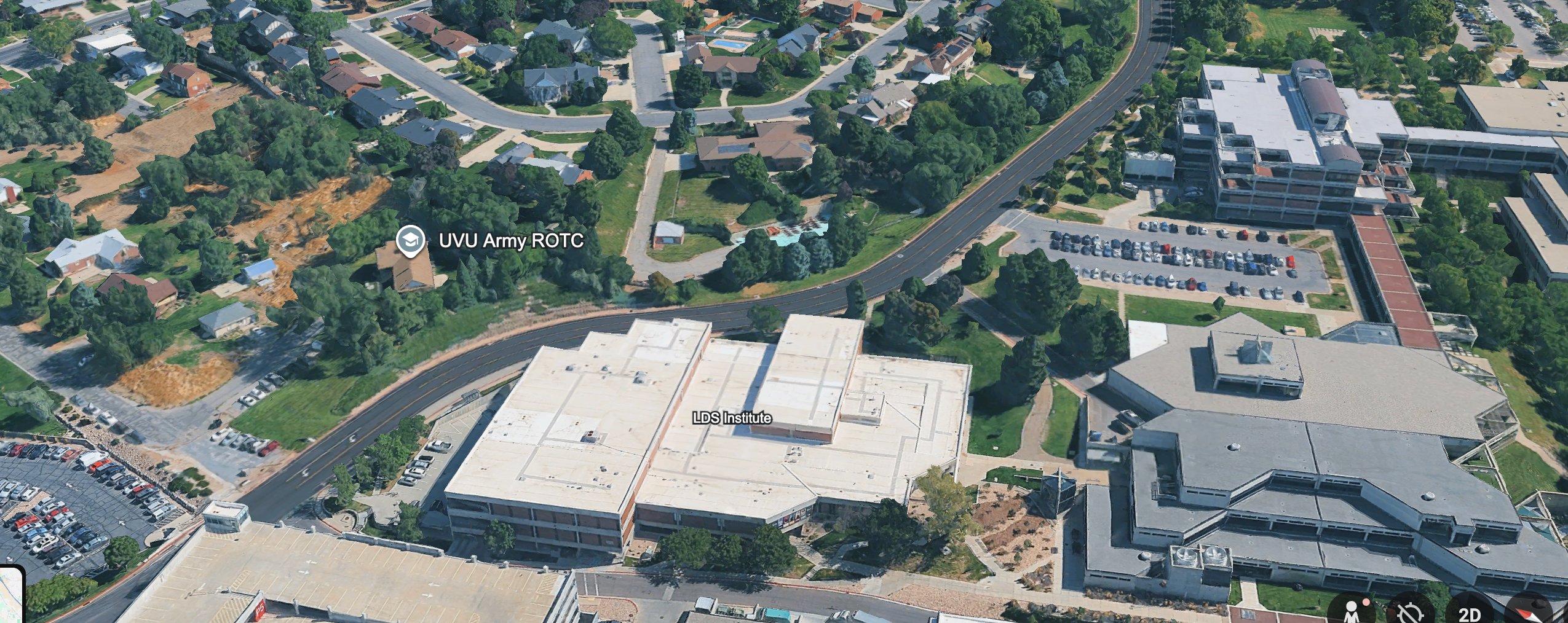
The Army ISR jet that flew near campus did not lift off from a civilian executive terminal. It reportedly departed an active Army airfield at Fort Bliss, and that military origin is the detail investigators keep returning to.
Read thisA Piper Navajo configured for high-resolution camera and LiDAR mapping reportedly flew four survey passes over campus hours before the shooting. What it photographed, and who tasked it, has never been established.
Read thisElsewhere In The Investigation
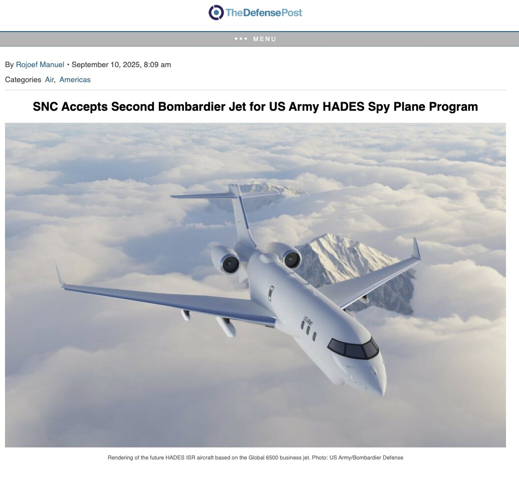
US Army HADES (Drone Launching Planes)
HADES is a real, publicly contracted Army ISR program built on the same Global 6500 airframe as N1098L. Defense-trade reporting separately describes Army interest in launching drones from that airframe.
Read this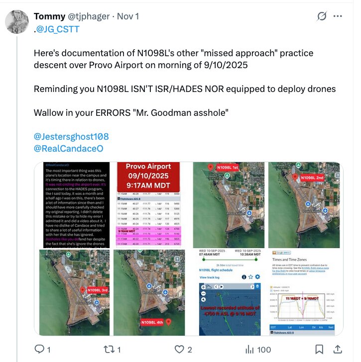
Public ADS-B puts an Army HADES jet in extremely low, slow passes near UVU before and after 12:23 PM. The master file's summary of it runs to four words: it was ours.
Read this
The argument that domestic agencies had the motive, the capability and a documented history — COINTELPRO, Operation CHAOS — plus what investigators say happened after September 10. Its most specific on-record item is a former counterterrorism director saying his foreign-nexus review was ordered stopped.
Read thisSources
- ADS-B Exchange, Flightradar24, and FlightAware historical track logs for N1098L on 2025-09-10 — including the shared legs 1348Z KBIF→KGPI and 1732Z KGPI→KBIF (investigators note some segments are absent from public data).
- The Defense Post and The War Zone (TWZ) coverage of the Army's HADES program and air-launched-drone trials from the Global 6500.
- Public commentary from Candace Owens, Ian Carroll, and Sam Parker on N1098L's flight path.
- Citizen investigator Blake Bednarz (drone sightings over the campus).
- @raumgeist for the airborne command/relay "Task Force Charlie" theory and the Fort Huachuca link.
- @hurtfeelingzday for the AXEL10 low-altitude Orem-loop flight summary.
- @TJPHager for the counter-argument that the airframe was not built to launch drones and was not equipped to full HADES (ME-11B) contracted specs.
- LASAI Aviation II LLC FAA registration records and Leidos defense-contracting disclosures.
- NTSB database (search returns no incident for N1098L) and FAA FOIA as the official channels for crew/tasking records.
Laws (Charlie Kirk)
- The crew and passengers aboard N1098L, who authorized its low-altitude UVU passes, whether drones were launched or recovered, and any HADES sensor footage of the kill zone and its recipients are exactly the kind of records that the Charlie Kirk Investigation Laws are designed to force into the open.
Citizen Investigator Claims on X
(Aircraft OSINT and attributed claims — not findings that any pilot, passenger, or official ordered or carried out the assassination.)
- X users including @Josh89220 cite FAA/transponder logs of an Army HADES-class ISR jet (N1098L / AXLE10 in investigation notes) making low (~200 ft class) passes near UVU/Orem before and after the shooting — correlation claims, not proven operational role in the killing.
- Commentators ask whether ISR/counter-UAS capability at Provo/UVU that week was routine training or something investigators should subpoena — open question for N1098L and Counter-UAS.
- This page’s focus (N1098L Spy Plane) should be read with the Planes overview and Sept 10 flight timeline for cross-checks.
Best understanding of when this happened
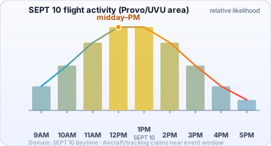
Best understanding: flight-tracking discussions focus on SEPT 10 daytime relative to the UVU window (not a multi-month axis).
Date range (working model): SEPT 10 daytime flight-tracking window
The chart below is not a government finding. Bar height is relative likelihood from public claims. Domain is trimmed to non-trivial likelihood.
Commentator coverage: Citizen journalist Ian Carroll has featured N1098L prominently in his flight-tracking OSINT commentary, arguing according to his posts that the jet's low-and-slow passes near UVU — alongside aircraft like SU-BTT — justify a formal federal investigation rather than a training-exercise dismissal, a position about process rather than a claim of anyone's guilt.
This website's author is @HolonCitizen on X and YouTube/@HolonCitizen. Follow me there.
Interesting
- Erika Kirk invited scrutiny of the logs, then that tracking history disappeared.
- A reported SAM-702 passenger links the DIA to the day before Kirk died.
- Utah's DPS commissioner was reportedly searched from DC the day before his appointment.
Related Areas
Related
Track This Aircraft
Research this aircraft's flight history yourself on both major flight-tracking sites. They differ in one important way:
- FlightRadar24 — N1098L — large commercial tracker that honors the FAA's LADD block list, so flights an owner or the government has asked to hide can be missing.
- ADS-B Exchange — N1098L — volunteer-fed, unfiltered tracker that does not honor LADD, so it often shows blocked aircraft and tracks the filtered sites leave out.
- ADS-B Exchange — by ICAO hex A0299E — the Mode-S hex is this jet's permanent transponder ID; use it when the registration lookup comes up empty.
Aircraft ID: Bombardier Global 6500 (US Army ISR, HADES/ATHENA program) · registration N1098L · callsign AXLE10 · ICAO hex A0299E. Investigators note some of this aircraft's flights are missing from public tracking, so the unfiltered ADS-B Exchange links above are usually the most complete.
Dates we looked for and did not find
Not every claimed N1098L flight could be checked against a primary ADS-B trace. Every date we queried and got nothing back for is listed — with the exact HTTP status and the reason we looked — on ADS-B gaps for N1098L. That page is published for the same reason the recovered traces are: a gap that is written down can be argued with, and a gap that is quietly dropped cannot.
An absence there is not a finding. A 404 means a volunteer receiver network heard nothing on that UTC day — parked and silent, outside coverage, or a wrong claimed date all come first, and what a 403 means sets out why a refusal and a deletion look identical from outside. The four free archives that did produce data, and the control test that separates a retention boundary from a removal, are on Flight data recovery and per-aircraft recovery status.
Where this aircraft actually went, and when
95 flight legs recovered, 2023-11-01 to 2026-07-01, touching 46 airports in 1 country. 37 of the 95 are continuously observed end to end.
Read the last column before you read anything else. A leg marked gap means the archives saw this aircraft at one field and then, some number of days later, at another. It is not a claim that the aircraft flew directly between them, and intermediate stops are not ruled out. A leg marked direct is one the traces actually follow from wheels-up to wheels-down.
Every airport this aircraft was on the ground at
| Airport | Name | Where | Ground visits | First seen | Last seen |
|---|---|---|---|---|---|
| KBIF | Biggs Army Air Field (Fort Bliss) | Fort Bliss/El Paso, TX | 28 | 2023-11-01 | 2026-08-01 |
| KELP | El Paso International Airport | El Paso, TX | 6 | 2026-05-04 | 2026-07-01 |
| KBFI | King County International Airport - Boeing Field | Seattle, WA | 5 | 2024-06-01 | 2025-09-05 |
| KLGB | Long Beach International Airport | Long Beach, CA | 5 | 2024-09-10 | 2026-05-29 |
| KRNO | Reno Tahoe International Airport | Reno, NV | 5 | 2023-11-01 | 2025-09-25 |
| KABQ | Albuquerque International Sunport | Albuquerque, NM | 4 | 2024-04-24 | 2025-07-14 |
| KGRK | Killeen Regional Airport / Robert Gray Army Airfield | Fort Cavazos, TX | 4 | 2026-04-01 | 2026-05-27 |
| KABI | Abilene Regional Airport | Abilene, TX | 3 | 2025-09-19 | 2025-10-08 |
| KCOS | City of Colorado Springs Municipal | Colorado Springs, CO | 3 | 2025-09-25 | 2026-05-08 |
| KPVU | Provo Municipal Airport | Provo, UT | 3 | 2023-11-08 | 2026-05-07 |
| — | — | — | 2 | 2026-05-18 | 2026-05-20 |
| KBIL | Billings Logan International Airport | Billings, MT | 2 | 2024-10-16 | 2025-07-09 |
| KBLI | Bellingham International Airport | Bellingham, WA | 2 | 2026-06-01 | 2026-06-02 |
| KEGE | Eagle County Regional Airport | Eagle, CO | 2 | 2026-05-04 | 2026-05-12 |
| KFAT | Fresno Yosemite International Airport | Fresno, CA | 2 | 2026-05-04 | 2026-05-19 |
| KGEG | Spokane International Airport | Spokane, WA | 2 | 2025-08-05 | 2025-08-05 |
| KHII | Lake Havasu City Airport | Lake Havasu City, AZ | 2 | 2024-02-01 | 2024-02-01 |
| KNZY | North Island Naval Air Station-Halsey Field | San Diego, CA | 2 | 2026-05-11 | 2026-05-12 |
| KOAK | Oakland International | Berkeley, CA | 2 | 2024-08-01 | 2024-09-10 |
| KPHX | Phoenix Sky Harbor International Airport | Phoenix, AZ | 2 | 2024-07-23 | 2024-12-18 |
| KSLN | Salina Municipal Airport | Salina, KS | 2 | 2025-01-18 | 2025-09-03 |
| KSMX | Santa Maria Public Airport Captain G Allan Hancock Field | Santa Maria, CA | 2 | 2024-06-01 | 2024-10-01 |
| KSNS | Salinas Municipal Airport | Salinas, CA | 2 | 2025-10-11 | 2026-05-12 |
| 4SD4 | Dan's Airport | Rapid City, SD | 1 | 2023-11-01 | 2023-11-01 |
| KAPA | Centennial Airport | Denver, CO | 1 | 2024-11-01 | 2024-11-01 |
| KBZN | Bozeman Yellowstone International | Bozeman, MT | 1 | 2026-05-05 | 2026-05-05 |
| KCOU | Columbia Regional Airport | Columbia, MO | 1 | 2026-07-01 | 2026-07-01 |
| KCPR | Casper-Natrona County International Airport | Casper, WY | 1 | 2026-05-28 | 2026-05-28 |
| KDSM | Des Moines International Airport | Des Moines, IA | 1 | 2024-09-03 | 2024-09-03 |
| KFAR | Hector International | Fargo, ND | 1 | 2025-09-06 | 2025-09-06 |
| KGTF | Great Falls International Airport | Great Falls, MT | 1 | 2024-07-01 | 2024-07-01 |
| KGYY | Gary/Chicago International Airport | Gary, IN | 1 | 2024-06-17 | 2024-06-17 |
| KL45 | Bakersfield International Airport | Bakersfield, CA | 1 | 2026-06-02 | 2026-06-02 |
| KLSV | Nellis Air Force Base | Las Vegas, NV | 1 | 2024-10-16 | 2024-10-16 |
| KMSO | Missoula Montana Airport | Missoula, MT | 1 | 2026-05-08 | 2026-05-08 |
| KNUQ | Moffett Federal Airfield | Mountain View, CA | 1 | 2025-08-01 | 2025-08-01 |
| KOKC | OKC Will Rogers World Airport | Oklahoma City, OK | 1 | 2025-09-04 | 2025-09-04 |
| KRAP | Rapid City Regional Airport | Rapid City, SD | 1 | 2024-10-01 | 2024-10-01 |
| KSAV | Savannah Hilton Head International Airport | Savannah, GA | 1 | 2025-03-20 | 2025-03-20 |
| KSBA | Santa Barbara Municipal | Santa Barbara, CA | 1 | 2025-04-24 | 2025-04-24 |
| KSLC | Salt Lake City International Airport | Salt Lake City, UT | 1 | 2025-09-18 | 2025-09-18 |
| KSVN | Hunter Army Air Field | Savannah, GA | 1 | 2025-10-01 | 2025-10-01 |
| KTUL | Tulsa International Airport | Tulsa, OK | 1 | 2026-05-01 | 2026-05-01 |
| KTUS | Tucson International | Tucson, AZ | 1 | 2024-05-01 | 2024-05-01 |
| KTWF | Joslin Field Magic Valley Regional Airport | Twin Falls, ID | 1 | 2025-08-19 | 2025-08-19 |
| KXNA | Northwest Arkansas National | Fayetteville, AR | 1 | 2025-10-21 | 2025-10-21 |
Every recovered flight leg
| Leg date (UTC) | From | To | Left after (UTC) | Arrived by (UTC) | How well observed |
|---|---|---|---|---|---|
| 2023-11-01 | KBIF Fort Bliss/El Paso, TX | 4SD4 Rapid City, SD | 15:48 | 17:36 | direct — continuous |
| 2023-11-01 | 4SD4 Rapid City, SD | KRNO Reno, NV | 17:51 | 19:47 | direct — continuous |
| 2023-11-01 | KRNO Reno, NV | KBIF Fort Bliss/El Paso, TX | 21:27 | 23:14 | direct — continuous |
| 2023-11-01 | KBIF Fort Bliss/El Paso, TX | KPVU Provo, UT | 23:16 | 2023-11-08 19:37 | gap — unobserved 6 days |
| 2023-11-08 | KPVU Provo, UT | KBIF Fort Bliss/El Paso, TX | 19:40 | 2023-12-01 00:03 | gap — unobserved 22 days |
| 2024-02-01 | KBIF Fort Bliss/El Paso, TX | KHII Lake Havasu City, AZ | 17:49 | 21:29 | direct — continuous |
| 2024-02-01 | KHII Lake Havasu City, AZ | KBIF Fort Bliss/El Paso, TX | 23:16 | 2024-03-01 00:53 | gap — unobserved 28 days |
| 2024-04-01 | KBIF Fort Bliss/El Paso, TX | KABQ Albuquerque, NM | 20:02 | 2024-04-24 19:24 | gap — unobserved 22 days |
| 2024-04-24 | KABQ Albuquerque, NM | KTUS Tucson, AZ | 19:54 | 2024-05-01 17:38 | gap — unobserved 6 days |
| 2024-05-01 | KTUS Tucson, AZ | KBFI Seattle, WA | 17:56 | 2024-06-01 18:41 | gap — unobserved 30 days |
| 2024-06-01 | KBFI Seattle, WA | KSMX Santa Maria, CA | 19:05 | 20:37 | direct — continuous |
| 2024-06-01 | KSMX Santa Maria, CA | KBIF Fort Bliss/El Paso, TX | 22:14 | 23:55 | direct — continuous |
| 2024-06-01 | KBIF Fort Bliss/El Paso, TX | KBFI Seattle, WA | 23:55 | 2024-06-07 17:45 | gap — unobserved 5 days |
| 2024-06-07 | KBFI Seattle, WA | KGYY Gary, IN | 17:53 | 2024-06-17 19:17 | gap — unobserved 9 days |
| 2024-06-17 | KGYY Gary, IN | KGTF Great Falls, MT | 19:17 | 2024-07-01 18:51 | gap — unobserved 13 days |
| 2024-07-01 | KGTF Great Falls, MT | KRNO Reno, NV | 19:44 | 21:14 | direct — continuous |
| 2024-07-01 | KRNO Reno, NV | KBIF Fort Bliss/El Paso, TX | 21:24 | 23:17 | direct — continuous |
| 2024-07-01 | KBIF Fort Bliss/El Paso, TX | KPHX Phoenix, AZ | 23:19 | 2024-07-23 17:45 | gap — unobserved 21 days |
| 2024-07-23 | KPHX Phoenix, AZ | KOAK Berkeley, CA | 18:12 | 2024-08-01 22:44 | gap — unobserved 8 days |
| 2024-08-01 | KOAK Berkeley, CA | KDSM Des Moines, IA | 23:14 | 2024-09-03 22:36 | gap — unobserved 32 days |
| 2024-09-03 | KDSM Des Moines, IA | KOAK Berkeley, CA | 22:45 | 2024-09-10 18:44 | gap — unobserved 6 days |
| 2024-09-10 | KOAK Berkeley, CA | KLGB Long Beach, CA | 19:14 | 20:11 | direct — continuous |
| 2024-09-10 | KLGB Long Beach, CA | KRAP Rapid City, SD | 21:31 | 2024-10-01 16:21 | gap — unobserved 20 days |
| 2024-10-01 | KRAP Rapid City, SD | KBFI Seattle, WA | 16:37 | 19:02 | direct — continuous |
| 2024-10-01 | KBFI Seattle, WA | KSMX Santa Maria, CA | 19:22 | 21:16 | direct — continuous |
| 2024-10-01 | KSMX Santa Maria, CA | KBIL Billings, MT | 22:15 | 2024-10-16 19:42 | gap — unobserved 14 days |
| 2024-10-16 | KBIL Billings, MT | KLSV Las Vegas, NV | 19:42 | 22:07 | direct — continuous |
| 2024-10-16 | KLSV Las Vegas, NV | KBFI Seattle, WA | 22:25 | 2024-11-01 18:34 | gap — unobserved 15 days |
| 2024-11-01 | KBFI Seattle, WA | KAPA Denver, CO | 19:31 | 21:39 | direct — continuous |
| 2024-11-01 | KAPA Denver, CO | KBIF Fort Bliss/El Paso, TX | 21:56 | 23:18 | direct — continuous |
| 2024-11-01 | KBIF Fort Bliss/El Paso, TX | KABQ Albuquerque, NM | 23:19 | 2024-12-18 16:28 | gap — unobserved 46 days |
| 2024-12-18 | KABQ Albuquerque, NM | KPHX Phoenix, AZ | 16:38 | 17:32 | direct — continuous |
| 2024-12-18 | KPHX Phoenix, AZ | KABQ Albuquerque, NM | 18:02 | 18:51 | direct — continuous |
| 2024-12-18 | KABQ Albuquerque, NM | KSLN Salina, KS | 19:15 | 2025-01-18 05:47 | gap — unobserved 30 days |
| 2025-01-18 | KSLN Salina, KS | KBIF Fort Bliss/El Paso, TX | 05:55 | 2025-02-01 00:00 | gap — unobserved 13 days |
| 2025-02-01 | KBIF Fort Bliss/El Paso, TX | KSAV Savannah, GA | 00:26 | 2025-03-20 21:01 | gap — unobserved 46 days |
| 2025-03-20 | KSAV Savannah, GA | KLGB Long Beach, CA | 21:16 | 2025-04-24 01:27 | gap — unobserved 34 days |
| 2025-04-24 | KLGB Long Beach, CA | KSBA Santa Barbara, CA | 02:45 | 17:17 | direct — continuous |
| 2025-04-24 | KSBA Santa Barbara, CA | KRNO Reno, NV | 18:07 | 2025-07-08 19:54 | gap — unobserved 74 days |
| 2025-07-08 | KRNO Reno, NV | KBIL Billings, MT | 20:52 | 2025-07-09 17:17 | overnight — crossed a UTC midnight |
| 2025-07-09 | KBIL Billings, MT | KABQ Albuquerque, NM | 18:09 | 2025-07-14 17:57 | gap — unobserved 4 days |
| 2025-07-14 | KABQ Albuquerque, NM | KBIF Fort Bliss/El Paso, TX | 19:04 | 2025-08-01 00:26 | gap — unobserved 17 days |
| 2025-08-01 | KBIF Fort Bliss/El Paso, TX | KNUQ Mountain View, CA | 00:50 | 16:37 | direct — continuous |
| 2025-08-01 | KNUQ Mountain View, CA | KBIF Fort Bliss/El Paso, TX | 17:01 | 20:52 | direct — continuous |
| 2025-08-01 | KBIF Fort Bliss/El Paso, TX | KGEG Spokane, WA | 23:59 | 2025-08-05 00:15 | gap — unobserved 3 days |
| 2025-08-05 | KGEG Spokane, WA | KTWF Twin Falls, ID | 01:12 | 2025-08-19 17:27 | gap — unobserved 13 days |
| 2025-08-19 | KTWF Twin Falls, ID | KSLN Salina, KS | 17:52 | 2025-09-03 18:10 | gap — unobserved 14 days |
| 2025-09-03 | KSLN Salina, KS | KOKC Oklahoma City, OK | 18:32 | 2025-09-04 02:02 | overnight — crossed a UTC midnight |
| 2025-09-04 | KOKC Oklahoma City, OK | KBIF Fort Bliss/El Paso, TX | 02:07 | 03:28 | direct — continuous |
| 2025-09-04 | KBIF Fort Bliss/El Paso, TX | KBFI Seattle, WA | 03:28 | 2025-09-05 17:23 | overnight — crossed a UTC midnight |
| 2025-09-05 | KBFI Seattle, WA | KFAR Fargo, ND | 17:40 | 2025-09-06 00:32 | overnight — crossed a UTC midnight |
| 2025-09-06 | KFAR Fargo, ND | KSLC Salt Lake City, UT | 00:33 | 2025-09-18 16:11 | gap — unobserved 11 days |
| 2025-09-18 | KSLC Salt Lake City, UT | KABI Abilene, TX | 16:22 | 2025-09-19 16:27 | overnight — crossed a UTC midnight |
| 2025-09-19 | KABI Abilene, TX | KRNO Reno, NV | 17:22 | 2025-09-25 01:24 | gap — unobserved 5 days |
| 2025-09-25 | KRNO Reno, NV | KCOS Colorado Springs, CO | 01:32 | 15:49 | direct — continuous |
| 2025-09-25 | KCOS Colorado Springs, CO | KSVN Savannah, GA | 16:01 | 2025-10-01 17:10 | gap — unobserved 5 days |
| 2025-10-01 | KSVN Savannah, GA | KBIF Fort Bliss/El Paso, TX | 18:12 | 21:25 | direct — continuous |
| 2025-10-01 | KBIF Fort Bliss/El Paso, TX | KABI Abilene, TX | 21:26 | 2025-10-08 16:56 | gap — unobserved 6 days |
| 2025-10-08 | KABI Abilene, TX | KPVU Provo, UT | 19:07 | 2025-10-09 23:16 | overnight — crossed a UTC midnight |
| 2025-10-09 | KPVU Provo, UT | KSNS Salinas, CA | 23:26 | 2025-10-11 00:06 | gap — unobserved 1 day |
| 2025-10-11 | KSNS Salinas, CA | KXNA Fayetteville, AR | 00:06 | 2025-10-21 16:48 | gap — unobserved 9 days |
| 2025-10-21 | KXNA Fayetteville, AR | KGRK Fort Cavazos, TX | 16:48 | 2026-04-01 15:36 | gap — unobserved 161 days |
| 2026-04-01 | KGRK Fort Cavazos, TX | KBIF Fort Bliss/El Paso, TX | 18:56 | 20:21 | direct — continuous |
| 2026-04-01 | KBIF Fort Bliss/El Paso, TX | KGRK Fort Cavazos, TX | 22:08 | 2026-04-27 18:52 | gap — unobserved 25 days |
| 2026-04-27 | KGRK Fort Cavazos, TX | KBIF Fort Bliss/El Paso, TX | 18:52 | 2026-05-01 17:14 | gap — unobserved 3 days |
| 2026-05-01 | KBIF Fort Bliss/El Paso, TX | KTUL Tulsa, OK | 20:29 | 23:53 | direct — continuous |
| 2026-05-01 | KTUL Tulsa, OK | KFAT Fresno, CA | 23:59 | 2026-05-04 17:37 | gap — unobserved 2 days |
| 2026-05-04 | KFAT Fresno, CA | KELP El Paso, TX | 18:01 | 22:03 | direct — continuous |
| 2026-05-04 | KELP El Paso, TX | KEGE Eagle, CO | 22:04 | 23:30 | direct — continuous |
| 2026-05-04 | KEGE Eagle, CO | KBZN Bozeman, MT | 23:57 | 2026-05-05 01:04 | overnight — crossed a UTC midnight |
| 2026-05-05 | KBZN Bozeman, MT | KPVU Provo, UT | 01:28 | 2026-05-07 16:06 | gap — unobserved 1 day |
| 2026-05-07 | KPVU Provo, UT | KCOS Colorado Springs, CO | 16:22 | 19:27 | direct — continuous |
| 2026-05-07 | KCOS Colorado Springs, CO | KMSO Missoula, MT | 19:37 | 2026-05-08 01:00 | overnight — crossed a UTC midnight |
| 2026-05-08 | KMSO Missoula, MT | KCOS Colorado Springs, CO | 01:01 | 02:40 | direct — continuous |
| 2026-05-08 | KCOS Colorado Springs, CO | KNZY San Diego, CA | 02:51 | 2026-05-11 23:41 | gap — unobserved 2 days |
| 2026-05-12 | KNZY San Diego, CA | KSNS Salinas, CA | 00:03 | 00:58 | direct — continuous |
| 2026-05-12 | KSNS Salinas, CA | KEGE Eagle, CO | 00:58 | 17:40 | direct — continuous |
| 2026-05-12 | KEGE Eagle, CO | KELP El Paso, TX | 18:29 | 2026-05-18 14:27 | gap — unobserved 5 days |
| 2026-05-18 | KELP El Paso, TX | — — | 14:28 | 16:57 | direct — continuous |
| 2026-05-18 | — — | KELP El Paso, TX | 18:16 | 22:16 | direct — continuous |
| 2026-05-18 | KELP El Paso, TX | KFAT Fresno, CA | 22:17 | 2026-05-19 17:59 | overnight — crossed a UTC midnight |
| 2026-05-19 | KFAT Fresno, CA | — — | 18:21 | 2026-05-20 03:38 | overnight — crossed a UTC midnight |
| 2026-05-20 | — — | KBIF Fort Bliss/El Paso, TX | 03:45 | 2026-05-22 17:11 | gap — unobserved 1 day |
| 2026-05-22 | KBIF Fort Bliss/El Paso, TX | KELP El Paso, TX | 20:49 | 22:55 | direct — continuous |
| 2026-05-22 | KELP El Paso, TX | KGRK Fort Cavazos, TX | 22:56 | 2026-05-27 16:17 | gap — unobserved 4 days |
| 2026-05-27 | KGRK Fort Cavazos, TX | KCPR Casper, WY | 16:17 | 2026-05-28 20:30 | overnight — crossed a UTC midnight |
| 2026-05-28 | KCPR Casper, WY | KLGB Long Beach, CA | 20:30 | 2026-05-29 20:03 | overnight — crossed a UTC midnight |
| 2026-05-29 | KLGB Long Beach, CA | KBLI Bellingham, WA | 20:22 | 2026-06-01 18:26 | gap — unobserved 2 days |
| 2026-06-01 | KBLI Bellingham, WA | KBIF Fort Bliss/El Paso, TX | 19:17 | 23:03 | direct — continuous |
| 2026-06-01 | KBIF Fort Bliss/El Paso, TX | KBLI Bellingham, WA | 23:07 | 2026-06-02 17:02 | overnight — crossed a UTC midnight |
| 2026-06-02 | KBLI Bellingham, WA | KL45 Bakersfield, CA | 17:03 | 19:52 | direct — continuous |
| 2026-06-02 | KL45 Bakersfield, CA | KBIF Fort Bliss/El Paso, TX | 20:07 | 21:43 | direct — continuous |
| 2026-06-02 | KBIF Fort Bliss/El Paso, TX | KELP El Paso, TX | 21:43 | 2026-07-01 03:10 | gap — unobserved 28 days |
| 2026-07-01 | KELP El Paso, TX | KCOU Columbia, MO | 14:06 | 17:07 | direct — continuous |
| 2026-07-01 | KCOU Columbia, MO | KBIF Fort Bliss/El Paso, TX | 17:15 | 2026-08-01 02:47 | gap — unobserved 30 days |
Every airport code above opens that field's own page — every recovered ground visit and flight leg there, by every aircraft this investigation tracks. See also every airport in this investigation.
Times are UTC as the archives recorded them — the last on-ground position before departure and the first on-ground position after arrival — not filed or scheduled times. Built by build_flight_record.py; see Investigating Deleted Flights for how much of the record is missing and why.
Flight-record pages for what is on this page
This investigation keeps one page per airport and one page per recorded ground contact, built directly from the recovered ADS-B traces. These are the ones this page touches.
Ground contacts near a sourced Charlie / Erika / TPUSA event:
| Date (UTC) | Aircraft | Airport | City, State | Whose event | When |
|---|---|---|---|---|---|
| 2024-04-24 | N582MM | KSLC | Salt Lake City, UT | Charlie | Day after |
| 2024-06-07 | N582MM | KSAT | San Antonio, TX | Charlie | Same day |
| 2024-09-10 | N582MM | KBJC | Boulder, CO | Charlie | Same day |
| 2024-09-10 | N872RA | KAPA | Denver, CO | Charlie | Same day |
| 2024-12-18 | N1098L | KPHX | Phoenix, AZ | Charlie | Day before |
| 2024-12-18 | N582MM | KSDL | Scottsdale, AZ | Charlie | Day before |
| 2025-09-10 | N102DZ | KPVU | Provo, UT | Charlie | Same day |
| 2025-09-10 | N102DZ | KSLC | Salt Lake City, UT | Charlie | Same day |
| 2025-09-10 | N40JD | KPVU | Provo, UT | Charlie | Same day |
| 2025-09-10 | N560TW | KPVU | Provo, UT | Charlie | Same day |
| 2025-09-10 | N59906 | KPVU | Provo, UT | Charlie | Same day |
| 2025-09-10 | N872RA | KPVU | Provo, UT | Charlie | Same day |
| 2025-09-10 | N888KG | KPVU | Provo, UT | Charlie | Same day |
| 2025-09-10 | SU-BND | KPVU | Provo, UT | Charlie | Same day |
| 2025-09-10 | SU-BTT | KPVU | Provo, UT | Charlie | Same day |
| 2025-09-19 | N582MM | KBJC | Boulder, CO | Charlie | Day after |
Airports named on this page:
- KPVU — Provo Municipal Airport, Provo, UT — 135 recorded ground visits, 13 tracked aircraft
- KSLC — Salt Lake City International Airport, Salt Lake City, UT — 33 recorded ground visits, 7 tracked aircraft
- KTUS — Tucson International, Tucson, AZ — 24 recorded ground visits, 8 tracked aircraft
- KPHX — Phoenix Sky Harbor International Airport, Phoenix, AZ — 94 recorded ground visits, 6 tracked aircraft
- KBIF — Biggs Army Air Field (Fort Bliss), Fort Bliss/El Paso, TX — 53 recorded ground visits, 2 tracked aircraft
- KAPA — Centennial Airport, Denver, CO — 44 recorded ground visits, 7 tracked aircraft
- KOAK — Oakland International, Berkeley, CA — 24 recorded ground visits, 5 tracked aircraft
- KRNO — Reno Tahoe International Airport, Reno, NV — 24 recorded ground visits, 5 tracked aircraft
- KSBA — Santa Barbara Municipal, Santa Barbara, CA — 23 recorded ground visits, 6 tracked aircraft
- KBFI — King County International Airport - Boeing Field, Seattle, WA — 18 recorded ground visits, 5 tracked aircraft
- KABQ — Albuquerque International Sunport, Albuquerque, NM — 17 recorded ground visits, 4 tracked aircraft
- KBZN — Bozeman Yellowstone International, Bozeman, MT — 16 recorded ground visits, 5 tracked aircraft
- KELP — El Paso International Airport, El Paso, TX — 16 recorded ground visits, 5 tracked aircraft
- KLGB — Long Beach International Airport, Long Beach, CA — 15 recorded ground visits, 5 tracked aircraft
- KNUQ — Moffett Federal Airfield, Mountain View, CA — 15 recorded ground visits, 4 tracked aircraft
- KCOS — City of Colorado Springs Municipal, Colorado Springs, CO — 13 recorded ground visits, 5 tracked aircraft
- KGEG — Spokane International Airport, Spokane, WA — 13 recorded ground visits, 4 tracked aircraft
- KFAT — Fresno Yosemite International Airport, Fresno, CA — 10 recorded ground visits, 2 tracked aircraft
- KGRK — Killeen Regional Airport / Robert Gray Army Airfield, Fort Cavazos, TX — 6 recorded ground visits, 2 tracked aircraft
- KBIL — Billings Logan International Airport, Billings, MT — 5 recorded ground visits, 2 tracked aircraft
- KOKC — OKC Will Rogers World Airport, Oklahoma City, OK — 5 recorded ground visits, 3 tracked aircraft
- KSAV — Savannah Hilton Head International Airport, Savannah, GA — 4 recorded ground visits, 3 tracked aircraft
- KSVN — Hunter Army Air Field, Savannah, GA — 4 recorded ground visits, 2 tracked aircraft
- KXNA — Northwest Arkansas National, Fayetteville, AR — 4 recorded ground visits, 3 tracked aircraft
- KABI — Abilene Regional Airport, Abilene, TX — 3 recorded ground visits, 1 tracked aircraft
- KBLI — Bellingham International Airport, Bellingham, WA — 3 recorded ground visits, 2 tracked aircraft
- KHII — Lake Havasu City Airport, Lake Havasu City, AZ — 3 recorded ground visits, 2 tracked aircraft
- KMSO — Missoula Montana Airport, Missoula, MT — 3 recorded ground visits, 2 tracked aircraft
- KNZY — North Island Naval Air Station-Halsey Field, San Diego, CA — 3 recorded ground visits, 2 tracked aircraft
- KSNS — Salinas Municipal Airport, Salinas, CA — 3 recorded ground visits, 2 tracked aircraft
- KTUL — Tulsa International Airport, Tulsa, OK — 3 recorded ground visits, 2 tracked aircraft
- KCOU — Columbia Regional Airport, Columbia, MO — 2 recorded ground visits, 2 tracked aircraft
- KDSM — Des Moines International Airport, Des Moines, IA — 2 recorded ground visits, 2 tracked aircraft
- KEGE — Eagle County Regional Airport, Eagle, CO — 2 recorded ground visits, 1 tracked aircraft
- KSLN — Salina Municipal Airport, Salina, KS — 2 recorded ground visits, 1 tracked aircraft
- KSMX — Santa Maria Public Airport Captain G Allan Hancock Field, Santa Maria, CA — 2 recorded ground visits, 1 tracked aircraft
- KCPR — Casper-Natrona County International Airport, Casper, WY — 1 recorded ground visit, 1 tracked aircraft
- KFAR — Hector International, Fargo, ND — 1 recorded ground visit, 1 tracked aircraft
- KGPI — Glacier Park International Airport, Kalispell, MT — 1 recorded ground visit, 1 tracked aircraft
- KGTF — Great Falls International Airport, Great Falls, MT — 1 recorded ground visit, 1 tracked aircraft
- KGYY — Gary/Chicago International Airport, Gary, IN — 1 recorded ground visit, 1 tracked aircraft
- KL45 — Bakersfield International Airport, Bakersfield, CA — 1 recorded ground visit, 1 tracked aircraft
- KLSV — Nellis Air Force Base, Las Vegas, NV — 1 recorded ground visit, 1 tracked aircraft
- KRAP — Rapid City Regional Airport, Rapid City, SD — 1 recorded ground visit, 1 tracked aircraft
- KTWF — Joslin Field Magic Valley Regional Airport, Twin Falls, ID — 1 recorded ground visit, 1 tracked aircraft
Aircraft named on this page:
- N1098L — full recovered movement record, every airport and every leg
- N2100L — full recovered movement record, every airport and every leg
- N582MM — full recovered movement record, every airport and every leg
- N59906 — full recovered movement record, every airport and every leg
- SU-BTT — full recovered movement record, every airport and every leg
The two indexes:
- Every airport in this investigation — 292 fields, each with its complete recovered ground-visit and flight-leg record
- Every interesting date, all aircraft — 147 ground contacts near a sourced event, across 110 pages
- Investigating Deleted Flights — how the data was recovered, how much of it we hold, and where it is still missing
Where this page fits
This is the airframe the entire aircraft angle is argued around, and it is checked here against primary position data rather than screenshots, with its sister ship N2100L, the rest of the LASAI fleet, the ISR program context and its morning departure field documented separately so the claim can be taken apart a piece at a time. Outside the Planes section the same aircraft carries the intelligence-services case, the drone counts over campus and the foreign-nexus review a sitting NCTC director says he was ordered to stop — none of which a flight track can settle, because a trace proves an airframe was in the sky and nothing whatever about why. The sharpest page next door is Joe Kent's account of the shutdown: a sitting intelligence director saying on the record that multiple people had pre-knowledge and that his investigation was ended before its leads ran out — the claim Law 2 was written to test by naming this tail number in the text of a statute.